close
-
Layers w
- Weather Layers
- Pro
- Pro
- Pro
- Pro
- Pro
- Pro
- More Layers
- Pro
- Pro
- Pro
- Pro
-
Upgrade to

3D
Trail Conditions
- Unknown
- Snow Groomed
- Snow Packed
- Snow Covered
- Snow Cover Partial
- Freeze/thaw Cycle
- Icy
- Prevalent Mud
- Wet
- Variable
- Ideal
- Dry
- Very Dry
Trail Flow (Ridden Direction)
Trailforks scans users ridelogs to determine the most popular direction each trail is ridden. A good flowing trail network will have most trails flowing in a single direction according to their intension.
The colour categories are based on what percentage of riders are riding a trail in its intended direction.
The colour categories are based on what percentage of riders are riding a trail in its intended direction.
- > 96%
- > 90%
- > 80%
- > 70%
- > 50%
- < 50%
- bi-directional trail
- no data
Trail Last Ridden
Trailforks scans ridelogs to determine the last time a trail was ridden.
- < 2 days
- < 1 week
- < 2 weeks
- < 1 month
- < 6 months
- > 6 months
Trail Ridden Direction
The intended direction a trail should be ridden.
- Downhill Only
- Downhill Primary
- Both Directions
- Uphill Primary
- Uphill Only
- One Direction
Contribute Details
Colors indicate trail is missing specified detail.
- Description
- Photos
- Description & Photos
- Videos
Trail Popularity ?
Trailforks scans ridelogs to determine which trails are ridden the most in the last 9 months.
Trails are compared with nearby trails in the same city region with a possible 25 colour shades.
Think of this as a heatmap, more rides = more kinetic energy = warmer colors.
- most popular
- popular
- less popular
- not popular
ATV/ORV/OHV Filter
Max Vehicle Width
inches
US Cell Coverage
Legend

Radar Time
Activity Recordings
Trailforks uses anonymized public activity data.
?
Activity Recordings
Trailforks uses anonymized public activity data.
?
Personal Heatmap
▶
Activity Types
all
/
none
▶
Options
2
Date range
month
–
Winter Trails
Warning
A routing network for winter maps does not exist. Selecting trails using the winter trails layer has been disabled.
Missing Trails
Most Popular
Least Popular
Trails are colored based on popularity. The more popular a trail is, the more red. Less popular trails trend towards green.
Jump Magnitude Heatmap
Heatmap of where riders jump on trails. Zoom in to see individual jumps, click circles to view jump details.
BC Backroad Status
![map legend]()
Service Road Atlas is a free to use, community-driven service for viewing and creating reports on the numerous back-country service roads around B.C. and Alberta.

Slope Aspect
Direction the slope faces
Trails Deemphasized
Trails are shown in grey.
Only show trails with no bike usage.
Suggested Layers
Based on selected activity type
Save the current map location and zoom level as your default home location whenever this page is loaded.
SavePopular Trail Networks
view all areas »
No description for Oregon has been added yet!
Login or register to submit one.
Files
- Oregon_Trail_Regions_(1).pdf (2.20 MB)
Region Details
- 752
- 210
- 1,309
- 1,202
- 405
- 57
- 2
- 3
Stats
- Avg Trail Rating
- Trails (view details)
- 7,916
- Trails Mountain Bike
- 3,952
- Trails E-Bike
- 1,796
- Trails Gravel Bike
- 2,290
- Trails Adaptive Bike
- 624
- Trails Winter Fat Bike
- 297
- Trails Horse
- 1,442
- Trails Hike
- 5,317
- Trails Trail Running
- 5,247
- Trails Dirtbike/Moto
- 1,616
- Trails Observed Trials
- 16
- Trails ATV/ORV/OHV
- 1,052
- Trails Snowmobile
- 6
- Trails Snowshoe
- 119
- Trails Downhill Ski
- 573
- Trails Backcountry Ski
- 183
- Trails Nordic Ski
- 252
- Total Distance
- 12,832 miles
- Total Descent
- 1,911,007 ft
- Total Vertical
- 10,341 ft
- Highest Trailhead
- 10,341 ft
- Reports
- 64,897
- Photos
- 15,644
- Ridden Counter
- 1,232,152
Articles
Video: Christian Rigal Builds a Dreamy Public Trail in the PNW in 'Mossy Hogs'
Jun 16, 2026 from pinkbike.com
Christian Rigal teams up with TORTA to make a dream trail a reality, opening a unique coastal line that is completely free and open to everyone...
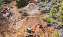
Video: Carson Storch & Cam McCaul Lead Star-Studded Rebuild of Legendary Oregon Jump Line
Jun 2, 2026 from pinkbike.com
In "Building the Dream Vol. 2," a heavy-hitting crew uses heavy machinery to completely revive and "bulletproof" the famous Apollo line at The Lair.

Video: Brice Shirbach Takes a Road Trip Through the Oregon Coast’s Best Mountain Biking in 'Underexposed'
Jun 25, 2025 from pinkbike.com
There's a growing number of top-notch mountain bike trails up and down Oregon's staggeringly beautiful shoreline.

The Best Summer Weekend Trips of 2025
Jun 3, 2025 from outsideonline.com
There are only 14 weekends between Memorial Day and Labor Day this year. So you better make them count.
Sub Regions
- Central Oregon (587)
- Crook County (80)
- Deschutes County (428)
- Jefferson County (66)
- Northeast Oregon (240)
- Baker County (77)
- Grant County (31)
- Umatilla County (59)
- Union County (95)
- Wallowa County (4)
- Northwest Oregon (1,057)
- Clackamas County (157)
- Clatsop County (45)
- Columbia County (5)
- Hood River County (229)
- Marion County (111)
- Mt. Hood (13)
- Multnomah County (206)
- Polk County (27)
- Tillamook County (106)
- Wasco County (13)
- Washington County (76)
- South Central Oregon (202)
- Kalmath County (0)
- Klamath County (189)
- Lake County (37)
- South East Oregon (11)
- Harney County (8)
- Malheur County (1)
- Southwest Oregon (859)
- Coos County (162)
- Curry County (25)
- Douglas County (84)
- Jackson County (468)
- Josephine County (121)
- Western Oregon (915)
- Benton County (378)
- Lane County (399)
- Lincoln County (77)
- Linn County (50)
Popular Oregon Mountain Biking Trails
• 85 ★ 4.3 • 6 miles • 526 ft • 6,339 •
The easiest loop out of the Welcome Center. Some fun rock features and a beautiful section through the canyon.
• 100 ★ 4.5 • 2 miles • 0 ft • 5,852 •
One of the most fun trails in the area. This trail is fast and fun. Multiple jump options and some that you can get pretty good air on. You can roll all the jumps, but there are some optional lines for some pretty big table tops. Rip...
• 100 ★ 3.6 • 5 miles • 712 ft • 5,303 •
Popular green difficulty singletrack. This mountain bike primary trail can be used one direction and has a moderate overall physical rating with a 712 ft blue climb. Adaptive MTB rating: amtb green. On average it takes 40 minutes to complete this trail.
• 100 ★ 4.5 • 2,582 ft • 11 ft • 5,092 •
GP is a high-speed trail that weaves down the side of the hill with high berms and a variety of blue/black features, some of which have mandatory gaps, but all of which have intermediate-friendly ride-around options. Upper and lower GP...
• 100 ★ 4.1 • 1 mile • 374 ft • 4,964 •
This is the main access climb trail to get to Family Man Staging area. It is a two way trial and commonly used by families as a shuttle for their kids. is the main climbing trail from the upper parking area on Post Canyon Road to Family Man
• 100 ★ 4.4 • 4,698 ft • 51 ft • 4,911 •
is a bench cut jump and berm flow trail. Features generally offer three options: ride around, table, and gap options. Difficult to make everything if the wind is up since this is on a clear cut side hill. You can hot lap this using...
• 100 ★ 4.4 • 4 miles • 79 ft • 4,845 •
This is the super fun section of Tiddlywinks. Flowy berms and tabletops make for huge grins all around. Nothing scary or technical about this part of the trail, just fun.
• 95 ★ 3.9 • 6 miles • 42 ft • 4,647 •
Most of the trail is downhill only, with the exception of the upper 1/4 which is 2-way from to the top. Super smooth and just flows but you'll have to pedal on some sections to keep your speed up. There is a little rooty section that...
Oregon Mountain Bike Routes
5K Route Featured
★ 5.0 • 3 miles • 273 ft • 3 • Loop •
This is a common route for running or walking a 5K. (3.1 Miles) Start out on Jame's then take Turn off...
Cross-country Loop Featured
★ 5.0 • 13 miles • 1,495 ft • 15 • Loop •
Ready to put those climbing legs to work? This is a big looped (figure-8 style) route that can be...
Intermediate Ride- Opt. 2 Featured
★ 5.0 • 11 miles • 1,446 ft • 18 • Loop •
This Intermediate 11+ mile loop is a great sampling of blue and green trails in the Whiskey Run Trail...
Trail Builder's Choice Featured
★ 5.0 • 20 miles • 3,880 ft • 24 • Loop •
Put your legs to work on this 20 mile ups and downs on some of Whiskey Run's best advanced trails. Warm up...
Whiskey Sampler Classic (Phase 1) Featured
★ 3.5 • 7 miles • 658 ft • 30 • Loop •
This route was offered as a guided ride at the Whiskey Run Trails opener June 9, 2017. During this time,...
STA: PRT - Peterson Ridge Overlook Featured
11 miles • 559 ft • 3 •
Length: Approx. 10.6 miles Difficulty: Easy to Moderate Surface: Dirt single track and some FS roads....
Photos of Oregon Mountain Bike
Videos of Oregon Mountain Bike
trail: Graveyard
0:38 |
2 |
Jun 25, 2026
trail: Cross Town Connector
0:30 |
9 |
May 12, 2026
trail: West Summit
0:31 |
4 |
May 12, 2026
trail: Catamount Trail (Upper)
3:29 |
17 |
May 11, 2026
trail: North Fork Wilson River Road
0:04 |
12 |
Apr 18, 2026
trail: Buteo Drop
0:27 |
13 |
Apr 17, 2026
trail: Peregrination
0:07 |
14 |
Apr 17, 2026
trail: Ouroboros
0:21 |
13 |
Apr 17, 2026
National Scenic Trails & Official Routes
-
Metolius Windigo Trail
- Mountain Bike
- E-Bike
- Horse
- Hike
- Trail Running
Activity Feed
| username | action | type | title | date |
|---|---|---|---|---|
| Sabrinaeng | wishlist | trail | activity #98393230 | Jul 4, 2026 @ 1:31am 3 hours |
| tnboyatheart | vote | trail | activity #98387626 and 1 more | Jul 3, 2026 @ 10:18pm 6 hours |
| tnboyatheart | vote | trail | activity #98387555 and 1 more | Jul 3, 2026 @ 10:15pm 6 hours |
| schmobob | add | report | activity #98387460 | Jul 3, 2026 @ 10:10pm 6 hours |
| tbmaddux | add | report | activity #98386466 and 6 more | Jul 3, 2026 @ 9:28pm 7 hours |
Recent Comments
| username | type | title | comment | date |
|---|---|---|---|---|
| trail | Suitable for most vehicles, don’t need 4WD,... | Jul 3, 2026 @ 5:44pm 10 hours | ||
| report | My my k n n. N I’m. M p | Jul 3, 2026 @ 12:00pm 16 hours | ||
| trail | Trail has been cleared, brushed and... | Jul 1, 2026 @ 8:55pm 2 days | ||
| trail | Closed | Jul 1, 2026 @ 4:00pm 3 days | ||
| trail | Skinny is super cool. Flat stacked turns kinda... | Jul 1, 2026 @ 11:13am 3 days |
Local Badges
-

Doodle's Badge0 awarded -

Big Ride 30k1,044 awarded -

10 Blue Trails28 awarded -

Epic Mountain Bike Climb 2k5 awarded -

Completionist2 awarded -

10 Green Trails23 awarded
Bike & Skill Parks
| name | type | city | rating |
|---|---|---|---|
| Mt. Bachelor Bike Park | bike park | Bend | |
| Timberline Bike Park | bike park | Government Camp | |
| Mount Hood Skibowl | bike park | Government Camp | |
| Mt. Hood Meadows | bike park | Government Camp | |
| Timberline Lodge Ski Resort | bike park | Government Camp |
Upcoming Local Events
Activity Type Stats
| activitytype | trails | distance | descent | descent distance | total vertical | rating | global rank | state rank | photos | reports | routes | ridelogs |
|---|---|---|---|---|---|---|---|---|---|---|---|---|
| Mountain Bike | 3,952 | 6,460 miles | 937,470 ft | 2,768 miles | 8,396 ft | #16 | 14,566 | 63,639 | 693 | 989,629 | ||
| E-Bike | 1,796 | 2,635 miles | 372,697 ft | 1,111 miles | 8,376 ft | #13 | 327 | 46,912 | 67 | 49,824 | ||
| Gravel Bike | 2,290 | 4,287 miles | 374,098 ft | 1,615 miles | 9,728 ft | #9 | 18 | 6,230 | 35 | 7,257 | ||
| Adaptive Bike | 624 | 1,275 miles | 115,128 ft | 451 miles | 7,910 ft | #14 | 2 | 9,570 | 24 | 75 | ||
| Winter Fat Bike | 297 | 344 miles | 42,096 ft | 142 miles | 7,762 ft | #23 | 3,634 | 1 | 115 | |||
| Horse | 1,442 | 4,198 miles | 586,804 ft | 1,757 miles | 10,335 ft | #9 | 18 | 12,286 | 6 | 355 | ||
| Hike | 5,317 | 9,580 miles | 1,354,101 ft | 3,927 miles | 10,341 ft | #14 | 545 | 60,117 | 34 | 95,682 | ||
| Trail Running | 5,247 | 9,462 miles | 1,329,790 ft | 3,882 miles | 10,341 ft | #13 | 58 | 60,395 | 44 | 78,541 | ||
| Dirtbike/Moto | 1,616 | 3,228 miles | 367,871 ft | 1,201 miles | 8,379 ft | #9 | 43 | 9,628 | 4 | 1,743 | ||
| Observed Trials | 16 | 30 miles | 3,780 ft | 13 miles | 4,508 ft | #19 | 3 | 931 | 201 | |||
| ATV/ORV/OHV | 1,052 | 2,176 miles | 210,315 ft | 893 miles | 8,350 ft | #10 | 12 | 9,156 | 1 | 371 | ||
| Snowmobile | 6 | 14 miles | 1,138 ft | 6 miles | 7,290 ft | #24 | 312 | 50 | ||||
| Snowshoe | 119 | 200 miles | 21,496 ft | 81 miles | 7,785 ft | #28 | 3 | 551 | 1 | 1,893 | ||
| Downhill Ski | 573 | 217 miles | 179,806 ft | 203 miles | 5,285 ft | #18 | 5 | 401 | 33,158 | |||
| Backcountry Ski | 183 | 171 miles | 39,531 ft | 79 miles | 6,348 ft | #16 | 6 | 340 | 5 | 15,963 | ||
| Nordic Ski | 252 | 261 miles | 24,882 ft | 108 miles | 7,411 ft | #24 | 19 | 1,087 | 21,502 |
Activities
- Oregon Mountain Biking Trails
- Oregon E-Biking Trails
- Oregon Gravel Biking Trails
- Oregon Adaptive Biking Trails
- Oregon Winter Fat Biking Trails
- Oregon Horseback Trails
- Oregon Hiking Trails
- Oregon Trail Running Trails
- Oregon Dirtbiking Trails
- Oregon Observed Trials Trails
- Oregon ATVing/Offroading Trails
- Oregon Snowmobiling Trails
- Oregon Snowshoeing Trails
- Oregon Skiing Trails
- Oregon Backcountry Skiing Trails
- Oregon Nordic Skiing Trails
Trails
Points of Interest
- McCulloch Peak Viewpoint
- Hawk Mountain Lookout Viewpoint
- Mt. Ashland Campground Camping
- Water Tank Sight
- Top Tower Sight
- Chip Ross Viewpoint
- Flaming Chicken Sight
- Dimple Hill Viewpoint
- All DH From Here! Information
- Paradise Campground Camping
- Crater Rock (3,210 m)
- Hodge Crest (3,058 m)
- Matterhorn (2,996 m)
- By northwestdhdad EMBA-SW & contributors
- Admins: Map Team, IMBA, TransRockies, chuktA, msmcfate, WillieJacobsz, PlumbBobM, ReckitRolley, colinreuter, OMBC
- #3101 - 165,643 views
- oregon activity log | embed map of Oregon mountain bike trails | oregon mountain biking points of interest polygons
Downloading of trail gps tracks in kml & gpx formats is enabled for Oregon.
You must login to download files.