close
-
Layers w
- Weather Layers
- Pro
- Pro
- Pro
- Pro
- Pro
- Pro
- More Layers
- Pro
- Pro
- Pro
- Pro
-
Upgrade to

3D
Trail Conditions
- Unknown
- Snow Groomed
- Snow Packed
- Snow Covered
- Snow Cover Partial
- Freeze/thaw Cycle
- Icy
- Prevalent Mud
- Wet
- Variable
- Ideal
- Dry
- Very Dry
Trail Flow (Ridden Direction)
Trailforks scans users ridelogs to determine the most popular direction each trail is ridden. A good flowing trail network will have most trails flowing in a single direction according to their intension.
The colour categories are based on what percentage of riders are riding a trail in its intended direction.
The colour categories are based on what percentage of riders are riding a trail in its intended direction.
- > 96%
- > 90%
- > 80%
- > 70%
- > 50%
- < 50%
- bi-directional trail
- no data
Trail Last Ridden
Trailforks scans ridelogs to determine the last time a trail was ridden.
- < 2 days
- < 1 week
- < 2 weeks
- < 1 month
- < 6 months
- > 6 months
Trail Ridden Direction
The intended direction a trail should be ridden.
- Downhill Only
- Downhill Primary
- Both Directions
- Uphill Primary
- Uphill Only
- One Direction
Contribute Details
Colors indicate trail is missing specified detail.
- Description
- Photos
- Description & Photos
- Videos
Trail Popularity ?
Trailforks scans ridelogs to determine which trails are ridden the most in the last 9 months.
Trails are compared with nearby trails in the same city region with a possible 25 colour shades.
Think of this as a heatmap, more rides = more kinetic energy = warmer colors.
- most popular
- popular
- less popular
- not popular
ATV/ORV/OHV Filter
Max Vehicle Width
inches
US Cell Coverage
Legend

Radar Time
Activity Recordings
Trailforks uses anonymized public activity data.
?
Activity Recordings
Trailforks uses anonymized public activity data.
?
Personal Heatmap
▶
Activity Types
all
/
none
▶
Options
2
Date range
month
–
Winter Trails
Warning
A routing network for winter maps does not exist. Selecting trails using the winter trails layer has been disabled.
Missing Trails
Most Popular
Least Popular
Trails are colored based on popularity. The more popular a trail is, the more red. Less popular trails trend towards green.
Jump Magnitude Heatmap
Heatmap of where riders jump on trails. Zoom in to see individual jumps, click circles to view jump details.
BC Backroad Status
![map legend]()
Service Road Atlas is a free to use, community-driven service for viewing and creating reports on the numerous back-country service roads around B.C. and Alberta.

Slope Aspect
Direction the slope faces
Trails Deemphasized
Trails are shown in grey.
Only show trails with no bike usage.
Suggested Layers
Based on selected activity type
Save the current map location and zoom level as your default home location whenever this page is loaded.
Save
No description for Selkirk has been added yet!
Login or register to submit one.
This region uses the Uk/Euro style trail grading system.
Activities Click to view
- Mountain Bike
118 trails
- E-Bike
116 trails
- Gravel Bike
0 trails
- Adaptive Bike
0 trails
- Winter Fat Bike
0 trails
- Horse
30 trails
- Hike
84 trails
- Trail Running
84 trails
Region Details
- 65
- 10
- 10
- 12
- 19
- 2
Region Status
Open as of May 27, 2026Stats
- Avg Trail Rating
- Trails (view details)
- 119
- Trails Mountain Bike
- 118
- Trails E-Bike
- 116
- Trails Horse
- 30
- Trails Hike
- 84
- Trails Trail Running
- 84
- Total Distance
- 84 miles
- Total Descent
- 18,957 ft
- Total Vertical
- 1,307 ft
- Highest Trailhead
- 1,703 ft
- Reports
- 497
- Photos
- 41
- Ridden Counter
- 14,598
Popular Selkirk Mountain Biking Trails
• 90 ★ 3.7 • 3,661 ft • 0 ft • 447 • • hike
Popular green difficulty singletrack. This hike primary trail can be used one direction and has a moderate overall physical rating. It features drop. Trail visibility is always easy to follow. On average it takes 3 minutes to complete this trail.
• 90 ★ 4.0 • 2,034 ft • 0 ft • 343 •
Highly rated popular red difficulty singletrack. This mountain bike primary trail can be used one direction and has a moderate overall physical rating with a 0 ft blue climb. Trail visibility is sometimes hard to follow. On average it takes 3 minutes to complete this trail.
• 80 ★ 4.0 • 650 ft • 0 ft • 301 •
Starting with a steep chute (I think there is a mellower option a couple of metres further along) , the trail flows nicely over some thin single-track before a wide corner puts you down a little ridge onto the fire road.
• 100 ★ 4.6 • 2,428 ft • 0 ft • 280 •
Highly rated popular black difficulty singletrack. This mountain bike primary trail can be used one direction and has a moderate overall physical rating. It features drop. Trail visibility is always easy to follow. On average it takes 4 minutes to complete this trail.
• 95 ★ 0.0 • 3,107 ft • 0 ft • 275 • • hike
Popular blue difficulty singletrack. This hike primary trail can be used both directions and has a moderate overall physical rating with a 0 ft blue climb. Trail visibility is always easy to follow. On average it takes 2 minutes to complete this trail.
• 85 ★ 2.4 • 3,245 ft • 56 ft • 272 •
Popular red difficulty singletrack. This mountain bike primary trail can be used one direction and has a moderate overall physical rating with a 56 ft blue climb. Trail visibility is always easy to follow. On average it takes 8 minutes to complete this trail.
• 65 ★ 1.0 • 4,452 ft • 22 ft • 244 •
Moderately popular blue difficulty singletrack. This mountain bike primary trail can be used one direction and has a moderate overall physical rating with a 22 ft blue climb. Trail visibility is always easy to follow. On average it takes 11 minutes to complete this trail.
Selkirk Mountain Bike Routes
Big Beastie Featured
★ 5.0 • 50 miles • 9,176 ft • 26 • Point to Point •
Unofficial Point to Point route taking in some of the best, and most technical singletrack of the Tweed...
34 miles • 6,537 ft • 14 • Loop •
Nice variation on the classic 'Beastie' route in the tweed valley by departing on the SUW and heading over...
52 miles • 10,606 ft • 30 • Point to Point •
Big Beastie route. One for the fitter riders
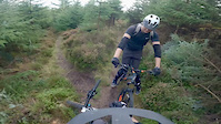
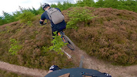
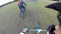
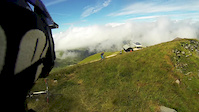
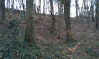
Photos of Selkirk Mountain Bike
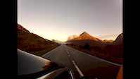
Videos of Selkirk Mountain Bike
trail: Off the saddle
3:16 |
71 |
Sep 23, 2022
trail: Ginger Mullet
8:28 |
101 |
Sep 23, 2022
trail: Up
0:39 |
36 |
Oct 23, 2017
trail: Peanut Butter
5:24 |
222 |
Jan 13, 2016

trail: Scorpion
0:20 |
88 |
Mar 4, 2015

trail: Scorpion
4:38 |
114 |
Mar 4, 2015
trail: Southern Upland Way
0:08 |
41 |
Feb 22, 2015
trail: Southern Upland Way
3:37 |
174 |
Dec 5, 2014
Recent Trail Reports
| status | trail | date | condition | info | user |
|---|---|---|---|---|---|
| 2 Hoes Bro | May 27, 2026 @ 2:41pm (Europe/London) May 27, 2026 | Unknown | Dangerousdav3 | ||
| Raelees Revenge | May 27, 2026 @ 2:40pm (Europe/London) May 27, 2026 | Unknown | Dangerousdav3 | ||
| Illuminati | May 19, 2026 @ 6:25pm (Europe/London) May 19, 2026 | Ideal | marin-matt | ||
| Trail | Apr 30, 2026 @ 11:52am (Europe/London) Apr 30, 2026 | Dry | SBMCD | ||
| Forest Road | Apr 30, 2026 @ 11:52am (Europe/London) Apr 30, 2026 | Dry | SBMCD | ||
| Quarry Descent | Apr 30, 2026 @ 11:52am (Europe/London) Apr 30, 2026 | Dry | SBMCD | ||
| Forest Path | Apr 30, 2026 @ 11:52am (Europe/London) Apr 30, 2026 | Very Dry | SBMCD | ||
| Up 2 | Mar 17, 2026 @ 1:31pm (Europe/London) Mar 17, 2026 | Unknown | marccr0wley FLS | ||
| Raelees Ridge | Mar 17, 2026 @ 1:31pm (Europe/London) Mar 17, 2026 | Unknown | marccr0wley FLS | ||
| Raelees Descent | Mar 17, 2026 @ 1:30pm (Europe/London) Mar 17, 2026 | Unknown | marccr0wley FLS |
Activity Feed
| username | action | type | title | date |
|---|---|---|---|---|
| marccr0wley | update | trail | activity #98254984 | Jul 2, 2026 @ 3:04am Jul 2, 2026 |
| Keefy67 | add | trail | activity #98254936 | Jul 2, 2026 @ 3:02am Jul 2, 2026 |
| IvorHZYqqQ | wishlist | region | activity #97168601 | Jun 17, 2026 @ 1:25am Jun 17, 2026 |
| zakk69 | wishlist | region | activity #95856682 | May 30, 2026 @ 8:45am May 30, 2026 |
| JamievBGGyx | ridden | trail | activity #95737555 | May 28, 2026 @ 3:43pm May 28, 2026 |
Recent Comments
| username | type | title | comment | date |
|---|---|---|---|---|
| trail | Trailforks didn't say closed, top half is... | May 26, 2025 @ 12:58pm May 26, 2025 | ||
| trail | Trees down about 50ft from end of trail | May 24, 2025 @ 12:56pm May 24, 2025 | ||
| trail | Steep chute. Running fast and great condition. | May 18, 2025 @ 3:38pm May 18, 2025 | ||
| trail | Perfect dry conditions. No issues. Running... | May 18, 2025 @ 3:36pm May 18, 2025 | ||
| trail | Top section is absolute magic, couple of... | Aug 25, 2024 @ 11:09am Aug 25, 2024 |
Local Badges
-

Epic Ride Climb 2k20 awarded -

Climbing 10k Badge38 awarded -

Climbing 100k Badge4 awarded -

Epic Ride Descent 2k21 awarded -

Descent 10k Badge38 awarded -

Descent 100k Badge4 awarded
Activity Type Stats
| activitytype | trails | distance | descent | descent distance | total vertical | rating | global rank | state rank | photos | reports | routes | ridelogs |
|---|---|---|---|---|---|---|---|---|---|---|---|---|
| Mountain Bike | 118 | 84 miles | 18,855 ft | 46 miles | 1,306 ft | #1,828 | #60 | 39 | 489 | 7 | 5,909 | |
| E-Bike | 116 | 84 miles | 18,622 ft | 46 miles | 1,306 ft | #1,368 | #58 | 2 | 462 | 2 | 909 | |
| Horse | 30 | 38 miles | 6,470 ft | 21 miles | 1,306 ft | #1,019 | #44 | 74 | 3 | |||
| Hike | 84 | 73 miles | 11,834 ft | 37 miles | 1,306 ft | #2,844 | #62 | 344 | 451 | |||
| Trail Running | 84 | 73 miles | 11,834 ft | 37 miles | 1,306 ft | #2,833 | #54 | 344 | 248 |
Frequently Asked Questions About Selkirk
▼
What are the best places to ride in Selkirk?
▼
What are the highest rated mountain biking trails in Selkirk?
The highest rated mountain biking trails in Selkirk are:
- Off the saddle (4.3/5)
- DD Descent (4.2/5)
- Raelees Revenge (4.2/5)
- Body Bag (4.1/5)
- Murfs Camber (4.1/5)
▼
What is the best time of the year to ride in Selkirk?
Based on ride log data, the most popular months to ride in Selkirk are:
- July (23 activities)
- June (16 activities)
- May (15 activities)
▼
Where can I park to ride in Selkirk?
There are 5 parking locations listed in Selkirk. The most popular parking spots are: View all parking and trailhead locations on the map to plan your visit.
Activities
Trails
- By gav-s
 & contributors
 - Admins: DMBinS, FLS, TVTA
- #7194 - 5,340 views
- selkirk activity log | embed map of Selkirk mountain bike trails | selkirk mountain biking points of interest polygons
Downloading of trail gps tracks in kml & gpx formats is enabled for Selkirk.
You must login to download files.