
close
3D
Trail Conditions
- Unknown
- Snow Groomed
- Snow Packed
- Snow Covered
- Snow Cover Partial
- Freeze/thaw Cycle
- Icy
- Prevalent Mud
- Wet
- Variable
- Ideal
- Dry
- Very Dry
Trail Flow (Ridden Direction)
Trailforks scans users activity logs to determine the most popular direction each trail is ridden. A good flowing trail network will have most trails flowing in a single direction according to their intension.
The colour categories are based on what percentage of users are riding a trail in its intended direction.
The colour categories are based on what percentage of users are riding a trail in its intended direction.
- > 96%
- > 90%
- > 80%
- > 70%
- > 50%
- < 50%
- bi-directional trail
- no data
Trail Last Used
Trailforks scans activity logs to determine the last time a trail was ridden.
- < 2 days
- < 1 week
- < 2 weeks
- < 1 month
- < 6 months
- > 6 months
Trail Ridden Direction
The intended direction a trail should be ridden.
- Downhill Only
- Downhill Primary
- Both Directions
- Uphill Primary
- Uphill Only
- One Direction
Contribute Details
Colors indicate trail is missing specified detail.
- Description
- Photos
- Description & Photos
- Videos
Trail Popularity ?
Trailforks scans activity logs to determine which trails are ridden the most in the last 9 months.
Trails are compared with nearby trails in the same city region with a possible 25 colour shades.
Think of this as a heatmap, more activities = more kinetic energy = warmer colors.
- most popular
- popular
- less popular
- not popular
ATV/ORV/OHV Filter
Max Vehicle Width
inches
US Cell Coverage
Legend

Radar Time
Activity Recordings
Trailforks uses anonymized public activity data.
?
Activity Recordings
Trailforks uses anonymized public activity data.
?
Winter Trails
Warning
A routing network for winter maps does not exist. Selecting trails using the winter trails layer has been disabled.
Missing Trails
Most Popular
Least Popular
Trails are colored based on popularity. The more popular a trail is, the more red. Less popular trails trend towards green.
Jump Magnitude Heatmap
Heatmap of where users jump on trails. Zoom in to see individual jumps, click circles to view jump details.
BC Backroad Status
![map legend]()
Service Road Atlas is a free to use, community-driven service for viewing and creating reports on the numerous back-country service roads around B.C. and Alberta.

Slope Aspect
Direction the slope faces
Trails Deemphasized
Trails are shown in grey.
Only show trails with no bike usage.
Suggested Layers
Based on selected activity type
Save the current map location and zoom level as your default home location whenever this page is loaded.
SavePopular Trail Networks
Copeland Forest
169 trails. 56 miles distance.
169 trails. 56 miles distance.
Simcoe County Forest - Strachan Tract
39 trails. 9 miles distance.
39 trails. 9 miles distance.
Simcoe County Forest - Orrock Creek North/South Tracts
35 trails. 18 miles distance.
35 trails. 18 miles distance.
Simcoe County Forest - North Barr Tract
33 trails. 22 miles distance.
33 trails. 22 miles distance.
Simcoe County Forest - Brentwood Tract
32 trails. 14 miles distance.
32 trails. 14 miles distance.
Simcoe County Forest - Lawden Tract
28 trails. 13 miles distance.
28 trails. 13 miles distance.
Simcoe County Forest - Orr Lake
28 trails. 35 miles distance.
28 trails. 35 miles distance.
Simcoe County Forest - Hendrie Main Tract
25 trails. 17 miles distance.
25 trails. 17 miles distance.
Simcoe County Forest - Baxter Tract
24 trails. 21 miles distance.
24 trails. 21 miles distance.
Simcoe County Forest - Drury Main Tract
22 trails. 20 miles distance.
22 trails. 20 miles distance.
Snow & Rain 3D forecast Pro
See where it will snow, sleet or rain on Simcoe County hour by hour, on 3D terrain.
View 3D snow forecast
Simcoe County trails and routes are listed on Trailforks with interactive trail maps, difficulty ratings, photos, and user-reported trail conditions. The Trailforks community has mapped thousands of trails and shared thousands of photos in this region. Supported activity types include Hiking, Trail Running, Mountain Biking, Snowshoeing, Nordic Skiing, Horseback, E-Biking, Snowmobiling, Dirtbiking, ATVing/Offroading, Skiing and Backcountry Skiing. Trails here are often faint trail, flowy and rail trail. Scenery includes creeks, views and ridgelines. Common trail features include berms, bridges and drops. Many trails are family friendly and lit for night riding. Amenities include huts. Popular destinations include Oro-Medonte, Springwater and Clearview Township.
This is an auto-generated description of Simcoe County.
Login or register to submit a custom description.
Trail info last updated
Activities Click to view
- Mountain Bike
2,253 trails
- E-Bike
812 trails
- Horse
844 trails
- Hike
2,333 trails
- Trail Running
2,326 trails
- Dirtbike/Moto
448 trails
- ATV/ORV/OHV
250 trails
- Snowmobile
457 trails
- Snowshoe
1,899 trails
- Downhill Ski
138 trails
- Backcountry Ski
19 trails
- Nordic Ski
1,405 trails


Horse Stats
- Trails (view details)
- 844
- Trails Mountain Bike
- 2,253
- Trails E-Bike
- 812
- Trails Gravel Bike
- 1,038
- Trails Adaptive Bike
- 95
- Trails Winter Fat Bike
- 245
- Trails Horse
- 844
- Trails Hike
- 2,333
- Trails Trail Running
- 2,326
- Trails Dirtbike/Moto
- 448
- Trails ATV/ORV/OHV
- 250
- Trails Snowmobile
- 457
- Trails Snowshoe
- 1,899
- Trails Downhill Ski
- 138
- Trails Backcountry Ski
- 19
- Trails Nordic Ski
- 1,405
- Total Distance
- 455 miles
- Total Descent Distance
- 152 miles
- Total Descent
- 22,080 ft
- Total Vertical
- 1,001 ft
- Reports
- 1,536
- Completed Counter
- 399
Articles
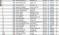
Results: Canadian National Championships 2019
Jul 28, 2019 from pinkbike.com
Check out all the results from the 2019 Canadian National Championships.
Sub Regions
- Adjala-Tosorontio (21)
- Barrie (16)
- Bradford (21)
- Clearview Township (87)
- Essa Township (25)
- Innisfil (9)
- Midland (12)
- New Tecumseth (10)
- Orillia (2)
- Oro-Medonte (359)
- Copeland Forest (169)
- East Coulson Swamp Reserve (0)
- Simcoe County Forest - Amos Tract (1)
- Simcoe County Forest - Arbour Tract (5)
- Simcoe County Forest - Barton Tract (1)
- Simcoe County Forest - Boys Tract (0)
- Simcoe County Forest - Breedon Tract (7)
- Simcoe County Forest - Centennial Tract (2)
- Simcoe County Forest - Crawford Tract (10)
- Simcoe County Forest - Douglas Tract (8)
- Simcoe County Forest - Drury Main Tract (22)
- Simcoe County Forest - Elsie Mills Tract (6)
- Simcoe County Forest - Hutchison/Brown Tract (3)
- Simcoe County Forest - Johnson Tract (8)
- Simcoe County Forest - Marrin Tract (4)
- Simcoe County Forest - North Barr Tract (33)
- Simcoe County Forest - Schumacher Tract (7)
- Simcoe County Forest - South Barr Tract (11)
- Simcoe County Forest - Strachan Tract (39)
- Simcoe County Forest - Sutherland Tract (6)
- Simcoe County Forest - Tustin Tract (6)
- Simcoe County Forest - Walsh Tract (2)
- Ramara (6)
- Severn (30)
- Springwater (208)
- Crown Land - Springwater (7)
- SCMBC - Hickling Trail Network (4)
- Simcoe Admin/Sports Complex Trail Area (8)
- Simcoe County Forest - Caston Tract (1)
- Simcoe County Forest - Cooper Tract (1)
- Simcoe County Forest - Coughlin Tract (10)
- Simcoe County Forest - Craighurst Tract (8)
- Simcoe County Forest - Fisher Tract (1)
- Simcoe County Forest - Freele Tract (4)
- Simcoe County Forest - Graham Tract (10)
- Simcoe County Forest - Hendrie Main Tract (25)
- Simcoe County Forest - Hickling Tract (4)
- Simcoe County Forest - Ivey Tract (3)
- Simcoe County Forest - Midhurst Tract (5)
- Simcoe County Forest - Millennium Tract (5)
- Simcoe County Forest - Museum Tract (7)
- Simcoe County Forest - O'Niell Tract (4)
- Simcoe County Forest - Orr Lake (28)
- Simcoe County Forest - Orrock Creek North East Tract (4)
- Simcoe County Forest - Orrock Creek North/South Tracts (35)
- Simcoe County Forest - Phelpston Tract (9)
- Simcoe County Forest - Smith/Tiffin Tracts (5)
- Simcoe County Forest - Stoney Tract (11)
- Simcoe County Forest - Williams Tract (3)
- Tay Township (8)
- Tiny (29)
Popular Simcoe County Horseback Trails
• 5 ★ 0.0 • 719 ft • 0 ft • 4 •
Less popular green difficulty singletrack. This multi-use trail can be used both directions and has a easy overall physical rating with a 0 ft green climb. On average it takes minutes to complete this trail.
• 5 ★ 3.0 • 578 ft • 40 ft • 3 •
Less popular green difficulty singletrack. This multi-use trail can be used both directions and has a easy overall physical rating with a 40 ft green climb. On average it takes minutes to complete this trail.
• 5 ★ 5.0 • 3,340 ft • 78 ft • 3 •
Less popular green difficulty singletrack. This multi-use trail can be used both directions and has a easy overall physical rating with a 78 ft green climb. On average it takes 5 minutes to complete this trail.
• 5 ★ 0.0 • 856 ft • 33 ft • 3 •
Less popular green difficulty singletrack. This multi-use trail can be used both directions and has a easy overall physical rating with a 33 ft green climb. On average it takes 1 minutes to complete this trail.
• 5 ★ 4.2 • 3,212 ft • 39 ft • 3 •
This is a technical trail. It can be ridden in both directions, though starting from the top at the "5 Points" and heading back towards Horseshoe is probably the more fun way. The soil is mostly sandy, so it can be safely ridden in the wet.
• 90 ★ 0.0 • 1,083 ft • 10 ft • 3 •
Popular green difficulty singletrack. This multi-use trail can be used both directions and has a easy overall physical rating with a 10 ft green climb. On average it takes 1 minutes to complete this trail.
• 90 ★ 5.0 • 1,923 ft • 40 ft • 3 •
Popular green difficulty family friendly singletrack. This multi-use trail can be used both directions and has a easy overall physical rating with a 40 ft green climb. Winter use: Groomed Smooth snow grooming. Trail visibility is always easy to follow. On average it takes 3 minutes to complete this trail.
Recent Ride Log Activity in Region
Today
- 0 horseback ridings
Yesterday
- 0 horseback ridings
Past Week
- 0 horseback ridings
Photos of Simcoe County
Videos of Simcoe County


Current Trail Warnings
| status | trail | date | condition | user | info |
|---|---|---|---|---|---|
| Slippery When Wet - Alt Exit Copeland Forest | Oct 29, 2026 @ 9:10am (America/Toronto) Oct 29, 2026 | Variable | Canadmos TRAILFORKS | Mountain Bike |
Recent Trail Reports
Activity Feed
| username | action | type | title | date |
|---|---|---|---|---|
| mGOpuF | wishlist | trail | activity #107777752 | Nov 14, 2026 @ 11:01am 4 hours |
| CwoodSkier1 | add | report | activity #107653500 | Nov 12, 2026 @ 6:30am 2 days |
| Mohammad7mxIqc | add | report | activity #107536500 | Nov 10, 2026 @ 6:20am Nov 10, 2026 |
| Canadmos | add | poi | activity #107065456 | Nov 2, 2026 @ 5:51am Nov 2, 2026 |
| Canadmos | add | poi | activity #107065442 | Nov 2, 2026 @ 5:50am Nov 2, 2026 |
Recent Comments
| username | type | title | comment | date |
|---|---|---|---|---|
| trail | A trail closed sign was just installed by the city | Nov 4, 2026 @ 7:28am Nov 4, 2026 | ||
| trail | Someone cut the easy log ride over the creek... | May 20, 2026 @ 7:48pm May 20, 2026 | ||
| trail | Pretty serious hill at the end | Sep 9, 2025 @ 6:50pm Sep 9, 2025 | ||
| report | I should have said the lower quarter, 3/4 is... | Sep 4, 2025 @ 4:39pm Sep 4, 2025 | ||
| trail | Tree down | Jul 28, 2025 @ 3:33pm Jul 28, 2025 |
Activity Type Stats
| activitytype | trails | distance | descent | descent distance | total vertical | rating | global rank | state rank | photos | reports | routes | activity logs |
|---|---|---|---|---|---|---|---|---|---|---|---|---|
| Mountain Bike | 2,253 | 1,289 miles | 65,056 ft | 414 miles | 1,184 ft | 1,436 | 11,399 | 80 | 151,491 | |||
| E-Bike | 812 | 478 miles | 24,918 ft | 160 miles | 1,063 ft | 19 | 7,455 | 14 | 4,304 | |||
| Gravel Bike | 1,038 | 639 miles | 20,666 ft | 216 miles | 1,181 ft | 3 | 920 | 1 | 1,717 | |||
| Adaptive Bike | 95 | 69 miles | 2,690 ft | 27 miles | 988 ft | 281 | 2 | 21 | ||||
| Winter Fat Bike | 245 | 172 miles | 8,625 ft | 64 miles | 951 ft | 4 | 973 | 7 | 111 | |||
| Horse | 844 | 455 miles | 22,080 ft | 152 miles | 1,001 ft | 1,536 | 126 | |||||
| Hike | 2,333 | 1,348 miles | 67,051 ft | 437 miles | 1,184 ft | 233 | 10,939 | 15 | 13,550 | |||
| Trail Running | 2,326 | 1,344 miles | 66,791 ft | 434 miles | 1,184 ft | 7 | 11,139 | 24 | 7,757 | |||
| Dirtbike/Moto | 448 | 355 miles | 11,184 ft | 107 miles | 725 ft | 4 | 666 | 2 | 393 | |||
| ATV/ORV/OHV | 250 | 180 miles | 4,551 ft | 56 miles | 1,001 ft | 7 | 627 | 1 | 89 | |||
| Snowmobile | 457 | 330 miles | 9,885 ft | 119 miles | 1,020 ft | 225 | 1 | 97 | ||||
| Snowshoe | 1,899 | 1,120 miles | 54,836 ft | 357 miles | 1,178 ft | 3 | 3,079 | 12 | 1,526 | |||
| Downhill Ski | 138 | 36 miles | 17,021 ft | 29 miles | 965 ft | 8 | 146 | 4,779 | ||||
| Backcountry Ski | 19 | 11 miles | 1,811 ft | 6 miles | 1,047 ft | 226 | 2 | 459 | ||||
| Nordic Ski | 1,405 | 924 miles | 34,951 ft | 284 miles | 1,181 ft | 4 | 1,914 | 9 | 7,626 |
Frequently Asked Questions
▼
What are the best places to ride in Simcoe County?
Simcoe County has 138 areas to explore for horseback. The top rated areas are:
▼
What are the highest rated horseback trails in Simcoe County?
The highest rated horseback trails in Simcoe County are:
- Phatty (0/5)
- Duck Pond (0/5)
- Copeland - No Name (0/5)
- Sign Post 5 to 10 Single Track (0/5)
- Rock Bottom (0/5)
▼
What is the best time of the year to ride in Simcoe County?
Based on activity log data, the most popular months to ride in Simcoe County are:
- July (10 activities)
- June (10 activities)
- September (8 activities)
▼
What is the longest trail in Simcoe County?
The longest trail in Simcoe County is Thornton-Cookstown Trans Canada Trail at 15.7 miles. View all trails sorted by distance.
▼
What are the best & highest rated hiking trails in Simcoe County?
The best hiking trails in Simcoe County are: View all hiking trails sorted by popularity score.
▼
What are the best & highest rated trail running trails in Simcoe County?
The best trail running trails in Simcoe County are:
- Oro-Medonte Rail Trail
- Parallel Trail
- Heart Attack Hill
- Bruce Trail (Blue Mountain Section)
- Bruce Trail
▼
What are the best & highest rated dirtbiking trails in Simcoe County?
▼
How many trails are in Simcoe County?
Simcoe County has a total of 2,647 trails. Of those, 844 are designated for horseback. Browse top horseback trails in Simcoe County to find detailed information including difficulty ratings, distances, and trail conditions.
▼
Which trail has the most elevation gain in Simcoe County?
The trail with the most elevation gain in Simcoe County is Trail with 501 ft of elevation gain. View all trails sorted by elevation gain.
▼
Which trail has the most elevation descent in Simcoe County?
The trail with the most elevation descent in Simcoe County is Trail with 450 ft of elevation descent. View all trails sorted by elevation descent.
▼
What activities are most popular in Simcoe County?
Simcoe County supports the following activities: Mountain Biking, E-Biking, Horseback, Hiking, Trail Running, Dirtbiking, ATVing/Offroading, Snowmobiling, Snowshoeing, Skiing, Backcountry Skiing, Nordic Skiing.
▼
What are the steepest horseback trails in Simcoe County?
The steepest horseback trail in Simcoe County is Private Property with an average grade of 12%. View all trails sorted by grade.
▼
Are there any trails with scenic viewpoints in Simcoe County?
Yes, there are 10 scenic viewpoints marked along trails in Simcoe County. Some popular viewpoints include: Explore more points of interest to find trails with the best views.
▼
Are the trails open in Simcoe County?
The overall region status for Simcoe County is Clear / Green. Out of 365 trails:
- Clear / Green: 227
- Minor Issue / Yellow: 21
- Significant Issue / Amber: 95
- Closed: 22
▼
What are the trail conditions in Simcoe County?
Based on trail reports from the past week in Simcoe County:
- Dry: 1 trail
▼
What are the top sights to see in Simcoe County?
There are 8 notable sights in Simcoe County. Some of the top sights include: Explore all points of interest in Simcoe County.
▼
What trails are closed in Simcoe County?
There are currently 22 closed trails in Simcoe County. The breakdown of all trail statuses is:
- Clear / Green: 227
- Minor Issue / Yellow: 21
- Significant Issue / Amber: 95
- Closed: 22
▼
Are there local clubs or events in Simcoe County?
There are 6 local clubs or associations listed in the Simcoe County directory. Browse the local directory for details.
▼
What are the most popular horseback trails in Simcoe County?
The most popular horseback trails in Simcoe County are: View all horseback trails sorted by popularity.
▼
What are the best beginner horseback riding trails in Simcoe County?
The best beginner horseback trails in Simcoe County are:
- Phatty (0/5)
- Duck Pond (0/5)
- Apple Trail (0/5)
Activities
- Simcoe County Mountain Biking Trails
- Simcoe County E-Biking Trails
- Simcoe County Horseback Trails
- Simcoe County Hiking Trails
- Simcoe County Trail Running Trails
- Simcoe County Dirtbiking Trails
- Simcoe County ATVing/Offroading Trails
- Simcoe County Snowmobiling Trails
- Simcoe County Snowshoeing Trails
- Simcoe County Skiing Trails
- Simcoe County Backcountry Skiing Trails
- Simcoe County Nordic Skiing Trails
Trails
- By markholloway
 Trailforks Map Team & contributors
- Admins: Canadmos
- #10090 - 29,199 views
- simcoe county activity log | embed map of Simcoe County mountain bike trails | simcoe county mountain biking points of interest polygons
Downloading of trail gps tracks in kml & gpx formats is enabled for Simcoe County.
You must login to download files.
