close
-
Layers w
- Weather Layers
- Pro
- Pro
- Pro
- Pro
- Pro
- Pro
- More Layers
- Pro
- Pro
- Pro
- Pro
-
Upgrade to

3D
Trail Conditions
- Unknown
- Snow Groomed
- Snow Packed
- Snow Covered
- Snow Cover Partial
- Freeze/thaw Cycle
- Icy
- Prevalent Mud
- Wet
- Variable
- Ideal
- Dry
- Very Dry
Trail Flow (Ridden Direction)
Trailforks scans users activity logs to determine the most popular direction each trail is ridden. A good flowing trail network will have most trails flowing in a single direction according to their intension.
The colour categories are based on what percentage of users are riding a trail in its intended direction.
The colour categories are based on what percentage of users are riding a trail in its intended direction.
- > 96%
- > 90%
- > 80%
- > 70%
- > 50%
- < 50%
- bi-directional trail
- no data
Trail Last Ridden
Trailforks scans activity logs to determine the last time a trail was ridden.
- < 2 days
- < 1 week
- < 2 weeks
- < 1 month
- < 6 months
- > 6 months
Trail Ridden Direction
The intended direction a trail should be ridden.
- Downhill Only
- Downhill Primary
- Both Directions
- Uphill Primary
- Uphill Only
- One Direction
Contribute Details
Colors indicate trail is missing specified detail.
- Description
- Photos
- Description & Photos
- Videos
Trail Popularity ?
Trailforks scans activity logs to determine which trails are ridden the most in the last 9 months.
Trails are compared with nearby trails in the same city region with a possible 25 colour shades.
Think of this as a heatmap, more activities = more kinetic energy = warmer colors.
- most popular
- popular
- less popular
- not popular
ATV/ORV/OHV Filter
Max Vehicle Width
inches
US Cell Coverage
Legend

Radar Time
Activity Recordings
Trailforks uses anonymized public activity data.
?
Activity Recordings
Trailforks uses anonymized public activity data.
?
Personal Heatmap
▶
Activity Types
all
/
none
▶
Options
2
Date range
month
–
Winter Trails
Warning
A routing network for winter maps does not exist. Selecting trails using the winter trails layer has been disabled.
Missing Trails
Most Popular
Least Popular
Trails are colored based on popularity. The more popular a trail is, the more red. Less popular trails trend towards green.
Jump Magnitude Heatmap
Heatmap of where users jump on trails. Zoom in to see individual jumps, click circles to view jump details.
BC Backroad Status
![map legend]()
Service Road Atlas is a free to use, community-driven service for viewing and creating reports on the numerous back-country service roads around B.C. and Alberta.

Slope Aspect
Direction the slope faces
Trails Deemphasized
Trails are shown in grey.
Only show trails with no bike usage.
Suggested Layers
Based on selected activity type
Save the current map location and zoom level as your default home location whenever this page is loaded.
Save
No description for Stratham has been added yet!
Login or register to submit one.
Activities Click to view
- Mountain Bike
41 trails
- Adaptive Bike
0 trails
- Winter Fat Bike
0 trails
- Hike
38 trails
- Trail Running
36 trails
- Snowshoe
4 trails
- Nordic Ski
4 trails
Region Details
- 2
- 2
- 20
- 17
Region Status
Open as of Apr 1, 2026Stats
- Avg Trail Rating
- Trails (view details)
- 41
- Trails Mountain Bike
- 41
- Trails E-Bike
- 1
- Trails Hike
- 38
- Trails Trail Running
- 36
- Trails Snowshoe
- 4
- Trails Backcountry Ski
- 1
- Trails Nordic Ski
- 4
- Total Distance
- 13 miles
- Total Descent Distance
- 5 miles
- Total Descent
- 1,181 ft
- Total Vertical
- 208 ft
- Highest Trailhead
- 282 ft
- Reports
- 294
- Photos
- 27
- Completed Counter
- 19,136
Sub Regions
-
Stratham Hill Park
- 2
- 20
- 17
Popular Stratham Mountain Biking Trails
• 100 ★ 3.8 • 2,963 ft • 2 ft • 905 •
Fantastic, flowy section of trail winding down from summit. Not much in the way of tech here, and pretty smooth for the most part. Just fast fun on the way down and a nice spin on the way up.
• 80 ★ 3.5 • 479 ft • 35 ft • 738 •
Popular blue difficulty singletrack. This multi-use trail can be used both directions. On average it takes minutes to complete this trail.
• 75 ★ 3.9 • 4,022 ft • 79 ft • 712 •
is one of the rougher trails at Stratham. But it's also one of the funnest. Roots abound, with some rocky bits here and there too. In addition, a couple steeper sections tip it toward the blue side.
• 95 ★ 3.6 • 2,316 ft • 54 ft • 702 •
Fun and flowy single track. Great in both directions.
• 85 ★ 0.0 • 919 ft • 6 ft • 687 •
Popular green difficulty singletrack. This multi-use trail can be used both directions. On average it takes 1 minutes to complete this trail.
• 85 ★ 0.0 • 938 ft • 12 ft • 675 •
Twisty Single Track up and down the side of
• 100 ★ 4.0 • 912 ft • 0 ft • 668 •
a short, flat connector trail. It does have some rooty sections and a rock wall crossing.
• 90 ★ 4.2 • 2,103 ft • 14 ft • 663 •
Fast and Flowy. A favorite for the family, as well as advanced riders.
Stratham Mountain Bike Routes
★ 3.0 • 3 miles • 222 ft • 6 • Loop •
4 mile beginner friendly route for the 2025 Seacoast NEMBA Spring kickoff. This route keeps to the easier...
9 miles • 744 ft • 11 • Out & Back •
Good ride at Stratham Hill Park from parking lot by SMS.
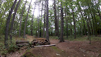
Photos of Stratham Mountain Bike


Recent Trail Reports
| status | trail | date | condition | info | user |
|---|---|---|---|---|---|
| Lower Father & Son | Apr 1, 2026 @ 9:17am (America/New_York) Apr 1, 2026 | Dry | TQ-6288 | ||
| Gifford Land Center Run | Jan 14, 2026 @ 3:45pm (America/New_York) Jan 14, 2026 | Icy | parider19 | ||
| Gifford Land South Jog | Jan 14, 2026 @ 3:45pm (America/New_York) Jan 14, 2026 | Snow Cover Partial | parider19 | ||
| Long Hill Single Side | Jan 14, 2026 @ 3:45pm (America/New_York) Jan 14, 2026 | Variable | parider19 | ||
| Dead Fish (unofficial name) | Jan 14, 2026 @ 3:45pm (America/New_York) Jan 14, 2026 | Ideal | parider19 | ||
| Kitty Rock | Jan 14, 2026 @ 3:45pm (America/New_York) Jan 14, 2026 | Wet | parider19 | ||
| Eagle | Aug 15, 2025 @ 7:22am Aug 15, 2025 | Ideal | Oldbikersam | ||
| Lovell Double Track | Aug 15, 2025 @ 7:22am Aug 15, 2025 | Ideal | Oldbikersam | ||
| Rivendell | Aug 15, 2025 @ 7:22am Aug 15, 2025 | Variable | Oldbikersam | ||
| Long Hill Connector | Aug 15, 2025 @ 7:22am Aug 15, 2025 | Variable | Oldbikersam |
Activity Feed
| username | action | type | title | date |
|---|---|---|---|---|
| NembaHobbit | wishlist | region | activity #99573651 | Jul 19, 2026 @ 3:40pm Jul 19, 2026 |
| chrisoZH30Q | vote | route | activity #99339656 | Jul 16, 2026 @ 4:35pm Jul 16, 2026 |
| chrisoZH30Q | vote | trail | activity #98890158 | Jul 10, 2026 @ 4:52pm Jul 10, 2026 |
| fishonbrown | wishlist | trail | activity #97990955 and 1 more | Jun 28, 2026 @ 8:11am Jun 28, 2026 |
| Ride4morefun | ridden | trail | activity #97401616 | Jun 20, 2026 @ 9:00am Jun 20, 2026 |
Recent Comments
| username | type | title | comment | date |
|---|---|---|---|---|
| trail | No elves live here, just squirts :/ | May 11, 2024 @ 4:40pm May 11, 2024 | ||
| report | All clear now | Aug 1, 2022 @ 3:56pm Aug 1, 2022 | ||
| report | Testing work report work flow from app | Jun 7, 2022 @ 12:13pm Jun 7, 2022 | ||
| trail | Pretty flat, pretty much no obstacles - fast... | May 7, 2022 @ 6:11am May 7, 2022 | ||
| trail | Fun fast flows trail. | Aug 18, 2021 @ 3:35pm Aug 18, 2021 |
Local Badges
-

Epic Ride Climb 2k1 awarded -

Climbing 10k Badge32 awarded -

Climbing 100k Badge0 awarded -

Epic Ride Descent 2k1 awarded -

Descent 10k Badge33 awarded -

Descent 100k Badge0 awarded
Bike & Skill Parks
| name | type | city | rating |
|---|---|---|---|
| Pump Track | skill park | Stratham |
Activity Type Stats
| activitytype | trails | distance | descent | descent distance | total vertical | rating | global rank | state rank | photos | reports | routes | activity logs |
|---|---|---|---|---|---|---|---|---|---|---|---|---|
| Mountain Bike | 41 | 13 miles | 1,181 ft | 5 miles | 210 ft | #1,732 | #638 | 27 | 294 | 7 | 12,862 | |
| E-Bike | 1 | 118 ft | 254 | 1 | 118 | |||||||
| Hike | 38 | 13 miles | 1,158 ft | 5 miles | 210 ft | #7,714 | #2,719 | 293 | 3 | 400 | ||
| Trail Running | 36 | 13 miles | 1,155 ft | 5 miles | 210 ft | #7,268 | #2,393 | 292 | 9 | 365 | ||
| Snowshoe | 4 | 2,995 ft | 3 ft | 322 ft | 49 ft | #1,624 | #923 | 1 | 1 | 5 | ||
| Backcountry Ski | 1 | 413 ft | 3 ft | 9 | ||||||||
| Nordic Ski | 4 | 2,995 ft | 3 ft | 322 ft | 49 ft | #1,655 | #837 | 1 | 26 |
Frequently Asked Questions About Stratham
▼
What are the best places to ride in Stratham?
Stratham has 1 areas to explore for mountain biking. The top rated areas are:
▼
What are the highest rated mountain biking trails in Stratham?
The highest rated mountain biking trails in Stratham are:
- Once A Pond A Time (4.1/5)
- Father & Son (4.1/5)
- Kitty Rock (4/5)
- Long Hill (4/5)
- Jewell Hill Connector (4/5)
▼
What is the best time of the year to ride in Stratham?
Based on activity log data, the most popular months to ride in Stratham are:
- July (318 activities)
- September (261 activities)
- August (260 activities)
▼
Where can I park to ride in Stratham?
There are 3 parking locations listed in Stratham. The most popular parking spots are: View all parking and trailhead locations on the map to plan your visit.
Trails
Points of Interest
- By Jsardinas
 & contributors
 - Admins: SC NEMBA-NH
- #16516 - 3,201 views
- stratham activity log | embed map of Stratham mountain bike trails | stratham mountain biking points of interest
Downloading of trail gps tracks in kml & gpx formats is enabled for Stratham.
You must login to download files.