
close
3D
Trail Conditions
- Unknown
- Snow Groomed
- Snow Packed
- Snow Covered
- Snow Cover Partial
- Freeze/thaw Cycle
- Icy
- Prevalent Mud
- Wet
- Variable
- Ideal
- Dry
- Very Dry
Trail Flow (Ridden Direction)
Trailforks scans users activity logs to determine the most popular direction each trail is ridden. A good flowing trail network will have most trails flowing in a single direction according to their intension.
The colour categories are based on what percentage of users are riding a trail in its intended direction.
The colour categories are based on what percentage of users are riding a trail in its intended direction.
- > 96%
- > 90%
- > 80%
- > 70%
- > 50%
- < 50%
- bi-directional trail
- no data
Trail Last Used
Trailforks scans activity logs to determine the last time a trail was ridden.
- < 2 days
- < 1 week
- < 2 weeks
- < 1 month
- < 6 months
- > 6 months
Trail Ridden Direction
The intended direction a trail should be ridden.
- Downhill Only
- Downhill Primary
- Both Directions
- Uphill Primary
- Uphill Only
- One Direction
Contribute Details
Colors indicate trail is missing specified detail.
- Description
- Photos
- Description & Photos
- Videos
Trail Popularity ?
Trailforks scans activity logs to determine which trails are ridden the most in the last 9 months.
Trails are compared with nearby trails in the same city region with a possible 25 colour shades.
Think of this as a heatmap, more activities = more kinetic energy = warmer colors.
- most popular
- popular
- less popular
- not popular
ATV/ORV/OHV Filter
Max Vehicle Width
inches
US Cell Coverage
Legend

Radar Time
Activity Recordings
Trailforks uses anonymized public activity data.
?
Activity Recordings
Trailforks uses anonymized public activity data.
?
Winter Trails
Warning
A routing network for winter maps does not exist. Selecting trails using the winter trails layer has been disabled.
Missing Trails
Most Popular
Least Popular
Trails are colored based on popularity. The more popular a trail is, the more red. Less popular trails trend towards green.
Jump Magnitude Heatmap
Heatmap of where users jump on trails. Zoom in to see individual jumps, click circles to view jump details.
BC Backroad Status
![map legend]()
Service Road Atlas is a free to use, community-driven service for viewing and creating reports on the numerous back-country service roads around B.C. and Alberta.

Slope Aspect
Direction the slope faces
Trails Deemphasized
Trails are shown in grey.
Only show trails with no bike usage.
Suggested Layers
Based on selected activity type
Save the current map location and zoom level as your default home location whenever this page is loaded.
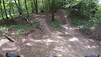
SaveThorndon has some good XC. Nothing massively technical, but good trail riding. Finding your way round can be a bit tricky as the woods are linked by fireroads and main roads but a massive loop is possible.
There is also a rather mental freeride area and pin sharp dirt jumps called Warley. Come for and ride and i'm sure we will find them on the way .
plan a road trip hereThere is also a rather mental freeride area and pin sharp dirt jumps called Warley. Come for and ride and i'm sure we will find them on the way
.source: Essex Herts MTB
This region uses the Uk/Euro style trail grading system.
Trail info last updated
Activities Click to view
- Mountain Bike
5 trails
- Hike
5 trails
- Trail Running
5 trails
Region Details
- 2
- 3
Region Status
Caution as of Oct 5, 2026Stats
- Avg Trail Rating
- Trails (view details)
- 5
- Trails Mountain Bike
- 5
- Trails Adaptive Bike
- 1
- Trails Winter Fat Bike
- 3
- Trails Hike
- 5
- Trails Trail Running
- 5
- Total Distance
- 1 mile
- Total Descent
- 292 ft
- Total Vertical
- 143 ft
- Highest Trailhead
- 397 ft
- Reports
- 20
- Photos
- 9
- Completed Counter
- 205
Popular Thorndon Mountain Biking Trails
• 50 ★ 3.0 • 1,333 ft • 0 ft • 61 •
The main trail based downhill run with a fallen tree drop off, bombhole and gap jumps that can be ridden around if needed. Can be very muddy at the bottom 50 yards most of the year.
• 30 ★ 0.0 • 1,045 ft • 7 ft • 11 •
The route from the carpark. Some rubbish and rubble to contend with near the carpark then some short steep inclines you may want to push up. After that its plain sailing to the road crossing, then you can join up to the warley run and...
• 5 ★ 0.0 • 735 ft • 0 ft • 3 •
Some nice tabletops and jumps, but take a look around, this is one of the tamer lines.
Photos of Thorndon Mountain Bike
Videos of Thorndon Mountain Bike

Recent Trail Reports
| status | trail | date | condition | info | user |
|---|---|---|---|---|---|
| Warley Main Line | Oct 5, 2026 @ 2:51pm (Europe/London) Oct 5, 2026 | Dry | joeg885 | ||
| Warley DH | Oct 5, 2026 @ 2:51pm (Europe/London) Oct 5, 2026 | Dry | joeg885 | ||
| Warley Run | Sep 10, 2023 @ 1:58pm Sep 10, 2023 | Ideal | joeg885 | ||
| Parking to Pleasure | Sep 10, 2023 @ 1:58pm Sep 10, 2023 | Dry | joeg885 |
Activity Feed
| username | action | type | title | date |
|---|---|---|---|---|
| joeg885 | add | report | activity #105270091 and 1 more | Oct 5, 2026 @ 6:51am Oct 5, 2026 |
| JohnnyHTRhOJ | ridden | trail | activity #93380033 | Apr 25, 2026 @ 12:05pm Apr 25, 2026 |
| talulah007 | ridden | trail | activity #89284706 | Feb 21, 2026 @ 8:19am Feb 21, 2026 |
| micad57 | wishlist | trail | activity #74458875 | Jun 24, 2025 @ 4:19am Jun 24, 2025 |
| Neilparker02 | ridden | trail | activity #60071688 | Oct 6, 2024 @ 2:14pm Oct 6, 2024 |
Nearby Areas
| name | distance | ||||
|---|---|---|---|---|---|
| Ingrebourne Bike Park | 1 | 3 | 2 | 6.2 km | |
| Redbridge Cycling Centre (Hog Hill) | 3 | 3 | 7.3 km | ||
| Hainault Forest | 9 | 2 | 7.3 km | ||
| Epping Forest | 94 | 88 | 11.3 km | ||
| Benfleet Downs | 12.7 km |


Activity Type Stats
| activitytype | trails | distance | descent | descent distance | total vertical | rating | global rank | state rank | photos | reports | routes | activity logs |
|---|---|---|---|---|---|---|---|---|---|---|---|---|
| Mountain Bike | 5 | 1 mile | 292 ft | 4,583 ft | 144 ft | #15,463 | #544 | 9 | 20 | 618 | ||
| Adaptive Bike | 1 | 1,371 ft | 26 ft | 682 ft | 16 ft | #8,434 | #402 | 3 | ||||
| Winter Fat Bike | 3 | 3,747 ft | 177 ft | 2,844 ft | 131 ft | #8,432 | #402 | 9 | ||||
| Hike | 5 | 1 mile | 292 ft | 4,583 ft | 144 ft | #15,281 | #439 | 20 | 12 | |||
| Trail Running | 5 | 1 mile | 292 ft | 4,583 ft | 144 ft | #14,187 | #417 | 20 | 2 |
- By brenthillier
 NSMBA TRAILFORKS & contributors
- Admins: apply
- #7008 - 8,968 views
- thorndon activity log | embed map of Thorndon mountain bike trails |
Downloading of trail gps tracks in kml & gpx formats is enabled for Thorndon.
You must login to download files.
