close
-
Layers w
- Weather Layers
- Pro
- Pro
- Pro
- Pro
- Pro
- Pro
- More Layers
- Pro
- Pro
- Pro
- Pro
-
Upgrade to

3D
Trail Conditions
- Unknown
- Snow Groomed
- Snow Packed
- Snow Covered
- Snow Cover Partial
- Freeze/thaw Cycle
- Icy
- Prevalent Mud
- Wet
- Variable
- Ideal
- Dry
- Very Dry
Trail Flow (Ridden Direction)
Trailforks scans users ridelogs to determine the most popular direction each trail is ridden. A good flowing trail network will have most trails flowing in a single direction according to their intension.
The colour categories are based on what percentage of riders are riding a trail in its intended direction.
The colour categories are based on what percentage of riders are riding a trail in its intended direction.
- > 96%
- > 90%
- > 80%
- > 70%
- > 50%
- < 50%
- bi-directional trail
- no data
Trail Last Ridden
Trailforks scans ridelogs to determine the last time a trail was ridden.
- < 2 days
- < 1 week
- < 2 weeks
- < 1 month
- < 6 months
- > 6 months
Trail Ridden Direction
The intended direction a trail should be ridden.
- Downhill Only
- Downhill Primary
- Both Directions
- Uphill Primary
- Uphill Only
- One Direction
Contribute Details
Colors indicate trail is missing specified detail.
- Description
- Photos
- Description & Photos
- Videos
Trail Popularity ?
Trailforks scans ridelogs to determine which trails are ridden the most in the last 9 months.
Trails are compared with nearby trails in the same city region with a possible 25 colour shades.
Think of this as a heatmap, more rides = more kinetic energy = warmer colors.
- most popular
- popular
- less popular
- not popular
ATV/ORV/OHV Filter
Max Vehicle Width
inches
US Cell Coverage
Legend

Radar Time
Activity Recordings
Trailforks uses anonymized public activity data.
?
Activity Recordings
Trailforks uses anonymized public activity data.
?
Personal Heatmap
▶
Activity Types
all
/
none
▶
Options
2
Date range
month
–
Winter Trails
Warning
A routing network for winter maps does not exist. Selecting trails using the winter trails layer has been disabled.
Missing Trails
Most Popular
Least Popular
Trails are colored based on popularity. The more popular a trail is, the more red. Less popular trails trend towards green.
Jump Magnitude Heatmap
Heatmap of where riders jump on trails. Zoom in to see individual jumps, click circles to view jump details.
BC Backroad Status
![map legend]()
Service Road Atlas is a free to use, community-driven service for viewing and creating reports on the numerous back-country service roads around B.C. and Alberta.

Slope Aspect
Direction the slope faces
Trails Deemphasized
Trails are shown in grey.
Only show trails with no bike usage.
Suggested Layers
Based on selected activity type
Save the current map location and zoom level as your default home location whenever this page is loaded.
SaveThe Three Stage trails are extremely susceptible to damage in wet conditions. If you find that the trails are muddy, please turn around and come back another day. Do not deviate from the main path to avoid braiding of trails. Keep singletrack single
Three Stage is a network of 40+ km of mostly advanced single track. There is a wide variety of terrain at Three Stage, everything from 10+ minute flowing descents to rolling hills and even some flat single track. Within a two-hour ride it is possible to ride five different forest types from wide-open hardwood to tightly spaced cedars, creating a feeling of riding totally different trail networks on your ride. The trails are on a clay base so things can get a little sideways in the wet and the rocks will be just as unforgiving even in the dry.
The trails at Three Stage are mostly unmarked and can be difficult to navigate unless you have a keen sense of direction. Finding a local to tag along with is usually your best bet for not getting lost. Three Stage is accessible from six trail access points. four of the access points are located on the 6th Side Road at the top of the Escarpment and the other two are at the bottom off of the 33/34-Side Road/ Pretty River Road at the bottom of the park. The main access is located at the 6th Line and 2nd Side Road.
The trails at Three Stage are built and maintained by local riders so please respect the trails and pick up any garbage and downed logs. If using Strava, follow the trail and do not cut corners. If you are unable to ride a section of trail walk your bike, do not create a ride around.
Primary Trail Type: Cross-Country
eBikes Allowed:
Yes
Shuttleable: YES
AKA: Pretty River Valley Provincial Park
Land Status: Provincial Park
Land Manager: Ontario Parks
 google parking directions
 Region Supporters & Maintainers
![]()
Collingwood Off-Road Cycling AssociationMaintainer
Activities Click to view
- Mountain Bike
71 trails
- E-Bike
7 trails
- Gravel Bike
0 trails
- Winter Fat Bike
0 trails
- Hike
72 trails
- Trail Running
72 trails
- Snowshoe
71 trails
- Backcountry Ski
0 trails
- Nordic Ski
3 trails
Region Details
- 4
- 1
- 11
- 31
- 21
- 3
Region Status
Caution as of 1 hoursStats
- Avg Trail Rating
- Trails (view details)
- 71
- Trails Mountain Bike
- 71
- Trails E-Bike
- 7
- Trails Hike
- 72
- Trails Trail Running
- 72
- Trails Snowmobile
- 2
- Trails Snowshoe
- 71
- Trails Nordic Ski
- 3
- Total Distance
- 37 miles
- Total Descent
- 4,548 ft
- Total Vertical
- 908 ft
- Highest Trailhead
- 1,794 ft
- Reports
- 2,811
- Photos
- 357
- Ridden Counter
- 44,611
Popular Three Stage Mountain Biking Trails
• 100 ★ 4.2 • 2,772 ft • 27 ft • 1,318 •
Perfect warm up for the rest of your ride. A flowing segment with some moderate climbs and downhill sections. Fairly smooth sailing except for a few roots and rocks. You will encounter traffic in both directions on this trail but the...
• 100 ★ 4.3 • 2,566 ft • 82 ft • 1,147 •
tracks along the edge of the Pretty River Valley. There are a couple of shorty, punchy climbs, but the majority of the trail is winding singletrack with roots and rocks interspersed. There are also some off camber sections with exposed...
• 100 ★ 3.0 • 1,476 ft • 24 ft • 1,132 •
Basically an access type road with aggregate so although it is straight and not very interesting, it has traction to climb when clay based trails don't.
• 100 ★ 4.0 • 896 ft • 0 ft • 1,098 •
Popular blue difficulty singletrack. This mountain bike primary trail can be used both directions and has a easy overall physical rating. On average it takes 2 minutes to complete this trail.
• 100 ★ 4.4 • 2,562 ft • 26 ft • 1,039 •
Rough singletrack with a short, fairly technical climb followed by a steep, rocky and rooty downhill section to help you carry speed back out to the parking lot. The vast majority of traffic on this trail is heading back out to the...
• 100 ★ 4.5 • 3,607 ft • 48 ft • 972 •
Popular blue difficulty singletrack. This mountain bike primary trail can be used both directions and has a easy overall physical rating with a 48 ft green climb. On average it takes 5 minutes to complete this trail.
• 100 ★ 3.9 • 2,300 ft • 27 ft • 932 •
Twisty and technical singletrack without many major changes in elevations or prolonged climbs. The majority of the trail will keep you at a steady pace as you navigate the roots and rocks.
Three Stage Mountain Bike Routes
★ 3.8 • 5 miles • 342 ft • 17 • Point to Point •
A good place to start for experienced riders who are new to Three Stage. This route will lead you through...
★ 5.0 • 12 miles • 1,523 ft • 32 •
East Loop, to loop, to loop. S-B-S: Small-Big-Small.
★ 4.8 • 7 miles • 597 ft • 33 • Out & Back •
This route contains some of the more popular three stage trails. It is a relatively flowy route for three...
★ 5.0 • 7 miles • 1,021 ft • 16 • Loop •
Enduro style loop. Single track downhill to bottom. Pretty River Climb back to top.
★ 5.0 • 8 miles • 731 ft • 19 • Loop •
15km 3 stage trial loop. hard hill climb finisher
6 miles • 447 ft • 12 •
Classic Loop with limited challenging sections giving you a taste of the top 3 stage area. Many options to...
Photos of Three Stage Mountain Bike
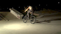
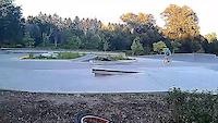
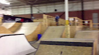
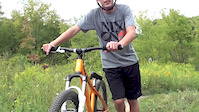
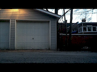
Videos of Three Stage Mountain Bike
trail: Trillium Hill
2:11 |
28805 |
Aug 20, 2013
trail: Millenium (South)
0:15 |
295 |
Mar 4, 2013
trail: Trillium Hill
0:06 |
76 |
Oct 2, 2012
trail: New Old
0:18 |
403 |
Sep 24, 2012
trail: Trillium Hill
0:15 |
165 |
Sep 7, 2012
trail: Trillium Hill
2:11 |
831 |
Aug 21, 2012

trail: Trillium Hill
0:22 |
335 |
Jul 24, 2012
trail: Trillium Hill
0:18 |
510 |
Mar 8, 2012
Current Trail Warnings
| status | trail | date | condition | user | info |
|---|---|---|---|---|---|
| Tech Trail | Jul 3, 2026 @ 7:38am (America/Toronto) Jul 3, 2026 | Ideal | goldn | Rapid growth from the forest floor due to... | |
| Old Bruce - side trail | Jun 20, 2026 @ 12:51pm (America/Toronto) Jun 20, 2026 | Ideal | AndyDurnford73 | Very grown over and weedy | |
| 540 DH | Jun 20, 2026 @ 12:51pm (America/Toronto) Jun 20, 2026 | Unknown | AndyDurnford73 |
Recent Trail Reports
Activity Feed
| username | action | type | title | date |
|---|---|---|---|---|
| kegor | wishlist | route | activity #98373724 | Jul 3, 2026 @ 4:28pm Jul 3, 2026 |
| goldn | add | report | activity #98344287 and 13 more | Jul 3, 2026 @ 9:36am Jul 3, 2026 |
| egroenke | wishlist | route | activity #98322756 and 1 more | Jul 3, 2026 @ 4:05am Jul 3, 2026 |
| jpold | wishlist | route | activity #98100582 | Jun 29, 2026 @ 6:21pm Jun 29, 2026 |
| maryteresa | wishlist | route | activity #98058305 | Jun 29, 2026 @ 6:11am Jun 29, 2026 |
Recent Comments
| username | type | title | comment | date |
|---|---|---|---|---|
| report | Chainsaw I think | Apr 27, 2026 @ 5:02am Apr 27, 2026 | ||
| report | Chainsaw or handsaw type job? | Apr 26, 2026 @ 11:41am Apr 26, 2026 | ||
| report | leaf and stick covered needs a clear | Apr 25, 2026 @ 1:53pm Apr 25, 2026 | ||
| trail | Trail is very much blocked | Aug 31, 2025 @ 10:15am Aug 31, 2025 | ||
| trail | trees down at entrance | Jun 25, 2025 @ 3:52pm Jun 25, 2025 |
Nearby Areas
| name | distance | ||||
|---|---|---|---|---|---|
| Osler Bluff Ski Club | 7 | 3 | 2 | 2 km | |
| Blue Mountain DH | 1 | 4.3 km | |||
| Grey County Forest - Kolapore Headwaters | 4.4 km | ||||
| Highlands Cluster - Nordic/Golf Course | 6 | 19 | 5 | 4.7 km | |
| Blue Mountain Resort | 5 | 9 | 5 | 4.9 km |
Local Badges
-

Completionist4 awarded
Activity Type Stats
| activitytype | trails | distance | descent | descent distance | total vertical | rating | global rank | state rank | photos | reports | routes | ridelogs |
|---|---|---|---|---|---|---|---|---|---|---|---|---|
| Mountain Bike | 71 | 37 miles | 4,547 ft | 14 miles | 909 ft | #220 | #18 | 322 | 2,811 | 17 | 20,732 | |
| E-Bike | 7 | 8 miles | 804 ft | 3 miles | 771 ft | #3,754 | #88 | 2,591 | 1 | 402 | ||
| Hike | 72 | 37 miles | 4,547 ft | 14 miles | 909 ft | #1,504 | #44 | 32 | 2,810 | 2 | 1,540 | |
| Trail Running | 72 | 37 miles | 4,547 ft | 14 miles | 909 ft | #2,887 | #24 | 2,810 | 2 | 571 | ||
| Snowmobile | 2 | 5 miles | 190 ft | 1 mile | 771 ft | 2 | 2 | |||||
| Snowshoe | 71 | 35 miles | 4,436 ft | 14 miles | 909 ft | #209 | #11 | 184 | 1 | 122 | ||
| Nordic Ski | 3 | 3 miles | 315 ft | 1 mile | 640 ft | #430 | #23 | 1 | 60 |
Frequently Asked Questions About Three Stage
▼
What are the highest rated mountain biking trails in Three Stage?
The highest rated mountain biking trails in Three Stage are:
- Pork Chop (4.4/5)
- Cumming Go (4.4/5)
- Big Berm (4.3/5)
- Five Points Loop (4.3/5)
- Fence Line East (4.3/5)
▼
What is the best time of the year to ride in Three Stage?
Based on ride log data, the most popular months to ride in Three Stage are:
- July (966 activities)
- August (778 activities)
- June (737 activities)
▼
Where can I park to ride in Three Stage?
There are 5 parking locations listed in Three Stage. The most popular parking spots are: View all parking and trailhead locations on the map to plan your visit.
▼
What is the longest trail in Three Stage?
The longest trail in Three Stage is Bruce Trail at 5.6 km. View all trails sorted by distance.
Activities
Trails
- By AdamChed & contributors
- Admins: CORC, Grey, jpetznick
- #4647 - 68,728 views
- three stage activity log | embed map of Three Stage mountain bike trails | three stage mountain biking points of interest
Downloading of trail gps tracks in kml & gpx formats is enabled for Three Stage.
You must login to download files.