close
-
Layers w
- Weather Layers
- Pro
- Pro
- Pro
- Pro
- Pro
- Pro
- More Layers
- Pro
- Pro
- Pro
- Pro
-
Upgrade to

3D
Trail Conditions
- Unknown
- Snow Groomed
- Snow Packed
- Snow Covered
- Snow Cover Partial
- Freeze/thaw Cycle
- Icy
- Prevalent Mud
- Wet
- Variable
- Ideal
- Dry
- Very Dry
Trail Flow (Ridden Direction)
Trailforks scans users ridelogs to determine the most popular direction each trail is ridden. A good flowing trail network will have most trails flowing in a single direction according to their intension.
The colour categories are based on what percentage of riders are riding a trail in its intended direction.
The colour categories are based on what percentage of riders are riding a trail in its intended direction.
- > 96%
- > 90%
- > 80%
- > 70%
- > 50%
- < 50%
- bi-directional trail
- no data
Trail Last Ridden
Trailforks scans ridelogs to determine the last time a trail was ridden.
- < 2 days
- < 1 week
- < 2 weeks
- < 1 month
- < 6 months
- > 6 months
Trail Ridden Direction
The intended direction a trail should be ridden.
- Downhill Only
- Downhill Primary
- Both Directions
- Uphill Primary
- Uphill Only
- One Direction
Contribute Details
Colors indicate trail is missing specified detail.
- Description
- Photos
- Description & Photos
- Videos
Trail Popularity ?
Trailforks scans ridelogs to determine which trails are ridden the most in the last 9 months.
Trails are compared with nearby trails in the same city region with a possible 25 colour shades.
Think of this as a heatmap, more rides = more kinetic energy = warmer colors.
- most popular
- popular
- less popular
- not popular
ATV/ORV/OHV Filter
Max Vehicle Width
inches
US Cell Coverage
Legend

Radar Time
Activity Recordings
Trailforks uses anonymized public activity data.
?
Activity Recordings
Trailforks uses anonymized public activity data.
?
Personal Heatmap
▶
Activity Types
all
/
none
▶
Options
2
Date range
month
–
Winter Trails
Warning
A routing network for winter maps does not exist. Selecting trails using the winter trails layer has been disabled.
Missing Trails
Most Popular
Least Popular
Trails are colored based on popularity. The more popular a trail is, the more red. Less popular trails trend towards green.
Jump Magnitude Heatmap
Heatmap of where riders jump on trails. Zoom in to see individual jumps, click circles to view jump details.
BC Backroad Status
![map legend]()
Service Road Atlas is a free to use, community-driven service for viewing and creating reports on the numerous back-country service roads around B.C. and Alberta.

Slope Aspect
Direction the slope faces
Trails Deemphasized
Trails are shown in grey.
Only show trails with no bike usage.
Suggested Layers
Based on selected activity type
Save the current map location and zoom level as your default home location whenever this page is loaded.
Save
No description for Tulsa has been added yet!
Login or register to submit one.
Activities Click to view
- Mountain Bike
111 trails
- E-Bike
73 trails
- Gravel Bike
0 trails
- Adaptive Bike
0 trails
- Winter Fat Bike
0 trails
- Hike
99 trails
- Trail Running
99 trails
Region Details
- 1
- 13
- 30
- 38
- 20
- 4
Region Status
Open as of May 9, 2026Local Trail Association
Stats
- Avg Trail Rating
- Trails (view details)
- 121
- Trails Mountain Bike
- 113
- Trails E-Bike
- 73
- Trails Hike
- 99
- Trails Trail Running
- 99
- Total Distance
- 105 miles
- Total Descent
- 7,089 ft
- Total Vertical
- 359 ft
- Highest Trailhead
- 938 ft
- Reports
- 590
- Photos
- 209
- Ridden Counter
- 20,063
Sub Regions
-
Bales Park
- 5
- 1
-
Haikey Creek Park
-
Lubell Park
- 1
- 1
-
Turkey Mountain - Tulsa
- 23
- 35
- 20
- 4
Popular Tulsa Mountain Biking Trails
• 95 ★ 4.0 • 2,920 ft • 137 ft • 448 •
The newest and easiest way to get from the Lower Parking lot to the upper trail system.
• 80 ★ 4.4 • 5,052 ft • 108 ft • 288 •
Smooth and flowy loop that takes you down by Pepsi lake and some of the older Turkey Mountain trails. Some tight berms make for good cornering practice. Trail crosses over older trails but is easy to distinguish between the old and new.
• 75 ★ 4.0 • 1,371 ft • 22 ft • 279 •
Popular black diamond difficulty singletrack. This multi-use trail can be used both directions and has a moderate overall physical rating with a 22 ft blue climb. Trail visibility is sometimes hard to follow. On average it takes 1 minutes to complete this trail.
• 65 ★ 4.4 • 3 miles • 232 ft • 275 •
is one of the new sustainable trails built by Progressive Trail Design. The trail is smooth and flowly with options for jumps along the sides of the wide trails. Great for beginners and speed seekers alike.
• 85 ★ 4.0 • 909 ft • 0 ft • 270 •
fun little sessionable trail with quick access back to top and one big jump that's fun.
Tulsa Mountain Bike Routes
★ 4.0 • 3 miles • 137 ft • 3 • Loop •
Clockwise loop of Bales Park Trails including ride from the parking lot to the hub, taking Blackjack...
• 13 miles • 403 ft • 3 •
• 17 miles • 596 ft • 2 •
• 17 miles • 2,224 ft • 56 •
• 12 miles • 683 ft • 13 •
• 12 miles • 1,379 ft • 25 •
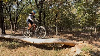
Photos of Tulsa Mountain Bike
Videos of Tulsa Mountain Bike
featured
![Bales Park Trails Virtual Tour - All Trails]()

15:10 |
452 |
Jan 5, 2023
featured
![Lubell Park Trails - Full CCW Loop]()
trail: Mary's Loop
14:00 |
581 |
Jan 5, 2023 , Tulsa
trail: The Yekrut
0:40 |
|
Aug 26, 2024
trail: UHF
0:09 |
194 |
Apr 11, 2022
trail: Fro Flo
0:06 |
661 |
Apr 10, 2020
7:47 |
77 |
Jan 25, 2026
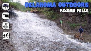
trail: Bixhoma Waterfall
4:32 |
403 |
Jun 6, 2021 , Tulsa
Recent Trail Reports
Activity Feed
| username | action | type | title | date |
|---|---|---|---|---|
| TreyTrails | vote | trail | activity #97599801 | Jun 22, 2026 @ 7:27pm 4 hours |
| chasethegnar | ridden | trail | activity #97487091 and 1 more | Jun 21, 2026 @ 8:22am 2 days |
| ShannonltvO6J | wishlist | badge | activity #97281424 | Jun 18, 2026 @ 4:10pm Jun 18, 2026 |
| BigheadTed | ridden | trail | activity #96995026 and 1 more | Jun 14, 2026 @ 12:23pm Jun 14, 2026 |
| GatorBoii | ridden | trail | activity #96696622 | Jun 10, 2026 @ 2:36pm Jun 10, 2026 |
Recent Comments
| username | type | title | comment | date |
|---|---|---|---|---|
| trail | Correct trail name: SAWBLADE | May 4, 2026 @ 1:39pm May 4, 2026 | ||
| trail | Incredible trail. Several line options all are fun | Jan 21, 2026 @ 7:51pm Jan 21, 2026 | ||
| trail | Wild of the trail builder to put a rock in the... | Jan 21, 2026 @ 7:49pm Jan 21, 2026 | ||
| trail | Overgrown with 7 foot tall grass. Some... | Jul 27, 2025 @ 5:57pm Jul 27, 2025 | ||
| trail | add a little rock jump going down into the... | Sep 6, 2024 @ 1:03pm Sep 6, 2024 |
Local Badges
-

10 Green Trails175 awarded -

10 Blue Trails192 awarded -

Epic Ride Climb 2k6 awarded -

Climbing 10k Badge67 awarded -

Climbing 100k Badge7 awarded -

Epic Ride Descent 2k6 awarded
Bike & Skill Parks
| name | type | city | rating |
|---|---|---|---|
| McCullough Park | skill park | Tulsa |
Local Mountain Biking Directory
-
Phat Tire Bike Shop: Tulsa South
-
Bike Club Tulsa
![Bike Club Tulsa]()
-
River Parks Foundation
![River Parks Foundation]()
-
918xcBike Shop
-
Spoke House BicyclesBike Shop
-
Tom's BicyclesBike Shop
Local Trail Supporters
- Progressive Trail Design
Activity Type Stats
| activitytype | trails | distance | descent | descent distance | total vertical | rating | global rank | state rank | photos | reports | routes | ridelogs |
|---|---|---|---|---|---|---|---|---|---|---|---|---|
| Mountain Bike | 111 | 98 miles | 6,309 ft | 40 miles | 338 ft | #738 | #286 | 183 | 606 | 1 | 24,893 | |
| E-Bike | 73 | 39 miles | 3,271 ft | 15 miles | 335 ft | #2,614 | #1,035 | 573 | 4 | 1,016 | ||
| Hike | 99 | 102 miles | 6,066 ft | 40 miles | 358 ft | #1,350 | #617 | 33 | 591 | 2 | 1,389 | |
| Trail Running | 99 | 102 miles | 6,066 ft | 40 miles | 358 ft | #1,965 | #636 | 591 | 2 | 701 |
Frequently Asked Questions About Tulsa
▼
What are the best places to ride in Tulsa?
Tulsa has 6 areas to explore for mountain biking. The top rated areas are:
▼
What are the highest rated mountain biking trails in Tulsa?
The highest rated mountain biking trails in Tulsa are:
- Zingo (4.5/5)
- BoomTown (4.4/5)
- WildCat (4.4/5)
- TwoLips (4.3/5)
- Black Gold (4.3/5)
▼
What is the best time of the year to ride in Tulsa?
Based on ride log data, the most popular months to ride in Tulsa are:
- July (128 activities)
- December (117 activities)
- October (106 activities)
▼
Where can I park to ride in Tulsa?
There are 10 parking locations listed in Tulsa. The most popular parking spots are: View all parking and trailhead locations on the map to plan your visit.
Activities
Trails
- By marshy152 & contributors
- Admins: RPA
- #7435 - 13,526 views
- tulsa activity log | embed map of Tulsa mountain bike trails | tulsa mountain biking points of interest
Downloading of trail gps tracks in kml & gpx formats is enabled for Tulsa.
You must login to download files.