close
-
Layers w
- Weather Layers
- Pro
- Pro
- Pro
- Pro
- Pro
- Pro
- More Layers
- Pro
- Pro
- Pro
- Pro
-
Upgrade to

3D
Trail Conditions
- Unknown
- Snow Groomed
- Snow Packed
- Snow Covered
- Snow Cover Partial
- Freeze/thaw Cycle
- Icy
- Prevalent Mud
- Wet
- Variable
- Ideal
- Dry
- Very Dry
Trail Flow (Ridden Direction)
Trailforks scans users activity logs to determine the most popular direction each trail is ridden. A good flowing trail network will have most trails flowing in a single direction according to their intension.
The colour categories are based on what percentage of users are riding a trail in its intended direction.
The colour categories are based on what percentage of users are riding a trail in its intended direction.
- > 96%
- > 90%
- > 80%
- > 70%
- > 50%
- < 50%
- bi-directional trail
- no data
Trail Last Ridden
Trailforks scans activity logs to determine the last time a trail was ridden.
- < 2 days
- < 1 week
- < 2 weeks
- < 1 month
- < 6 months
- > 6 months
Trail Ridden Direction
The intended direction a trail should be ridden.
- Downhill Only
- Downhill Primary
- Both Directions
- Uphill Primary
- Uphill Only
- One Direction
Contribute Details
Colors indicate trail is missing specified detail.
- Description
- Photos
- Description & Photos
- Videos
Trail Popularity ?
Trailforks scans activity logs to determine which trails are ridden the most in the last 9 months.
Trails are compared with nearby trails in the same city region with a possible 25 colour shades.
Think of this as a heatmap, more activities = more kinetic energy = warmer colors.
- most popular
- popular
- less popular
- not popular
ATV/ORV/OHV Filter
Max Vehicle Width
inches
US Cell Coverage
Legend

Radar Time
Activity Recordings
Trailforks uses anonymized public activity data.
?
Activity Recordings
Trailforks uses anonymized public activity data.
?
Personal Heatmap
▶
Activity Types
all
/
none
▶
Options
2
Date range
month
–
Winter Trails
Warning
A routing network for winter maps does not exist. Selecting trails using the winter trails layer has been disabled.
Missing Trails
Most Popular
Least Popular
Trails are colored based on popularity. The more popular a trail is, the more red. Less popular trails trend towards green.
Jump Magnitude Heatmap
Heatmap of where users jump on trails. Zoom in to see individual jumps, click circles to view jump details.
BC Backroad Status
![map legend]()
Service Road Atlas is a free to use, community-driven service for viewing and creating reports on the numerous back-country service roads around B.C. and Alberta.

Slope Aspect
Direction the slope faces
Trails Deemphasized
Trails are shown in grey.
Only show trails with no bike usage.
Suggested Layers
Based on selected activity type
Save the current map location and zoom level as your default home location whenever this page is loaded.
SaveThis region is Unsanctioned, Ride at your own Risk!
The main tourist destinations are:
The Olt River Valley:
The Călimănești-Căciulata resorts
The Cozia Monastery.
The Turnu Monastery.
The Cozia Mountains.
Various small churches and fortifications.
The Lotru River valley:
The town of Brezoi.
The Lotru Mountanis.
The Voineasa Resort
The Vidra Resort
The Obârșia Lotrului Resort.
The city of Râmnicu Vâlcea.
The Băile Govora Resort.
The Băile Olănești Resort.
This region uses the Uk/Euro style trail grading system.
Region Details
- 34
- 10
- 14
- 5
- 5
Stats
- Avg Trail Rating
- Trails (view details)
- 69
- Trails Mountain Bike
- 68
- Trails E-Bike
- 42
- Trails Horse
- 15
- Trails Hike
- 64
- Trails Trail Running
- 63
- Trails Dirtbike/Moto
- 9
- Trails Observed Trials
- 1
- Trails ATV/ORV/OHV
- 6
- Trails Snowmobile
- 1
- Trails Snowshoe
- 1
- Trails Downhill Ski
- 1
- Trails Backcountry Ski
- 2
- Trails Nordic Ski
- 1
- Total Distance
- 265 miles
- Total Descent
- 69,122 ft
- Total Vertical
- 6,792 ft
- Highest Trailhead
- 7,612 ft
- Reports
- 33
- Photos
- 104
- Completed Counter
- 262
Sub Regions
- Băile Olăneşti (8)
- Bărbăteşti (3)
- Berislavesti (1)
- Bogdăneşti (2)
- Bujoreni (1)
- Câineni (8)
- Călimăneşti (3)
- Dăeşti (1)
- Horezu (1)
- Mălaia (2)
- Ocnele Mari (2)
- Păușești-Măglași (1)
- Perișani (1)
- Ramnicu Valcea (28)
- Runcu (1)
- Vladesti (1)
- Voineasa (3)
- Obarsia Lotrului (0)
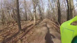
Popular Valcea Mountain Biking Trails
• 100 ★ 4.5 • 1 mile • 67 ft • 21 •
Built in 2007 by Gheorghiu Radu, trailhead at (for some time it used to be at the high voltage line). Moderate skills required to descend, problems with pedestrians going up, rain will damage parts of trail often. It is the most...
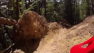
• 50 ★ 4.5 • 2 miles • 80 ft • 8 •
Built in 2013 by Gheorghiu Silviu and Gheorghiu Radu. It is currently the longest and most maintained DH trail in the region. Very low pedestrian traffic, sometimes there are goats and dogs in the way, rain makes some parts pretty...
• 5 ★ 3.0 • 2,969 ft • 0 ft • 7 • • hike
Rocky alpine descent, really punishing to your wheels and tires. It has a short exposed section and also one or two places where you'll have to dismount your bike and carry it down some big rocks.
• 100 ★ 0.0 • 3,307 ft • 0 ft • 6 •
Poteca care duce la la Boul de Piatră la Terenurile de ciment care sunt mai sus de Ghețărie
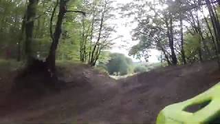
• 90 ★ 0.0 • 3,301 ft • 0 ft • 5 •
Prima sectiune prin padure este rapida si fluida, apoi de la terasa capelanilor urmeaza o sectiune abrupta dar scurta, iar spre final poteca este din nou lina si cursiva. Atentie la hikeri pe poteca!
• 5 ★ 5.0 • 4 miles • 55 ft • 4 •
In some parts you have to carry the bike, even downhill. Only 70% of this trail is rideable, but is worth it.
• 100 ★ 0.0 • 1 mile • 356 ft • 4 •
Popular green difficulty paved path. This mountain bike primary trail and has a easy overall physical rating with a 356 ft green climb. It features bridge. On average it takes 14 minutes to complete this trail.
• 65 ★ 0.0 • 1,942 ft • 7 ft • 4 •
Moderately popular green difficulty singletrack. This mountain bike primary trail can be used downhill primary.
Valcea Mountain Bike Routes
8 miles • 2,106 ft • 0 • Point to Point •
Varainta care uneste statiunile Calimanesti și Olănești.
• 2 miles • 52 ft • 2 •
Photos of Valcea Mountain Bike
Videos of Valcea Mountain Bike
trail: Cozia
10:28 |
195 |
Jun 15, 2016
trail: Grassland II
7:53 |
192 |
Nov 23, 2021 , Voineasa
trail: Fundatura
19:07 |
304 |
Jan 12, 2021 , Vladesti
trail: Boul de Piatra
12:10 |
817 |
Jan 3, 2021 , Ramnicu Valcea
trail: West DH
8:56 |
268 |
Jan 3, 2021 , Ramnicu Valcea
trail: Pătrunsa
18:54 |
204 |
Jan 2, 2021 , Bărbăteşti
trail: Baghera
11:17 |
278 |
Jan 2, 2021 , Ramnicu Valcea
trail: Tigra
13:42 |
306 |
Jan 2, 2021 , Ramnicu Valcea
Recent Trail Reports
| status | trail | date | condition | info | user |
|---|---|---|---|---|---|
| Vf. Scara - Șaua Scării Perișani | Aug 4, 2025 @ 1:46am Aug 4, 2025 | Variable | zbangee | ||
| Tigra Capela | Dec 26, 2023 @ 9:54am Dec 26, 2023 | Dry | cosmin04 | ||
| South dh Capela | Dec 26, 2023 @ 9:52am Dec 26, 2023 | Dry | cosmin04 | ||
| Terasa Capelanilor Ramnicu Valcea | Apr 14, 2023 @ 11:07pm Apr 14, 2023 | Dry | cosmin04 | ||
| Budișteanu Street Capela | Apr 15, 2023 @ 6:07am Apr 15, 2023 | Dry | cosmin04 | ||
| Boul de Piatra Capela | Feb 18, 2023 @ 10:15pm Feb 18, 2023 | Dry | cosmin04 | ||
| La Terenuri Capela | Feb 18, 2023 @ 10:15pm Feb 18, 2023 | Dry | cosmin04 | ||
| Direct Ghețărie Capela | Feb 19, 2023 @ 6:15am Feb 19, 2023 | Dry | cosmin04 | ||
| Acces to Cozia hut Berislavesti | Dec 28, 2022 @ 1:09am Dec 28, 2022 | Dry | ksuap | ||
| Baghera Capela | Nov 5, 2022 @ 9:48pm Nov 5, 2022 | Very Dry | cosmin04 |
Activity Feed
| username | action | type | title | date |
|---|---|---|---|---|
| pufalot | update | region | activity #80051825 | Sep 10, 2025 @ 9:08am Sep 10, 2025 |
| pufalot | update | region | activity #80051816 | Sep 10, 2025 @ 9:08am Sep 10, 2025 |
| pufalot | update | region | activity #80051804 | Sep 10, 2025 @ 9:08am Sep 10, 2025 |
| pufalot | update | region | activity #80051792 | Sep 10, 2025 @ 9:08am Sep 10, 2025 |
| pufalot | update | region | activity #80051780 | Sep 10, 2025 @ 9:07am Sep 10, 2025 |
Recent Comments
| username | type | title | comment | date |
|---|---|---|---|---|
| trail | Forestry works destroyed the track, I had hard... | Aug 9, 2025 @ 11:09pm Aug 9, 2025 | ||
| trail | poti pune si traseul de urcare te rog? | Apr 16, 2025 @ 5:26am Apr 16, 2025 | ||
| trail | rareș v s a bagat pe poteci ! | Dec 9, 2020 @ 3:53am Dec 9, 2020 | ||
| trail | This track is also known as Silvian! | Aug 22, 2015 @ 6:26am Aug 22, 2015 | ||
| trail | Pentru intreaga familie! | Dec 26, 2014 @ 8:41am Dec 26, 2014 |
Local Badges
-

Epic Mountain Bike Climb 2k9 awarded -

Climbing 10k Badge4 awarded -

Mountain Biking 100k Badge2 awarded -

Epic Ride Descent 2k9 awarded -

Descent 10k Badge4 awarded -

Descent 100k Badge2 awarded
Activity Type Stats
| activitytype | trails | distance | descent | descent distance | total vertical | rating | global rank | state rank | photos | reports | routes | activity logs |
|---|---|---|---|---|---|---|---|---|---|---|---|---|
| Mountain Bike | 68 | 264 miles | 69,042 ft | 134 miles | 6,791 ft | 104 | 33 | 3 | 2,788 | |||
| E-Bike | 42 | 197 miles | 47,772 ft | 99 miles | 6,755 ft | 28 | 3 | 728 | ||||
| Horse | 15 | 98 miles | 16,385 ft | 42 miles | 6,335 ft | 8 | 1 | |||||
| Hike | 64 | 258 miles | 65,171 ft | 128 miles | 6,791 ft | 29 | 1 | 1,173 | ||||
| Trail Running | 63 | 256 miles | 63,855 ft | 127 miles | 6,791 ft | 29 | 12 | |||||
| Dirtbike/Moto | 9 | 61 miles | 12,277 ft | 32 miles | 6,358 ft | 8 | 1 | |||||
| Observed Trials | 1 | 12 miles | 2,264 ft | 7 miles | 1,663 ft | |||||||
| ATV/ORV/OHV | 6 | 45 miles | 8,448 ft | 24 miles | 6,217 ft | 8 | 1 | 6 | ||||
| Snowmobile | 1 | 12 miles | 2,264 ft | 7 miles | 1,663 ft | |||||||
| Snowshoe | 1 | 12 miles | 2,264 ft | 7 miles | 1,663 ft | |||||||
| Downhill Ski | 1 | 12 miles | 2,264 ft | 7 miles | 1,663 ft | 97 | ||||||
| Backcountry Ski | 2 | 40 miles | 9,416 ft | 24 miles | 5,535 ft | 16 | ||||||
| Nordic Ski | 1 | 12 miles | 2,264 ft | 7 miles | 1,663 ft |
Activities
Trails
- By punksovereign & contributors
- Admins: pufalot
- #6343 - 2,663 views
- valcea activity log | embed map of Valcea mountain bike trails | valcea mountain biking points of interest
Downloading of trail gps tracks in kml & gpx formats is enabled for Valcea.
You must login to download files.