close
-
Layers w
- Weather Layers
- Pro
- Pro
- Pro
- Pro
- Pro
- Pro
- More Layers
- Pro
- Pro
- Pro
- Pro
-
Upgrade to

3D
Trail Conditions
- Unknown
- Snow Groomed
- Snow Packed
- Snow Covered
- Snow Cover Partial
- Freeze/thaw Cycle
- Icy
- Prevalent Mud
- Wet
- Variable
- Ideal
- Dry
- Very Dry
Trail Flow (Ridden Direction)
Trailforks scans users ridelogs to determine the most popular direction each trail is ridden. A good flowing trail network will have most trails flowing in a single direction according to their intension.
The colour categories are based on what percentage of riders are riding a trail in its intended direction.
The colour categories are based on what percentage of riders are riding a trail in its intended direction.
- > 96%
- > 90%
- > 80%
- > 70%
- > 50%
- < 50%
- bi-directional trail
- no data
Trail Last Ridden
Trailforks scans ridelogs to determine the last time a trail was ridden.
- < 2 days
- < 1 week
- < 2 weeks
- < 1 month
- < 6 months
- > 6 months
Trail Ridden Direction
The intended direction a trail should be ridden.
- Downhill Only
- Downhill Primary
- Both Directions
- Uphill Primary
- Uphill Only
- One Direction
Contribute Details
Colors indicate trail is missing specified detail.
- Description
- Photos
- Description & Photos
- Videos
Trail Popularity ?
Trailforks scans ridelogs to determine which trails are ridden the most in the last 9 months.
Trails are compared with nearby trails in the same city region with a possible 25 colour shades.
Think of this as a heatmap, more rides = more kinetic energy = warmer colors.
- most popular
- popular
- less popular
- not popular
ATV/ORV/OHV Filter
Max Vehicle Width
inches
US Cell Coverage
Legend

Radar Time
Activity Recordings
Trailforks uses anonymized public activity data.
?
Activity Recordings
Trailforks uses anonymized public activity data.
?
Personal Heatmap
▶
Activity Types
all
/
none
▶
Options
2
Date range
month
–
Winter Trails
Warning
A routing network for winter maps does not exist. Selecting trails using the winter trails layer has been disabled.
Missing Trails
Most Popular
Least Popular
Trails are colored based on popularity. The more popular a trail is, the more red. Less popular trails trend towards green.
Jump Magnitude Heatmap
Heatmap of where riders jump on trails. Zoom in to see individual jumps, click circles to view jump details.
BC Backroad Status
![map legend]()
Service Road Atlas is a free to use, community-driven service for viewing and creating reports on the numerous back-country service roads around B.C. and Alberta.

Slope Aspect
Direction the slope faces
Trails Deemphasized
Trails are shown in grey.
Only show trails with no bike usage.
Suggested Layers
Based on selected activity type
Save the current map location and zoom level as your default home location whenever this page is loaded.
Save
No description for Visp has been added yet!
Login or register to submit one.
This region uses the Uk/Euro style trail grading system.
Activities Click to view
- Mountain Bike
21 trails
- E-Bike
20 trails
- Adaptive Bike
0 trails
- Hike
21 trails
- Trail Running
21 trails
Region Details
- 2
- 13
- 3
- 2
Region Status
Open as of Jun 5, 2026Stats
- Avg Trail Rating
- Trails (view details)
- 20
- Trails Mountain Bike
- 21
- Trails E-Bike
- 20
- Trails Hike
- 21
- Trails Trail Running
- 21
- Total Distance
- 11 miles
- Total Descent Distance
- 9 miles
- Total Descent
- 8,623 ft
- Total Vertical
- 2,772 ft
- Highest Trailhead
- 4,934 ft
- Reports
- 174
- Photos
- 12
- Ridden Counter
- 1,176
Popular Visp Mountain Biking Trails
• 80 ★ 4.7 • 2 miles • 77 ft • 272 • • hike
Highly rated popular blue difficulty singletrack. This hike primary trail can be used downhill primary and has a easy overall physical rating. Trail visibility is always easy to follow. On average it takes 16 minutes to complete this trail.
• 95 ★ 4.2 • 2 miles • 48 ft • 181 •
Highly rated popular red difficulty family friendly alpine singletrack. This mountain bike primary trail. It features berm, jump, rock garden, roller coaster and skinny. Exposure: Life Threatening Consequences. Trail visibility is always easy to follow.
• 100 ★ 3.0 • 1,371 ft • 0 ft • 139 •
Popular blue difficulty singletrack. This multi-use trail can be used downhill primary and has a easy overall physical rating with a 0 ft green climb. Trail visibility is always easy to follow. On average it takes 1 minutes to complete this trail.
• 100 ★ 5.0 • 1,463 ft • 0 ft • 131 •
Popular blue difficulty singletrack. This multi-use trail can be used downhill primary and has a easy overall physical rating with a 0 ft green climb. Trail visibility is always easy to follow. On average it takes 1 minutes to complete this trail.
• 85 ★ 5.0 • 3,819 ft • 0 ft • 81 •
Popular green difficulty singletrack. This multi-use trail can be used downhill primary and has a easy overall physical rating with a 0 ft green climb. Trail visibility is always easy to follow. On average it takes 2 minutes to complete this trail.
• 85 ★ 5.0 • 1,519 ft • 0 ft • 81 •
Popular blue difficulty singletrack. This multi-use trail can be used downhill primary and has a easy overall physical rating with a 0 ft green climb. Trail visibility is always easy to follow. On average it takes 1 minutes to complete this trail.
• 90 ★ 5.0 • 4,823 ft • 3 ft • 72 •
Popular blue difficulty family friendly singletrack. This multi-use trail can be used downhill primary. It features rock garden. On average it takes 5 minutes to complete this trail.
Visp Mountain Bike Routes
Visp-Zermatt Bike #150 Featured
★ 5.0 • 23 miles • 4,649 ft • 7 • Point to Point •
Paved: 18km Forest Track: 9km SingleTrail: 11km
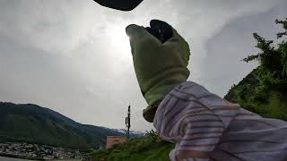
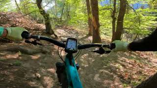
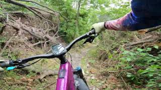
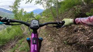
Photos of Visp Mountain Bike
Videos of Visp Mountain Bike

trail: Schlusselacher
3:47 |
50 |
May 4, 2026 , Visp

trail: Plattji
3:47 |
56 |
May 4, 2026 , Visp
trail: Albumatte
3:47 |
63 |
May 4, 2026 , Visp
trail: Teelwald
10:22 |
14 |
May 1, 2026 , Visp
trail: Schlusselacher
7:28 |
7 |
Apr 30, 2026 , Visp

trail: Graubärg
7:28 |
11 |
Apr 30, 2026 , Visp
trail: The Phoenix
17:06 |
29 |
Apr 30, 2026 , Visp

trail: The Phoenix
6:48 |
275 |
Aug 9, 2024 , Visp
Recent Trail Reports
| status | trail | date | condition | info | user |
|---|---|---|---|---|---|
| Albumatte | Jun 6, 2026 @ 8:59am (Europe/Zurich) Jun 5, 2026 | Variable | nike-ch | ||
| The Phoenix | May 30, 2026 @ 8:09am (Europe/Zurich) May 29, 2026 | Dry | doncortisone | ||
| Bärugrüebe | May 24, 2026 @ 4:48pm (Europe/Zurich) May 24, 2026 | Ideal | nike-ch | ||
| Schlusselacher | May 21, 2026 @ 10:14am (Europe/Zurich) May 21, 2026 | Dry | micheletraversi SGREBENZONE | ||
| Plattji | May 21, 2026 @ 10:14am (Europe/Zurich) May 21, 2026 | Dry | micheletraversi SGREBENZONE | ||
| Teelwald Lower Access | May 20, 2026 @ 12:07pm (Europe/Zurich) May 20, 2026 | Dry | micheletraversi SGREBENZONE | ||
| Obri Hellela | May 5, 2026 @ 12:19pm (Europe/Zurich) May 5, 2026 | Ideal | nike-ch | ||
| Schaller | May 3, 2026 @ 9:35am (Europe/Zurich) May 3, 2026 | Ideal | nike-ch | ||
| Teelwald | May 1, 2026 @ 9:17pm (Europe/Zurich) May 1, 2026 | Ideal | Grzesfajny | ||
| Englischgrussweg 2 | Apr 30, 2026 @ 6:33pm (Europe/Zurich) Apr 30, 2026 | Ideal | CyrilrtHN2H |
Activity Feed
| username | action | type | title | date |
|---|---|---|---|---|
| roeland1202 | wishlist | region | activity #96552306 | Jun 8, 2026 @ 11:12am Jun 8, 2026 |
| nike-ch | add | report | activity #96375284 | Jun 6, 2026 @ 8:42am Jun 6, 2026 |
| SandrosUznOP | ridden | trail | activity #95950390 and 2 more | May 31, 2026 @ 9:38am May 31, 2026 |
| doncortisone | add | report | activity #95846817 | May 30, 2026 @ 6:50am May 30, 2026 |
| nike-ch | add | report | activity #95419424 | May 24, 2026 @ 9:38am May 24, 2026 |
Recent Comments
| username | type | title | comment | date |
|---|---|---|---|---|
| trail | Es hat nur noch einen Baum auf dem Weg. Im... | Sep 25, 2025 @ 5:10am Sep 25, 2025 | ||
| trail | Do you know the trail reporting function on... | Aug 25, 2025 @ 1:27am Aug 25, 2025 | ||
| trail | 5 star for the flow and the trail, 2 stars for... | Aug 22, 2025 @ 4:39am Aug 22, 2025 | ||
| trail | Great! Thx for the info! | Jun 30, 2025 @ 10:18am Jun 30, 2025 | ||
| trail | @julke the trail clear and good to ride | Jun 30, 2025 @ 6:57am Jun 30, 2025 |
Local Badges
-

Epic Mountain Bike Climb 2k1 awarded -

Climbing 10k Badge0 awarded -

Mountain Biking 100k Badge0 awarded -

Epic Ride Descent 2k1 awarded -

Descent 10k Badge1 awarded -

Descent 100k Badge0 awarded
Activity Type Stats
| activitytype | trails | distance | descent | descent distance | total vertical | rating | global rank | state rank | photos | reports | routes | ridelogs |
|---|---|---|---|---|---|---|---|---|---|---|---|---|
| Mountain Bike | 21 | 11 miles | 8,622 ft | 9 miles | 2,772 ft | #5,219 | #126 | 12 | 174 | 248 | ||
| E-Bike | 20 | 9 miles | 6,946 ft | 7 miles | 2,772 ft | #5,014 | #213 | 165 | 41 | |||
| Hike | 21 | 11 miles | 8,622 ft | 9 miles | 2,772 ft | #6,684 | #177 | 174 | 9 | |||
| Trail Running | 21 | 11 miles | 8,622 ft | 9 miles | 2,772 ft | #7,009 | #180 | 173 | 99 |
Frequently Asked Questions About Visp
▼
What are the highest rated mountain biking trails in Visp?
The highest rated mountain biking trails in Visp are:
- Teelwald (4.4/5)
- Albumatte (4.3/5)
- Upper Bürchen (4.2/5)
- Plattji (4.2/5)
- Schaller (4.1/5)
▼
Where can I park to ride in Visp?
Check the Visp trail map for trailhead and parking information. Community members regularly update access and parking details for trails in the area.
▼
What is the longest trail in Visp?
The longest trail in Visp is The Phoenix at 1.9 miles. View all trails sorted by distance.
▼
What are the best & highest rated hiking trails in Visp?
The best hiking trails in Visp are: View all hiking trails sorted by popularity score.
- By inversedotch
 & contributors
 - Admins: VS-Admin, VS-Admin
- #28377 - 2,417 views
- visp activity log | embed map of Visp mountain bike trails | visp mountain biking points of interest
Downloading of trail gps tracks in kml & gpx formats is enabled for Visp.
You must login to download files.