close
-
Layers w
- Weather Layers
- Pro
- Pro
- Pro
- Pro
- Pro
- Pro
- More Layers
- Pro
- Pro
- Pro
- Pro
-
Upgrade to

3D
Trail Conditions
- Unknown
- Snow Groomed
- Snow Packed
- Snow Covered
- Snow Cover Partial
- Freeze/thaw Cycle
- Icy
- Prevalent Mud
- Wet
- Variable
- Ideal
- Dry
- Very Dry
Trail Flow (Ridden Direction)
Trailforks scans users ridelogs to determine the most popular direction each trail is ridden. A good flowing trail network will have most trails flowing in a single direction according to their intension.
The colour categories are based on what percentage of riders are riding a trail in its intended direction.
The colour categories are based on what percentage of riders are riding a trail in its intended direction.
- > 96%
- > 90%
- > 80%
- > 70%
- > 50%
- < 50%
- bi-directional trail
- no data
Trail Last Ridden
Trailforks scans ridelogs to determine the last time a trail was ridden.
- < 2 days
- < 1 week
- < 2 weeks
- < 1 month
- < 6 months
- > 6 months
Trail Ridden Direction
The intended direction a trail should be ridden.
- Downhill Only
- Downhill Primary
- Both Directions
- Uphill Primary
- Uphill Only
- One Direction
Contribute Details
Colors indicate trail is missing specified detail.
- Description
- Photos
- Description & Photos
- Videos
Trail Popularity ?
Trailforks scans ridelogs to determine which trails are ridden the most in the last 9 months.
Trails are compared with nearby trails in the same city region with a possible 25 colour shades.
Think of this as a heatmap, more rides = more kinetic energy = warmer colors.
- most popular
- popular
- less popular
- not popular
ATV/ORV/OHV Filter
Max Vehicle Width
inches
US Cell Coverage
Legend

Radar Time
Activity Recordings
Trailforks uses anonymized public activity data.
?
Activity Recordings
Trailforks uses anonymized public activity data.
?
Personal Heatmap
▶
Activity Types
all
/
none
▶
Options
2
Date range
month
–
Winter Trails
Warning
A routing network for winter maps does not exist. Selecting trails using the winter trails layer has been disabled.
Missing Trails
Most Popular
Least Popular
Trails are colored based on popularity. The more popular a trail is, the more red. Less popular trails trend towards green.
Jump Magnitude Heatmap
Heatmap of where riders jump on trails. Zoom in to see individual jumps, click circles to view jump details.
BC Backroad Status
![map legend]()
Service Road Atlas is a free to use, community-driven service for viewing and creating reports on the numerous back-country service roads around B.C. and Alberta.

Slope Aspect
Direction the slope faces
Trails Deemphasized
Trails are shown in grey.
Only show trails with no bike usage.
Suggested Layers
Based on selected activity type
Save the current map location and zoom level as your default home location whenever this page is loaded.
SaveThe Woolastook trail network is on a former Provincial Park and is managed and maintained by River Valley Cycling under an agreement with the Province. This is an excellent riding experience in tall forests and with beautiful trails running by the water. There are options here for brand new riders and experienced riders will often come to crank out laps. It's worth going out of the way just to get a view from the lookout at the top of Mountain Rd. This is a shared trail network so be aware of hikers, dogs, and ATVs which do frequent the double-track. Now groomed for winter fatbiking
Primary Trail Type: Cross-Country
eBikes Allowed:
Yes
AKA: Wooly
Land Status: Crown Land
Activities Click to view
- Mountain Bike
82 trails
- E-Bike
81 trails
- Horse
9 trails
- Hike
89 trails
- Trail Running
89 trails
- Dirtbike/Moto
1 trails
- ATV/ORV/OHV
3 trails
- Snowmobile
5 trails
- Snowshoe
31 trails
- Backcountry Ski
17 trails
- Nordic Ski
16 trails
Region Details
- 9
- 1
- 16
- 12
- 1
Region Status
Open as of 2 daysStats
- Avg Trail Rating
- Trails (view details)
- 39
- Trails Mountain Bike
- 90
- Trails E-Bike
- 81
- Trails Horse
- 9
- Trails Hike
- 89
- Trails Trail Running
- 89
- Trails Dirtbike/Moto
- 1
- Trails ATV/ORV/OHV
- 3
- Trails Snowmobile
- 5
- Trails Snowshoe
- 31
- Trails Backcountry Ski
- 17
- Trails Nordic Ski
- 16
- Total Distance
- 17 miles
- Total Descent
- 1,708 ft
- Total Vertical
- 437 ft
- Highest Trailhead
- 492 ft
- Reports
- 1,067
- Photos
- 114
- Ridden Counter
- 11,337
Popular Woolastook Mountain Biking Trails
• 95 ★ 5.0 • 2 miles • 239 ft • 698 •
This trail is too fast for it's own good! A masterpiece of hand-building techniques and amazing views Try not to go into the water!
• 100 ★ 4.7 • 1,611 ft • 0 ft • 262 •
Popular green difficulty singletrack. This mountain bike primary trail can be used both directions. On average it takes 3 minutes to complete this trail.
• 100 ★ 5.0 • 997 ft • 3 ft • 256 •
Reimaged for 2023 this trail is improved and rerouted.
• 100 ★ 0.0 • 3,530 ft • 101 ft • 248 •
A bridge between the existing Woolastook trail network and the new trails being designed from the Woolastook Park Master Plan.
• 95 ★ 5.0 • 3,957 ft • 87 ft • 246 •
Nice old road that runs parallel to Kelly Creek. Extra fun if ridden fast.
• 100 ★ 5.0 • 2,218 ft • 60 ft • 246 •
A machine built trail that makes an excellent start/end to any Woolastook loop.
• 100 ★ 4.7 • 673 ft • 26 ft • 234 •
Fun single track trail running over the highest point in the park and along the top of the ridge.
• 95 ★ 5.0 • 1,519 ft • 19 ft • 232 •
Popular green difficulty doubletrack. This mountain bike primary trail can be used both directions and has a easy overall physical rating with a 19 ft green climb. On average it takes 2 minutes to complete this trail.
Woolastook Mountain Bike Routes
7 miles • 658 ft • 10 • Loop •
This loop covers most of the RVC groomed fat bike trails for 2022 in an enjoyable direction. For a shorter...
4 miles • 418 ft • 15 • Loop •
Touring various aspects of RVC's master plan as well as looking at various construction techniques.
8 miles • 1,078 ft • 13 • Loop •
This route makes use of many new improvements made in Woolastook and maximizes flow.
3 miles • 381 ft • 8 • Loop •
A great family friendly option to introduce new people to mountain biking in Fredericton. Lots of ways to...
3 miles • 300 ft • 12 •
Looking forward to doing this loop. Woolastook is a great park for biking :)
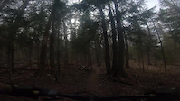
Photos of Woolastook Mountain Bike
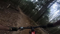
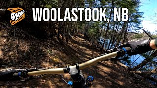
Videos of Woolastook Mountain Bike
trail: Woolastook Loop Climb
3:13 |
9 |
May 10, 2026
trail: Mammoth
4:13 |
16 |
May 10, 2026

trail: Shoreline
9:47 |
312 |
May 11, 2022 , Fredericton
trail: Hallway Descent
9:47 |
214 |
May 11, 2022 , Fredericton

trail: Summit Trail
9:47 |
321 |
May 11, 2022 , Fredericton

trail: Birch Descent
9:47 |
304 |
May 11, 2022 , Fredericton

trail: Shoreline
9:47 |
255 |
May 11, 2022 , Fredericton

trail: Kelly's Cove
9:47 |
330 |
May 11, 2022 , Fredericton
Recent Trail Reports
| status | trail | date | condition | info | user |
|---|---|---|---|---|---|
| Radical Ledge | May 31, 2026 @ 6:46pm (America/Halifax) May 31, 2026 | Ideal | mhughson | ||
| The Otterbahn | May 24, 2026 @ 6:33pm (America/Halifax) May 24, 2026 | Ideal | DanHBsWMV | ||
| Woolastook Road | May 11, 2026 @ 12:48pm (America/Moncton) May 11, 2026 | Ideal | Haydenbro | ||
| Pond Trail | May 11, 2026 @ 12:48pm (America/Moncton) May 11, 2026 | Ideal | Haydenbro | ||
| Mammoth | May 11, 2026 @ 12:48pm (America/Moncton) May 11, 2026 | Variable | Haydenbro | ||
| Big Wooly | May 11, 2026 @ 12:48pm (America/Moncton) May 11, 2026 | Variable | Haydenbro | ||
| Twenty-one | May 11, 2026 @ 12:48pm (America/Moncton) May 11, 2026 | Ideal | Haydenbro | ||
| Missing Link | May 11, 2026 @ 12:48pm (America/Moncton) May 11, 2026 | Ideal | Haydenbro | ||
| Silver Fox | May 11, 2026 @ 12:48pm (America/Moncton) May 11, 2026 | Ideal | Haydenbro | ||
| Kelly's Cove | May 11, 2026 @ 12:48pm (America/Moncton) May 11, 2026 | Ideal | Haydenbro |
Activity Feed
| username | action | type | title | date |
|---|---|---|---|---|
| mhughson | add | report | activity #95979650 | May 31, 2026 @ 2:46pm May 31, 2026 |
| nMRPig | ridden | trail | activity #95510472 and 1 more | May 25, 2026 @ 11:56am May 25, 2026 |
| DanHBsWMV | add | report | activity #95446465 | May 24, 2026 @ 2:33pm May 24, 2026 |
| Dorito_MTB | add | photo | activity #95441119 | May 24, 2026 @ 1:27pm May 24, 2026 |
| DanHBsWMV | wishlist | route | activity #95428333 and 1 more | May 24, 2026 @ 11:10am May 24, 2026 |
Recent Comments
| username | type | title | comment | date |
|---|---|---|---|---|
| trail | Double checked, it is currently signed as a... | May 27, 2023 @ 11:00pm May 27, 2023 | ||
| report | My bad. I see now that 10 hours was how long... | Feb 1, 2023 @ 8:26am Feb 1, 2023 | ||
| report | Is this 10 hours overall, or 10 hours spent... | Jan 31, 2023 @ 6:15pm Jan 31, 2023 | ||
| trail | Great trail! Lots of fun! | Sep 20, 2021 @ 3:53am Sep 20, 2021 | ||
| trail | I believe this trail is also marked as a Black... | Sep 20, 2021 @ 3:52am Sep 20, 2021 |
Nearby Areas
| name | distance | ||||
|---|---|---|---|---|---|
| Mactaquac Provincial Park | 19 | 6.4 km | |||
| Island View | 4 | 10 | 3 | 7.8 km | |
| Kingswood / Woodlot | 7 | 3 | 11.3 km | ||
| Odell Park | 15 | 16 | 1 | 12.5 km | |
| Claudie | 8 | 14 | 7 | 12.6 km |
Local Badges
-
Full Wooly3 awarded
Activity Type Stats
| activitytype | trails | distance | descent | descent distance | total vertical | rating | global rank | state rank | photos | reports | routes | ridelogs |
|---|---|---|---|---|---|---|---|---|---|---|---|---|
| Mountain Bike | 82 | 17 miles | 1,709 ft | 6 miles | 436 ft | #944 | #3 | 77 | 1,043 | 20 | 5,838 | |
| E-Bike | 81 | 14 miles | 1,650 ft | 6 miles | 266 ft | #3,598 | #7 | 984 | 1 | 92 | ||
| Horse | 9 | 1,844 ft | 3 ft | 144 ft | 62 ft | #1,298 | #1 | 332 | ||||
| Hike | 89 | 17 miles | 1,709 ft | 6 miles | 436 ft | #2,814 | #4 | 37 | 1,040 | 206 | ||
| Trail Running | 89 | 17 miles | 1,709 ft | 6 miles | 436 ft | #4,619 | #6 | 1,043 | 231 | |||
| Dirtbike/Moto | 1 | 1,844 ft | 3 ft | 144 ft | 62 ft | #580 | #2 | 330 | 3 | |||
| ATV/ORV/OHV | 3 | 1 mile | 7 ft | 394 ft | 331 ft | #380 | #2 | 332 | ||||
| Snowmobile | 5 | 2 miles | 10 ft | 673 ft | 331 ft | #22 | #1 | 210 | 5 | |||
| Snowshoe | 31 | 4 miles | 203 ft | 4,551 ft | 394 ft | #644 | #6 | 238 | 29 | |||
| Backcountry Ski | 17 | 4,767 ft | 95 ft | 1,220 ft | 167 ft | #291 | #2 | 222 | 26 | |||
| Nordic Ski | 16 | 4,767 ft | 95 ft | 1,220 ft | 167 ft | #950 | #5 | 220 | 12 |
Frequently Asked Questions About Woolastook
▼
What are the highest rated mountain biking trails in Woolastook?
The highest rated mountain biking trails in Woolastook are:
- Shoreline (4.4/5)
- Double Bypass (4.3/5)
- Split Rail (4.2/5)
- Kelly's Cove (4.2/5)
- Woolastook Loop Climb (4.2/5)
▼
What is the best time of the year to ride in Woolastook?
Based on ride log data, the most popular months to ride in Woolastook are:
- August (55 activities)
- September (48 activities)
- July (45 activities)
▼
Where can I park to ride in Woolastook?
Check the Woolastook trail map for trailhead and parking information. Community members regularly update access and parking details for trails in the area.
▼
What is the longest trail in Woolastook?
The longest trail in Woolastook is Shoreline at 2.5 km. View all trails sorted by distance.
Activities
Trails
Points of Interest
- By alexisberube RVC & contributors
- Admins: RVC
- #5449 - 24,664 views
- woolastook activity log | embed map of Woolastook mountain bike trails | woolastook mountain biking points of interest
Downloading of trail gps tracks in kml & gpx formats is enabled for Woolastook.
You must login to download files.