15.1 miles
Distance
2,706 ft
Climb
-2,706 ft
Descent
3,989 ft
High Point
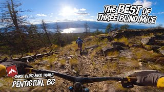
A classic climb and descent to give you the most bang for your buck in the Mice. Suitable for intermediate skill levels, but due to the length and vertical gain a bit more demanding on the fitness side. Most of the climb is steady and not too steep, however a few pitches are tough. The descent has occasional short technical challenges but is mostly low angle, wide, and smooth.
As with any ride in the Mice zone, be sure to bring a flat repair kit
Detailed Description
3BM Intermediate Full Loop is a 15 mile popular intermediate route located near Penticton British Columbia. This mountain bike primary route can be used one direction and has a hard overall physical rating. This route includes 9 trails. This route climbs 2,706 ft with a max elevation of 3,989 ft then descends -2,706 ft.
Local Trail Association
Penticton and Area Cycling Association (www.bikepenticton.com)Please consider joining or donating to the local riding association to support trail development & maintenance.
donate to earn trail karma!
Trail Products
15 Reviews & Comments
We hope you've been enjoying Trailforks!
Create a FREE account to view route comments and much more.
Trails in Route
745 ft | |||||
2 miles | |||||
2 miles | |||||
2,638 ft | |||||
1 mile | |||||
2,779 ft | |||||
676 ft | |||||
1,322 ft | |||||
1,385 ft |
Details
-
Riding area
-
Primary ActivityMountain Bike
-
Other Activities
- E-Bike
- Trail Running
-
Difficulty ratingBlue
-
Route TypeLoop
-
eBike Allowed
-
Bike typeAM, XC
-
DirectionOne Direction
-
Physical ratingHard
-
Ridelogs
More Stats for 3BM Intermediate Full Loop mountain bike route
-
Avg time1 hr 49 min
-
Altitude min1,423 ft
-
Altitude start1,423 ft
-
Altitude end1,424 ft
-
Grade max-40.9%
-
Grade min71.8%
-
Distance climb7 miles
-
Distance down6 miles
-
Distance flat1 mile
close
3D
Trail Conditions
- Unknown
- Snow Groomed
- Snow Packed
- Snow Covered
- Snow Cover Partial
- Freeze/thaw Cycle
- Icy
- Prevalent Mud
- Wet
- Variable
- Ideal
- Dry
- Very Dry
Trail Flow (Ridden Direction)
Trailforks scans users ridelogs to determine the most popular direction each trail is ridden. A good flowing trail network will have most trails flowing in a single direction according to their intension.
The colour categories are based on what percentage of riders are riding a trail in its intended direction.
- > 96%
- > 90%
- > 80%
- > 70%
- > 50%
- < 50%
- bi-directional trail
- no data
Trail Last Ridden
Trailforks scans ridelogs to determine the last time a trail was ridden.
- < 2 days
- < 1 week
- < 2 weeks
- < 1 month
- < 6 months
- > 6 months
Trail Ridden Direction
The intended direction a trail should be ridden.
- Downhill Only
- Downhill Primary
- Both Directions
- Uphill Primary
- Uphill Only
- One Direction
Contribute Details
Colors indicate trail is missing specified detail.
- Description
- Photos
- Description & Photos
- Videos
Trail Popularity ?
Trailforks scans ridelogs to determine which trails are ridden the most in the last 9 months.
Trails are compared with nearby trails in the same city region with a possible 25 colour shades.
Think of this as a heatmap, more rides = more kinetic energy = warmer colors.
- most popular
- popular
- less popular
- not popular
ATV/ORV/OHV Filter
Max Vehicle Width
inches
US Cell Coverage
Legend
Radar Time
x
Activity Recordings
Trailforks users anonymized public ridelogs from the past 6 months.
- mountain biking recent
- mountain biking (>6 month)
- hiking (1 year)
- moto (1 year)
Activity Recordings
Trailforks users anonymized public skilogs from the past 12 months.
- Downhill Ski
- Backcountry Ski
- Nordic Ski
- Snowmobile
Winter Trails
Warning
A routing network for winter maps does not exist. Selecting trails using the winter trails layer has been disabled.
x
Missing Trails
Most Popular
Least Popular
Trails are colored based on popularity. The more popular a trail is, the more red. Less popular trails trend towards green.
Jump Magnitude Heatmap
Heatmap of where riders jump on trails. Zoom in to see individual jumps, click circles to view jump details.
Trails Deemphasized
Trails are shown in grey.
Only show trails with NO bikes.
Save the current map location and zoom level as your default home location whenever this page is loaded.
Save
Trail transparency
Photos
Videos
youtuber

Flow Coaster & Tsweet Tsue - Three Blind Mice - Penticton Mountain Biking
trail: Flow Coaster
3:59 | 501 | comments: 0 | favs:
May 28, 2022

Penticton Perfection : Riding The Best MTB Trails of The Three Blind Mice System
trail: Flow Coaster
30:38 | 13 | comments: 0 | favs:
Apr 7, 2025
Recent Trail Reports Along Route
more reports »
- By smoke
Simpcw & contributors
- #29612 - 1,395 views