
70.3 miles
Distance
9,730 ft
Climb
-10,263 ft
Descent
2 miles
High Point
-533 ft
Altitude change
5,362 ft
Altitude min
5,895 ft
Altitude start
5,361 ft
Altitude end
-0.1%
Grade
-145.8%
Grade max
72.7%
Grade min
36 miles
Distance climb
31 miles
Distance down
3 miles
Distance flat

Link a lot of the common go-to classics from the mormon pioneer trailhead above mountain dell reservoir to flying dog, mid mountain, pinecone, crest, and gwt to pipeline in millcreek

Detailed Description
All the classics is a 70 mile popular intermediate route located near Bountiful Utah. This mountain bike only route can be used both directions and has a hard overall physical rating. This route includes 58 trails. This route climbs 9,730 ft with a max elevation of 9,888 ft then descends -10,263 ft.
Tags

Trail Issues on Route

  • Closed: 3 trails (newest: Oct 6, 2026)
  • Significant Issue / Amber: 1 trail (newest: Oct 7, 2026)
  • Minor Issue / Yellow: 4 trails (newest: Sep 28, 2026)

Local Trail Association

Please consider joining or donating to the local riding association to support trail development & maintenance.
Donate to earn trail karma!

Stats

  • Distance
    70 miles
  • Avg time
    13 hr 10 min
  • Altitude change
    -533 ft
  • Altitude min
    5,362 ft
  • Altitude start
    5,895 ft
  • Altitude end
    5,361 ft
  • Climb
    2 miles
  • Descent
    -10,263 ft
  • Grade
    -0.1%
  • Grade max
    -145.8%
  • Grade min
    72.7%
  • Distance climb
    36 miles
  • Distance down
    31 miles
  • Distance flat
    3 miles

125 Reviews & Comments

Lincovich Lincovich
A great route to explore the area and cut your teeth on some tough bikepcking.

The route took us 3 days. There are plenty of water sources along the way, just don’t be too hardheaded to stop. A bike shop en route in Kimbell jct, and the Olympic center outside of the city. Both are good places to get water and a battery charge if you’re using strava.

Sleeping was a bit tough though, as everything is pretty inclined.

Great shade. We did the route early June 2018. Could be saved for later in the season.

We hope you've been enjoying Trailforks!

Create a FREE account to view all route reviews and much more.

Details

  • Riding area
  • Primary Activity
    Mountain Bike
  • Difficulty rating
    Blue
  • Route Type
    Point to Point
  • Bike type
    AM, XC
  • Direction
    Both Directions
  • Physical rating
    Hard
Avg: 5 (1 votes)
close
Trail transparency
  • Singletrack
  • Unpaved
  • Paved
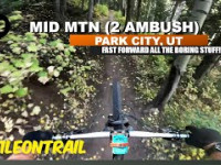
Mid MTN   (2 ambush) - Park City, UT - MTB...
mtb
Mid MTN (2 ambush) - Park City, UT - MTB Trail Preview
182 | comments: 0 | favs:
Jun 12, 2025

Recent Trail Reports Along Route

statustraildateconditiondescription
BLT
Nov 11, 2026 @ 8:01pm (America/Denver)
Nov 11, 2026
RTS
Nov 11, 2026 @ 7:59pm (America/Denver)
Nov 11, 2026
Rattlesnake Gulch, Lower
Oct 28, 2026 @ 8:47am (America/Denver)
Oct 28, 2026
Rattlesnake Gulch (Upper)
Oct 28, 2026 @ 8:47am (America/Denver)
Oct 28, 2026
Mid Mountain
Oct 8, 2026 @ 10:58am (America/Boise)
Oct 8, 2026
beautiful aspen colors
more reports »
  • By cgrosh & contributors
  • #5455 - 3,864 views

Hit the Trail

Open in App

Get this route on your phone instantly.

Download Route

Save to wishlist, Garmin & download.