22.4 miles
Distance
4,273 ft
Climb
-4,274 ft
Descent
1 mile
High Point

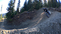
After a 4 year construction to ensure all details were met we’re proud to showcase Beowulf, our minted XC epic, named after the poem about a legendary dragon-slaying Scandinavian warrior. Borrowing its name from the poem is a true fit for the trail, capturing the undertaking of building it from beginning to end. The 35km loop takes riders along ridgelines, through cedar rainforests and grassy meadows as it winds its way from the village and back again, covering all of the incredible terrains SilverStar has to offer. A must-do ride for the discerning mountain biker.

Detailed Description
Beowulf- The loop is a 22 mile popular expert route located near Kelowna British Columbia. This mountain bike only route can be used one direction and has a hard overall physical rating. This route includes 24 trails. This route climbs 4,273 ft with a max elevation of 5,644 ft then descends -4,274 ft.
Route Supporters
Local Trail Association
Local trail association
Mountain Bikers of the Central Okanagan (mtbco.ca)
Please consider joining or donating to the local riding association to support trail development & maintenance.
donate to earn trail karma!

54 Reviews & Comments


We hope you've been enjoying Trailforks!

Create a FREE account to view route comments and much more.

Details

  • Featured
  • Riding area
  • Primary Activity
    Mountain Bike
  • Difficulty rating
    Black Diamond
  • Route Type
    Loop
  • Bike type
    AM, XC
  • Direction
    One Direction
  • Physical rating
    Hard
  • Ridelogs
    145
More Stats for Beowulf- The loop mountain bike route
  • Avg time
    3 hr 46 min
  • Altitude min
    3,500 ft
  • Altitude start
    5,260 ft
  • Altitude end
    5,259 ft
  • Grade max
    -64.4%
  • Grade min
    58.5%
  • Distance climb
    10 miles
  • Distance down
    10 miles
  • Distance flat
    3 miles
Avg: 3.4 (23 votes)

  • view (1)
close
3D
Trail Conditions
  • Unknown
  • Snow Groomed
  • Snow Packed
  • Snow Covered
  • Snow Cover Partial
  • Freeze/thaw Cycle
  • Icy
  • Prevalent Mud
  • Wet
  • Variable
  • Ideal
  • Dry
  • Very Dry
Trail Flow (Ridden Direction)
Trailforks scans users ridelogs to determine the most popular direction each trail is ridden. A good flowing trail network will have most trails flowing in a single direction according to their intension.
The colour categories are based on what percentage of riders are riding a trail in its intended direction.
  • > 96%
  • > 90%
  • > 80%
  • > 70%
  • > 50%
  • < 50%
  • bi-directional trail
  • no data
Trail Last Ridden
Trailforks scans ridelogs to determine the last time a trail was ridden.
  • < 2 days
  • < 1 week
  • < 2 weeks
  • < 1 month
  • < 6 months
  • > 6 months
Trail Ridden Direction
The intended direction a trail should be ridden.
  • Downhill Only
  • Downhill Primary
  • Both Directions
  • Uphill Primary
  • Uphill Only
  • One Direction
Contribute Details
Colors indicate trail is missing specified detail.
  • Description
  • Photos
  • Description & Photos
  • Videos
Trail Popularity ?
Trailforks scans ridelogs to determine which trails are ridden the most in the last 9 months. Trails are compared with nearby trails in the same city region with a possible 25 colour shades. Think of this as a heatmap, more rides = more kinetic energy = warmer colors.
  • most popular
  • popular
  • less popular
  • not popular
ATV/ORV/OHV Filter
Max Vehicle Width
inches
US Cell Coverage
Legend
cell carrier legend

Radar Time
x Activity Recordings
Trailforks users anonymized public ridelogs from the past 6 months.
  • mountain biking recent
  • mountain biking (>6 month)
  • hiking (1 year)
  • moto (1 year)
Activity Recordings
Trailforks users anonymized public skilogs from the past 12 months.
  • Downhill Ski
  • Backcountry Ski
  • Nordic Ski
  • Snowmobile
Winter Trails
Warning A routing network for winter maps does not exist. Selecting trails using the winter trails layer has been disabled.
x Missing Trails
Most Popular
Least Popular
Trails are colored based on popularity. The more popular a trail is, the more red. Less popular trails trend towards green.
Jump Magnitude Heatmap
Heatmap of where riders jump on trails. Zoom in to see individual jumps, click circles to view jump details.
Trails Deemphasized
Trails are shown in grey.
disable
Only show trails with NO bikes.
enable

Save the current map location and zoom level as your default home location whenever this page is loaded.

Save
Trail transparency
382
877
886
156
Silver Star Bike Park with Kids
3:43 | 171 | comments: 0 | favs:
Jul 11, 2022
JUST BIKING
JUST BIKING
0:00 | 1410 | comments: 2 | favs: 1
Oct 7, 2017
Had a epic road trip around southern BC

Recent Trail Reports Along Route

statustraildateconditiondescription
Silver Shack
Sep 16, 2024 @ 6:17am
Sep 16, 2024
Thanks for a great season, ALL DH, Beowulf and upper XC trails are now closed. The Knoll XC will remain open. reporter
Paradise Trail
Sep 16, 2024 @ 6:16am
Sep 16, 2024
Thanks for a great season, ALL DH, Beowulf and upper XC trails are now closed. The Knoll XC will remain open. reporter
Cross-Mountain Trail
Sep 16, 2024 @ 6:16am
Sep 16, 2024
Thanks for a great season, ALL DH, Beowulf and upper XC trails are now closed. The Knoll XC will remain open. reporter
Beowulf- into Putnam Ck
Sep 16, 2024 @ 6:15am
Sep 16, 2024
Thanks for a great season, ALL DH, Beowulf and upper XC trails are now closed. The Knoll XC will remain open. reporter
Beowulf- Alder Point Lookout
Sep 16, 2024 @ 6:15am
Sep 16, 2024
Thanks for a great season, ALL DH, Beowulf and upper XC trails are now closed. The Knoll XC will remain open. reporter
more reports »
  • By SilverStarBikeParkTF Pro SSMR & contributors
  • #4462 - 25,174 views