

Open in App
Get this route on your phone instantly.
This beginner-level loop starts on the main Bert Flinn Loop Trail which takes riders through Bert Flinn Park to the entrance of Black Dog, a cross-country trail.
Black Dog takes riders back toward the park entrance, where they will exit Black Dog via the Black Dog Connector and then follow the Off-leash Side Trail east back to the entrance. Connecting to the Bert Flinn Loop Trail once again.
Following the Bert Flinn Loop Trail back into the park, riders will turn north (right) on a short Connector trail which exists on to Bert Flinn Loop - Robin Way Connector. Heading east towards the schools, riders will connect with Fence line Trail and turn north (left) to reach North Straz.
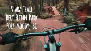
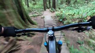
North Straz is a cross-country and has several different features that will provide a beginner rider numerous challenges to master over time. These include several climbing challenges with steep tight turns, as well as, ladders, and wood bridges. A more advanced feature includes a rock roll option.
Riders will follow North Straz to The Finn-ish line intersection and turn south (left) on to it. This trail provides a smooth flow ride which connects to the North Straz again near the exit. (Riders can follow the North Straz full route for additional cross-country and rollable drop features.
Exist North Straz on to the Bert Flinn Loop Trail back towards the entrance of Black Dog, riders will turn on to Jo-Jo Finn's Green Spectacles. This flow trail provides riders with bermed corners and several easy features and can be ridden in either direction.
Exiting Jo-Jo Finn's Green Spectacles, riders will continue downhill on Straz-Line 2 which includes larger rollable features with optional lines and introduces the beginner rider to intermediate features. This trail exists on to Straz-Line 1 which includes additional blue features, with ride-around options. Features include a long log ride, a couple of sets of skinnies, a large A-frame ramp, an elevated log ride, and a drop feature with an air-drop or rollable drop option.
Starz-Line 1 exits on to a path that leads to the Off Leash Area where riders can follow back to "Black Dog" and follow it back to the entrance. (Riders may also stay on the Off Leash Area/Loop Trail and return to the entrance that way).

We hope you've been enjoying Trailforks!
Create a FREE account to view all route reviews and much more.
| 75 ft | |||||
| 144 ft | |||||
| 430 ft | |||||
| 2,093 ft | |||||
| 200 ft | |||||
| 561 ft | |||||
| 1,155 ft | |||||
| 246 ft | |||||
| 669 ft | |||||
| 279 ft | |||||
| 1,332 ft | |||||
| 1,060 ft | |||||
| 157 ft | |||||
| 1,299 ft | |||||
| 515 ft | |||||
| 1,932 ft | |||||
| 230 ft | |||||
| 1,414 ft | |||||
| 659 ft | |||||
| 1,286 ft | |||||
| 571 ft | |||||
| 1,306 ft | |||||
| 2,093 ft | |||||
| 200 ft | |||||
| 561 ft | |||||
| 144 ft | |||||
| 75 ft |


Service Road Atlas is a free to use, community-driven service for viewing and creating reports on the numerous back-country service roads around B.C. and Alberta.
Save the current map location and zoom level as your default home location whenever this page is loaded.
Save TRAILFORKS & contributors