

55.7 miles
Distance
9,712 ft
Climb
-10,560 ft
Descent
7,378 ft
High Point
-847 ft
Altitude change
3,989 ft
Altitude min
4,837 ft
Altitude start
3,990 ft
Altitude end
-0.3%
Grade
-145.9%
Grade max
68.8%
Grade min
27 miles
Distance climb
25 miles
Distance down
4 miles
Distance flat

Chilcotins trip proposal for Aug 2025

Detailed Description
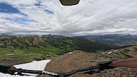
Chilcotins is a 56 mile moderately popular expert route located near Mud Lakes British Columbia. This mountain bike only route. This route includes 10 trails. This route climbs 9,712 ft with a max elevation of 7,378 ft then descends -10,560 ft.
Tags
River or creek

Trail Issues on Route

  • Closed: 1 trail (newest: Sep 5, 2026)

Local Trail Association

Local trail association
Bridge River Valley Community Association (www.bridgerivervalley.ca)
Please consider joining or donating to the local riding association to support trail development & maintenance.
Donate to earn trail karma!

Stats

  • Distance
    56 miles
  • Avg time
    18 hr 27 min
  • Altitude change
    -847 ft
  • Altitude min
    3,989 ft
  • Altitude start
    4,837 ft
  • Altitude end
    3,990 ft
  • Climb
    9,712 ft
  • Descent
    -10,560 ft
  • Grade
    -0.3%
  • Grade max
    -145.9%
  • Grade min
    68.8%
  • Distance climb
    27 miles
  • Distance down
    25 miles
  • Distance flat
    4 miles

16 Reviews & Comments


We hope you've been enjoying Trailforks!

Create a FREE account to view all route reviews and much more.

Details

  • Riding area
  • Primary Activity
    Mountain Bike
  • Difficulty rating
    Black Diamond
no votes yet
close
Trail transparency
  • Singletrack
  • Unpaved
youtuber RIDGE-O-RAMA — The Most Epic Alpine Trail in BC
mtb
RIDGE-O-RAMA — The Most Epic Alpine Trail in BC
30:00 | 26 | comments: 0 | favs:
Oct 13, 2026
Ridge-o-Rama (East Section)
mtb
Ridge-o-Rama (East Section)
9:41 | 66 | comments: 0 | favs:
Jul 20, 2026
Descent of Ridge O Rama East

Recent Trail Reports Along Route

statustraildateconditiondescription
Relay Creek Doubletrack
Sep 19, 2026 @ 10:15am (America/Vancouver)
Sep 19, 2026
reporter
Spruce Lake Main
Sep 19, 2026 @ 7:24am (America/Vancouver)
Sep 19, 2026
Relay Creek Trail
Sep 5, 2026 @ 8:05pm (America/Vancouver)
Sep 5, 2026
Closed as per BC parks trail closure https://bcparks.ca/south-chilcotin-mountains-park/#advisories
Ridge-o-Rama (East Section)
Sep 5, 2026 @ 8:02pm (America/Vancouver)
Sep 5, 2026
The South Chilcotin Mountains Park is now open! A local wrangler recently cleared Lower Gun Creek, Spruce Main, WD and Mid-Tyaiughton creek. Lots of blowdown reported, so expect lots of deadfalls on other trails. Bring a trail saw! Due to the lack of people travelling in the park this summer, we expect lots of bear activity. Ride slow, keep your head up and make a lot of noise! Some sections of the park remain closed due to the Bonanza Creek wildfire. Please respect the following trail closures: -Tyaughton Creek Trailhead -Tyaughton Creek from trailhead to WD junction -Castle Pass Trail -Relay Creek Trail -Little Paradise Creek Trail Happy riding! -Tyax Adventures crew!
Pearson Trail
Sep 5, 2026 @ 7:50pm (America/Vancouver)
Sep 5, 2026
The South Chilcotin Mountains Park is now open! A local wrangler recently cleared Lower Gun Creek, Spruce Main, WD and Mid-Tyaughton creek. Lots of blowdown reported, so expect lots of deadfalls on other trails. Bring a trail saw! Due to the lack of people travelling in the park this summer, we expect lots of bear activity. Ride slow, keep your head up and make a lot of noise! Some sections of the park remain closed due to the Bonanza Creek wildfire. Please respect the following trail closures: -Tyaughton Creek Trailhead -Tyaughton Creek from trailhead to WD junction -Castle Pass Trail -Relay Creek Trail -Little Paradise Creek Trail Happy riding! -Tyax Adventures crew!
more reports »
  • By andreyapopovTF Pro & contributors
  • #62730 - 505 views

Hit the Trail

Open in App

Get this route on your phone instantly.

Download Route

Save to wishlist, Garmin & download.