14.4 miles
Distance
2,976 ft
Climb
-2,966 ft
Descent
2 miles
High Point
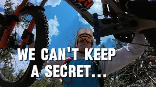
This route can be done in either direction. Either way there will be some hike-a-bike involved. The preferred direction involves climbing the West Chile trail, with excellent close up views of Shaggy Peak. Then you drop down into a beautiful valley and climb back to Trail #175. Then you have a stout climb up Trail #175 to the ridge. To add a "Stem" to the Chile Loop, you can continue up Trail #175 to the Glorieta Baldy fire tower. Otherwise, enjoy the fast descent down Secret to the Deer Trail and back to I-25 to complete the loop.
Detailed Description
Chile Loop is a 14 mile moderately popular expert route located near Santa Fe New Mexico. This mountain bike only route can be used one direction and has a hard overall physical rating. This route includes 4 trails. This route climbs 2,976 ft with a max elevation of 9,391 ft then descends -2,966 ft.
Local Trail Association
Santa Fe Fat Tire Society (santafefattiresociety.org)Please consider joining or donating to the local riding association to support trail development & maintenance.
donate to earn trail karma!
10 Reviews & Comments
Pcforno
(Oct 25, 2022 at 6:22)

Trail West Chile
This is not worth it for biking.
It’s a good running loop instead
[Reply]
It’s a good running loop instead
Ruchell
(May 9, 2022 at 12:08)

Trail Deer Trail
Great trail. Nice gradual ascent (was able to bike about 90% of the climb) to Ponderosa Pine trees, then a great descent back to the start with lots of rocky sections and flowy sections as well...fun ride! Great workout.
[Reply]


Trail Deer Trail
Two track top to bottom. We shuttled it from Glorietta and left a truck on the interstate. Not very fun or really worth it.
[Reply]


Trail West Chile
Made an attempt to ride this trail, but only got a couple miles up before deciding we weren't having a good time. The start of the trail is hard to locate, we had to stop and hike around a bit to find it. It turns into a double track/old road for a while, then we got sick of it and turned around. Maybe it is better after the first couple of miles but we did not stay to find out.
[Reply]
Zoonhollis
(May 24, 2019 at 7:05)
The climbs near the end of Trail #175 are stout indeed. Unless you're an Olympian, there will be some hike-a-bike. But the descent on Secret and Deer are worth the effort.
[Reply]
Kstrebor
(May 6, 2018 at 16:36)
I road it counterclockwise and was lost in five different occasions. I don't recommend this one.
[Reply]
Trails in Route
7 miles | |||||
1 mile | |||||
2 miles | |||||
4 miles |
Details
-
Riding area
-
Primary ActivityMountain Bike
-
Difficulty ratingBlack Diamond
-
Route TypeLoop
-
Bike typeAM, XC
-
DirectionOne Direction
-
Physical ratingHard
-
Ridelogs
More Stats for Chile Loop mountain bike route
-
Altitude min7,063 ft
-
Altitude start7,088 ft
-
Altitude end7,096 ft
-
Grade max-56.3%
-
Grade min59.1%
-
Distance climb6 miles
-
Distance down7 miles
-
Distance flat5,174 ft
close
3D
Trail Conditions
- Unknown
- Snow Groomed
- Snow Packed
- Snow Covered
- Snow Cover Inadequate
- Freeze/thaw Cycle
- Icy
- Prevalent Mud
- Wet
- Variable
- Ideal
- Dry
- Very Dry
Trail Flow (Ridden Direction)
Trailforks scans users ridelogs to determine the most popular direction each trail is ridden. A good flowing trail network will have most trails flowing in a single direction according to their intension.
The colour categories are based on what percentage of riders are riding a trail in its intended direction.
- > 96%
- > 90%
- > 80%
- > 70%
- > 50%
- < 50%
- bi-directional trail
- no data
Trail Last Ridden
Trailforks scans ridelogs to determine the last time a trail was ridden.
- < 2 days
- < 1 week
- < 2 weeks
- < 1 month
- < 6 months
- > 6 months
Trail Ridden Direction
The intended direction a trail should be ridden.
- Downhill Only
- Downhill Primary
- Both Directions
- Uphill Primary
- Uphill Only
- One Direction
Contribute Details
Colors indicate trail is missing specified detail.
- Description
- Photos
- Description & Photos
- Videos
Trail Popularity ?
Trailforks scans ridelogs to determine which trails are ridden the most in the last 9 months.
Trails are compared with nearby trails in the same city region with a possible 25 colour shades.
Think of this as a heatmap, more rides = more kinetic energy = warmer colors.
- most popular
- popular
- less popular
- not popular
ATV/ORV/OHV Filter
Max Vehicle Width
inches
Radar Time
x
Activity Recordings
Trailforks users anonymized public ridelogs from the past 6 months.
- mountain biking recent
- mountain biking (>6 month)
- hiking (1 year)
- moto (1 year)
Activity Recordings
Trailforks users anonymized public skilogs from the past 12 months.
- Downhill Ski
- Backcountry Ski
- Nordic Ski
- Snowmobile
Jump Magnitude Heatmap
Heatmap of where riders jump on trails. Zoom in to see individual jumps, click circles to view jump details.
Trails Deemphasized
Trails are shown in grey.
Only show trails with NO bikes.
Save the current map location and zoom level as your default home location whenever this page is loaded.
Save
Trail transparency
Photos
Recent Trail Reports Along Route
more reports »
- By 8wire
SFFTS & contributors
- #6066 - 2,102 views
Nice for a running loop instead