


Open in App
Get this route on your phone instantly.
Grade 3 - Intermediate
This is a backcountry mountain bike trail requiring moderate levels of skill and fitness. While the trail is well formed and marked, it is a more challenging experience than the rest of the Queenstown Trail Great Ride.
The Coronet Loop trail begins in Arrowtown at Butler’s Green, adjacent to the historic Chinese Settlement by the Arrow River. Whilst the trail can be ridden in either direction, we think it rides best in a clockwise direction, so start by heading up Bush Creek. The new bridges and repairs made in 2021 have made this a great climbing track which passes through native beech forest and towering schist bluffs. This is a two-way track and popular with walkers, so keep an eye out for downhill riders and hikers.
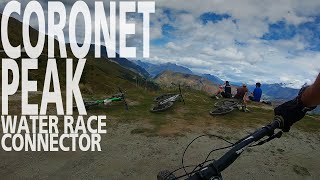
At the head of Bush Creek, the trail continues along the Coronet Face Water Race, which was the first part of the loop to be developed and was opened by the Queenstown Trails Trust and Soho Property in 2018. The Water Race weaves along the front face of Coronet Peak through remnant Beech Forest, passing old sections of flume pipe and the site of the old Racemans Hut at Station Creek. The race was developed in the goldrush era, with water taken from McMullen and Station Creeks being channelled all the way across the front face of Mt Dewar to sluice the Shotover faces at Arthurs Point. Work will soon begin on a restoration of the Racemans hut chimney to ensure it is there for generations to come. This marks a great place to pause and enjoy the view across the Wakatipu basin.
The connector trail climbs up and over into Skippers Canyon on the excellent Tradesmans and Pack, Track and Sack trails. These trails had a recent makeover from the QMTBC and the descent into Long Gully is a real highlight of the circuit. *NOTE the Pack, Track and Sack is a Grade 4 with some steep rock drops. To bypass the technical challenges, take the Skippers Pack Track, or follow the Skippers Road before joining the climb to the Greengate Saddle.
At Baldersons Hut, a right-hand turn enters the Loop proper and climbs to Greengates saddle. From the saddle a flowing downhill follows the historic pack track, past the historic Greengates Hut before it opens out high above Deep Creek overlooking the remains of the Old Greengates Hotel.
The Loop then continues upstream, over Picnic Rock with its amazing vistas before a long steady descent into Deep Creek, passing a couple of spectacular waterfalls on the way to the Golden Terraces visible in the distance. The track sidles in and out of the Creek and up the ‘Willows Climb’ before crossing Parkers Creek and emerging onto the high plateau of Golden Terraces. This section gives a stunning backcountry experience, linking sections of old pack track and passing old mining ruins as it weaves between the bluffs.
The terrain eases up a little before the Eight Mile saddle and passes beneath the Coronet Saddle Turk which is the final hut on the Mahu Whenua Traverse. After the descent to Eight Mile Creek (aka Coronet Creek), the trail follows an old miners track down the true right to join the Macetown Rd. The miners track here is narrow and exposed (Grade 4), and less confident riders can walk this section, or follow the Macetown Rd, but be prepared to get wet as the road criss-crosses the Arrow River.
The track continues on the Macetown 4WD road along the Arrow River. After the Norman Spencer bridge, there are a set of steep stairs to climb with some narrow sections before the track levels off to return you back at Butler’s Green in Arrowtown.

We hope you've been enjoying Trailforks!
Create a FREE account to view all route reviews and much more.
| 3 miles | |||||
| 1 mile |

Service Road Atlas is a free to use, community-driven service for viewing and creating reports on the numerous back-country service roads around B.C. and Alberta.
Save the current map location and zoom level as your default home location whenever this page is loaded.
Save Elevate & contributors