17.8 miles
Distance
3,747 ft
Climb
-3,746 ft
Descent
1 mile
High Point
-1 ft
Altitude change
3,218 ft
Altitude min
3,219 ft
Altitude start
3,219 ft
Altitude end
-59.8%
Grade max
58.5%
Grade min
9 miles
Distance climb
6 miles
Distance down
3 miles
Distance flat

Long day loop, bring your water.

Detailed Description
Deadman's Ridge Loop is a 18 mile moderately popular expert route located near Missoula Montana. This mountain bike only route can be used one direction and has a hard overall physical rating. This route includes 6 trails. This route climbs 3,747 ft with a max elevation of 6,450 ft then descends -3,746 ft.
Tags
RidgelineViewsWater source

Trail Issues on Route

  • Significant Issue / Amber: 2 trails (newest: May 11, 2026)

Local Trail Association

Local trail association
Missoula Mountain Bike Coalition (www.msomtbco.org)
Please consider joining or donating to the local riding association to support trail development & maintenance.
Donate to earn trail karma!

Stats

  • Distance
    18 miles
  • Avg time
    3 hr 2 min
  • Altitude min
    3,218 ft
  • Altitude start
    3,219 ft
  • Altitude end
    3,219 ft
  • Climb
    3,747 ft
  • Descent
    -3,746 ft
  • Grade max
    -59.8%
  • Grade min
    58.5%
  • Distance climb
    9 miles
  • Distance down
    6 miles
  • Distance flat
    3 miles

12 Reviews & Comments


We hope you've been enjoying Trailforks!

Create a FREE account to view all route reviews and much more.

Trails in Route

Details

  • Riding area
  • Primary Activity
    Mountain Bike
  • Difficulty rating
    Black Diamond
  • Route Type
    Loop
  • Bike type
    AM
  • Direction
    One Direction
  • Physical rating
    Hard
Avg: 3 (2 votes)
close
Trail transparency
  • Singletrack
  • Unpaved
youtuber Deadmans Ridge - Blue Mountain - Missoula, MT
mtb
Deadmans Ridge - Blue Mountain - Missoula, MT
20:14 | 805 | comments: 0 | favs:
Jul 10, 2022
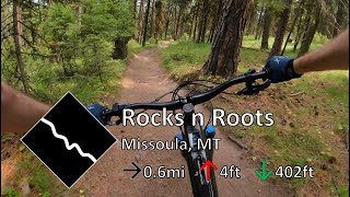
youtuber Rocks n Roots - Blue Mountain - Missoula, MT
mtb
Rocks n Roots - Blue Mountain - Missoula, MT
2:39 | 196 | comments: 0 | favs:
Jul 10, 2022

Recent Trail Reports Along Route

statustraildateconditiondescription
Rocks n Roots
Jul 17, 2026 @ 12:54pm (America/Denver)
Jul 17, 2026
Very loose and lots of rocks. Good challenge on an ebike.
Blue Mountain Lookout
May 11, 2026 @ 9:37am (America/Denver)
May 11, 2026
There’s about 30 trees down in the section before the first switchback. There is snow on the right side in this section but the left mostly clear and rideable. Above the switchback is much better with just a few trees and no snow.
Deadmans Ridge
May 9, 2026 @ 12:07am (America/Denver)
May 8, 2026
Almost fully cleared of deadfall. Couple minor trees above the road crossing but can ride around them. Couple spots below the road crossing with lots of sticks still in trail so watch derailleurs.
Wilderness Trail
May 8, 2026 @ 6:23pm (America/Denver)
May 8, 2026
Why Not
May 8, 2026 @ 6:23pm (America/Denver)
May 8, 2026
more reports »
  • By hardtailhowieTF Pro & contributors
  • #22369 - 1,281 views

Hit the Trail

Open in App

Get this route on your phone instantly.

Download Route

Save to wishlist, Garmin & download.