
Open in App
Get this route on your phone instantly.
You're gonna want to have a gps file on hand.
Start at the 31st St. parking lot by Rudy's. Head up the connector to Red Rock Rim Trail then a left onto Hogback Ridge Trail at mile 0.2. There is some new work here, so it is singletrack now At mile 1.3 it will spit you out onto doubletrack (26th Street Connector), stay rigth and continue to climb on the dirt road.
At mile 2.0, you'll finish the climb on the dirt road as it will descend into another valley. Hang a left onto Ridgeline Trail (White Acres) and keep climbing! This is one of my favorite consistent bits of singletrack in town. If you can nail it without stepping off, make sure to have another beer!
Mile 2.6, there will be a split, take the hard right on Section 16 Connector that will spit you out at an ackward four way (bench on your left as a marker). Take a gradual right onto Section 16 Trail.
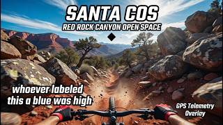
Continue on this trail even through it's tough with plenty of punchy rocky climbs until mile 3.2 then take a right onto Intemann Trail. At mile 3.4, look for an intersection (see photo) on the right, take Red Rock Canyon Overlook Trail for a fast downhill.
At mile 4.45, you'll take the uphill left option onto Switchback Express - Meadow Trail to Red Rock Canyon Connector and then a right onto Dirty Acres at mile 4.6. Take Dirty Acres back to Section 16 Trail at that four way stop with the bench. Climb back to Intemann Trail via Section 16 Trail, right at mile 5.3. Your uphill tech & cardio will thank me later.
This time though, stay on Intemann Trail until you reach mile 6.2 with a clearing and a bench uphill to your left. East Fork Sand Canyon Trail will in front of you with a right, downhill turn. Check your speed on this one! Plenty of obstructed, off camber switchbacks that can send you into the bushes. Have fun!
At mile 6.95 you'll join Sand Canyon Trail and continue downhill. Look for Roundup Trail at mile 7.3 for a right turn. You'll cross over Mesa Trail at mile 7.7 and continue to Greenlee Trail to take a left at mile 7.9.
Greenlee trail has had a lot of work done as is a fun, tight turn endevour. Look for your bail at mile 8.5 with a left turn onto Quarry Pass Trail then a quick right onto Mesa Trail. Another quick left turn at mile 8.9 back onto Sand Canyon Trail, take a right to keep descending.
Follow Sand Canyon Trail all the way to the parking lot, staying on the trail to the south side, around the jump/skills park towards the second lot. You'll be climbing up Lower Hogback Trail after passing through a gate on the SE side of the lot.
As soon as you have topped out at mile 10, you'll be at a T-intersection, hang a right. Follow the meandering trail with dropping of the ridge to your right with tempting downhill. You'll be rejoining Red Rock Rim Trail at mile 10.4. Enjoy the view as you climb up the middle valley!
At mile 10.8, you'll have a short downhill into a two way intersection. Stay on the doubletrack to your right as the gravel changes to a grey and you start climbing.
At mile 11.6 you're back to where you started with the first road climb. Hang a right onto Ridgeline Trail again! This time though, at mile 11.75 you'll be hanging a right onto White Acres Trail (Hannah Montana) to descend for a bit!
Hit the road at mile 12.6 with speed and climb to Upper Codell Trail that is a right turn, mile 12.66.
Check yourself because you can wreck yourself. There is one move that can spill you over! Have fun and keep your momentum.
Cross Hogback Ridge Trail at mile 13.3 to stay straight towards an obvious ridge. Stay on the longer left turn to stay low and descend on Lower Codell Trail.
You're almost done! Hang a hard right at mile 13.9 then a left back to the parking lot!
We hope you've been enjoying Trailforks!
Create a FREE account to view route comments and much more.
| 3,100 ft | |||||
| 3,383 ft | |||||
| 3,432 ft | |||||
| 594 ft | |||||
| 1,106 ft | |||||
| 676 ft | |||||
| 1,631 ft | |||||
| 3,422 ft | |||||
| 1,581 ft | |||||
| 558 ft | |||||
| 3,333 ft |

Service Road Atlas is a free to use, community-driven service for viewing and creating reports on the numerous back-country service roads around B.C. and Alberta.
Save the current map location and zoom level as your default home location whenever this page is loaded.
Save