3.5 miles
Distance
320 ft
Climb
-316 ft
Descent
943 ft
High Point
5 ft
Altitude change
826 ft
Altitude min
868 ft
Altitude start
873 ft
Altitude end
-12.3%
Grade max
55%
Grade min
1 mile
Distance climb
1 mile
Distance down
3,573 ft
Distance flat

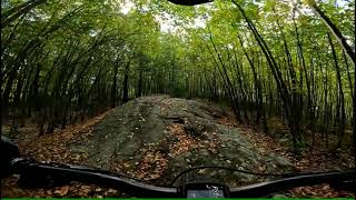
JORBA Jam Easy Route
All rides counter clockwise
No demo bikes

Ditch Witch to Warthog. Exit Warthog cross lot to quad trail next to Warthog. Ride Jungle Junction to Safari 1, Enter Tiger Pen on left, or continue on road and enter Tiger Pen Road, Tigerfish Rocks towards Boon make left along Baboon Fenceline to Safari 1, Right on Safari 1 to Snake, Snake down to Safari 1, Left into Jungle Junction, and out through tunnels.

Detailed Description
Easy is a 3 mile popular easy route located near West Milford New Jersey. This mountain bike only route. This route includes 13 trails. This route climbs 320 ft with a max elevation of 943 ft then descends -316 ft.

Trail Issues on Route

  • Minor Issue / Yellow: 3 trails (newest: Mar 11, 2026)
Local Trail Association
Local trail association
Jersey Off Road Bicycle Association (www.jorba.org)
Please consider joining or donating to the local riding association to support trail development & maintenance.
Donate to earn trail karma!

Stats

  • Distance
    3 miles
  • Avg time
    1 hr 19 min
  • Altitude change
    5 ft
  • Altitude min
    826 ft
  • Altitude start
    868 ft
  • Altitude end
    873 ft
  • Climb
    320 ft
  • Descent
    -316 ft
  • Grade max
    -12.3%
  • Grade min
    55%
  • Distance climb
    1 mile
  • Distance down
    1 mile
  • Distance flat
    3,573 ft

1 Review & Comments


We hope you've been enjoying Trailforks!

Create a FREE account to view route comments and much more.

Trails in Route

Fish715 ft
Tiger Pen1,516 ft
Safari 14,065 ft
Snake1,030 ft
Tunnels1,115 ft
Tunnel Top131 ft
Jungle Junction 1577 ft
Jungle Junction 21,486 ft
Tapawingo Stags837 ft
Lo285 ft
Boon Tiger702 ft

Details

  • Riding area
  • Primary Activity
    Mountain Bike
  • Difficulty rating
    Green
no votes yet
close
3D
Trail Conditions
  • Unknown
  • Snow Groomed
  • Snow Packed
  • Snow Covered
  • Snow Cover Partial
  • Freeze/thaw Cycle
  • Icy
  • Prevalent Mud
  • Wet
  • Variable
  • Ideal
  • Dry
  • Very Dry
Trail Flow (Ridden Direction)
Trailforks scans users ridelogs to determine the most popular direction each trail is ridden. A good flowing trail network will have most trails flowing in a single direction according to their intension.
The colour categories are based on what percentage of riders are riding a trail in its intended direction.
  • > 96%
  • > 90%
  • > 80%
  • > 70%
  • > 50%
  • < 50%
  • bi-directional trail
  • no data
Trail Last Ridden
Trailforks scans ridelogs to determine the last time a trail was ridden.
  • < 2 days
  • < 1 week
  • < 2 weeks
  • < 1 month
  • < 6 months
  • > 6 months
Trail Ridden Direction
The intended direction a trail should be ridden.
  • Downhill Only
  • Downhill Primary
  • Both Directions
  • Uphill Primary
  • Uphill Only
  • One Direction
Contribute Details
Colors indicate trail is missing specified detail.
  • Description
  • Photos
  • Description & Photos
  • Videos
Trail Popularity ?
Trailforks scans ridelogs to determine which trails are ridden the most in the last 9 months. Trails are compared with nearby trails in the same city region with a possible 25 colour shades. Think of this as a heatmap, more rides = more kinetic energy = warmer colors.
  • most popular
  • popular
  • less popular
  • not popular
ATV/ORV/OHV Filter
Max Vehicle Width
inches
US Cell Coverage
Legend
cell carrier legend

Radar Time
Activity Recordings
Trailforks uses anonymized public activity data. ?
Activity Recordings
Trailforks uses anonymized public activity data. ?
Personal Heatmap
Activity Types
all / none
Options
2
Date range month
Winter Trails
Warning A routing network for winter maps does not exist. Selecting trails using the winter trails layer has been disabled.
Missing Trails
Most Popular
Least Popular
Trails are colored based on popularity. The more popular a trail is, the more red. Less popular trails trend towards green.
Jump Magnitude Heatmap
Heatmap of where riders jump on trails. Zoom in to see individual jumps, click circles to view jump details.
BC Backroad Status

Service Road Atlas is a free to use, community-driven service for viewing and creating reports on the numerous back-country service roads around B.C. and Alberta.

map legend
Slope Aspect
Direction the slope faces
Flat N NE E SE S SW W NW
Trails Deemphasized
Trails are shown in grey.
disable
Only show trails with no bike usage.
Enable
Suggested Layers
Based on selected activity type

    Save the current map location and zoom level as your default home location whenever this page is loaded.

    Save
    Trail transparency
    • Singletrack
    • Unpaved
    • Paved
    72
    131
    194
    219
    Fish Trail Oct 1, 2021
    Fish Trail Oct 1, 2021
    trail: Fish
    8:00 | 309 | comments: 0 | favs:
    Oct 4, 2021
    Jungle Habitat  | West Milford, NJ
    Jungle Habitat | West Milford, NJ
    trail: Fish
    16:26 | 951 | comments: 0 | favs:
    May 22, 2018

    Recent Trail Reports Along Route

    statustraildateconditiondescription
    Tunnel Top
    Jun 2, 2026 @ 2:06pm (America/New_York)
    Jun 2, 2026
    Tunnels
    May 7, 2026 @ 12:58pm (America/New_York)
    May 7, 2026
    Fish
    Mar 11, 2026 @ 7:19am (America/New_York)
    Mar 11, 2026
    reporter
    Tiger Pen
    Mar 11, 2026 @ 7:19am (America/New_York)
    Mar 11, 2026
    reporter
    Lot
    Sep 8, 2024 @ 2:16pm
    Sep 8, 2024
    more reports »

    Hit the Trail

    Open in App

    Get this route on your phone instantly.

    Download Route

    Save to wishlist, Garmin & download.