The Elk Loop is a great introduction to Wagonhammer rides. A short but tough ride that opens up in early April usually.
A steady ~1000' climb gets you up to the saddle between the Wagonhammer and 4th of July drainages.
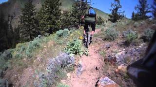
Ride through the gate to the contouring trail that takes of from there for the main Elk Loop. This trail sidehills for over 2 miles around the butte. It is primitive and narrow at times and will be a challenging experience for riders new to the area.
Once around the butte, the trail comes to an old Lewis and Clark carsonite marker. Here the bottom drops out of the ride and it descends back to the Wagonhammer Creek bottom.
Follow the trail downstream back to the trailhead.
Trail Issues on Route
- Minor Issue / Yellow: 1 trail (newest: Mar 30, 2026)
Local Trail Association
Salmon Idaho Mountain Bike Association (salmonidahomtb.org)Trail Products
-
Idaho's Mountain Bike License PlateTrail Pass
Stats
-
Distance9 miles
-
Avg time1 hr 50 min
-
Altitude min3,789 ft
-
Altitude start3,794 ft
-
Altitude end3,789 ft
-
Climb1,492 ft
-
Descent-1,497 ft
-
Grade max-37.8%
-
Grade min25.3%
-
Distance climb4 miles
-
Distance down4 miles
-
Distance flat1,585 ft
We hope you've been enjoying Trailforks!
Create a FREE account to view route comments and much more.
Trails in Route
Details
-
Riding area
-
Primary ActivityMountain Bike
-
Difficulty ratingBlue
-
Route TypeLoop
-
Bike typeAM, XC
-
DirectionOne Direction
-
Physical ratingModerate
-
Ridelogs
- Unknown
- Snow Groomed
- Snow Packed
- Snow Covered
- Snow Cover Partial
- Freeze/thaw Cycle
- Icy
- Prevalent Mud
- Wet
- Variable
- Ideal
- Dry
- Very Dry
The colour categories are based on what percentage of riders are riding a trail in its intended direction.
- > 96%
- > 90%
- > 80%
- > 70%
- > 50%
- < 50%
- bi-directional trail
- no data
- < 2 days
- < 1 week
- < 2 weeks
- < 1 month
- < 6 months
- > 6 months
- Downhill Only
- Downhill Primary
- Both Directions
- Uphill Primary
- Uphill Only
- One Direction
- Description
- Photos
- Description & Photos
- Videos
- most popular
- popular
- less popular
- not popular
Service Road Atlas is a free to use, community-driven service for viewing and creating reports on the numerous back-country service roads around B.C. and Alberta.
Save the current map location and zoom level as your default home location whenever this page is loaded.
Save- Unpaved
Photos
Recent Trail Reports Along Route
- By chuktA
TRAILFORKS NFTA & contributors - #7038 - 1,466 views

