close
-
Layers w
- Weather Layers
- Pro
- Pro
- Pro
- Pro
- Pro
- Pro
- More Layers
- Pro
- Pro
- Pro
- Pro
-
Upgrade to

3D
Trail Conditions
- Unknown
- Snow Groomed
- Snow Packed
- Snow Covered
- Snow Cover Partial
- Freeze/thaw Cycle
- Icy
- Prevalent Mud
- Wet
- Variable
- Ideal
- Dry
- Very Dry
Trail Flow (Ridden Direction)
Trailforks scans users ridelogs to determine the most popular direction each trail is ridden. A good flowing trail network will have most trails flowing in a single direction according to their intension.
The colour categories are based on what percentage of riders are riding a trail in its intended direction.
The colour categories are based on what percentage of riders are riding a trail in its intended direction.
- > 96%
- > 90%
- > 80%
- > 70%
- > 50%
- < 50%
- bi-directional trail
- no data
Trail Last Ridden
Trailforks scans ridelogs to determine the last time a trail was ridden.
- < 2 days
- < 1 week
- < 2 weeks
- < 1 month
- < 6 months
- > 6 months
Trail Ridden Direction
The intended direction a trail should be ridden.
- Downhill Only
- Downhill Primary
- Both Directions
- Uphill Primary
- Uphill Only
- One Direction
Contribute Details
Colors indicate trail is missing specified detail.
- Description
- Photos
- Description & Photos
- Videos
Trail Popularity ?
Trailforks scans ridelogs to determine which trails are ridden the most in the last 9 months.
Trails are compared with nearby trails in the same city region with a possible 25 colour shades.
Think of this as a heatmap, more rides = more kinetic energy = warmer colors.
- most popular
- popular
- less popular
- not popular
ATV/ORV/OHV Filter
Max Vehicle Width
inches
US Cell Coverage
Legend

Radar Time
Activity Recordings
Trailforks uses anonymized public activity data.
?
Activity Recordings
Trailforks uses anonymized public activity data.
?
Personal Heatmap
▶
Activity Types
all
/
none
▶
Options
2
Date range
month
–
Winter Trails
Warning
A routing network for winter maps does not exist. Selecting trails using the winter trails layer has been disabled.
Missing Trails
Most Popular
Least Popular
Trails are colored based on popularity. The more popular a trail is, the more red. Less popular trails trend towards green.
Jump Magnitude Heatmap
Heatmap of where riders jump on trails. Zoom in to see individual jumps, click circles to view jump details.
BC Backroad Status
![map legend]()
Service Road Atlas is a free to use, community-driven service for viewing and creating reports on the numerous back-country service roads around B.C. and Alberta.

Slope Aspect
Direction the slope faces
Trails Deemphasized
Trails are shown in grey.
Only show trails with no bike usage.
Suggested Layers
Based on selected activity type
Save the current map location and zoom level as your default home location whenever this page is loaded.
Save
No description for Wagonhammer has been added yet!
Login or register to submit one.
 google parking directions
Primary Trail Type: Cross-Country
Shuttleable: YES
Land Status: National Forest
google parking directionsLinks
Activities Click to view
- Mountain Bike
50 trails
- E-Bike
2 trails
- Horse
9 trails
- Hike
49 trails
- Trail Running
49 trails
Region Details
- 11
- 13
- 19
- 4
- 1
Region Status
Open as of Jun 14, 2026Stats
- Avg Trail Rating
- Trails (view details)
- 50
- Trails Mountain Bike
- 50
- Trails E-Bike
- 2
- Trails Gravel Bike
- 1
- Trails Horse
- 9
- Trails Hike
- 50
- Trails Trail Running
- 49
- Total Distance
- 81 miles
- Total Descent
- 25,296 ft
- Total Vertical
- 4,874 ft
- Highest Trailhead
- 8,558 ft
- Reports
- 690
- Photos
- 210
- Ridden Counter
- 1,077
Popular Wagonhammer Mountain Biking Trails
• 100 ★ 2.0 • 2 miles • 716 ft • 117 •
Good singletrack from the trail head with sections of rocks on old road bed. Several stream crossings can be expected. There are gates across the trail too, leave them how you found them please.
• 100 ★ 2.9 • 3 miles • 1,228 ft • 104 •
Straight forward singletrack climbing on a very old road bed. Once you gain the ridge there are big views all around. The lower end has a couple of rocky sections and a couple of short steeper bits. Fit riders can easily "middle-ring" this.
• 100 ★ 3.3 • 1 mile • 52 ft • 98 •
Best ridden downhill. Steep at the top. This trail can be dry and loose later in the season with sidehill consequences, so check the speed.
• 100 ★ 3.5 • 1 mile • 685 ft • 83 •
The Trail single track trail provides access from Creek to Trails, Big and Trails, Trails as well as points beyond. It is a moderately steep climb leaving and there will be some short hike a bike sections unless you are really fit. The...
• 95 ★ 2.0 • 1,637 ft • 14 ft • 42 •
This short connector cuts off the and allows for a direct access to Meadowsurfer or a clockwise . Don't cross the fence/gate in the saddle, but continue on the road briefly to a singletrack marked by a small cairn contouring to the next...
• 100 ★ 2.5 • 3,606 ft • 12 ft • 39 •
Popular black diamond difficulty singletrack. This mountain bike primary trail can be used downhill primary. On average it takes 5 minutes to complete this trail.
• 70 ★ 2.5 • 2 miles • 556 ft • 36 •
Great trail for more adventures in the Wagonhammer area. This trail should be used to get into the Silverleads for bigger loop options and can be a bit primitive in places at certain times of the year.
Wagonhammer Mountain Bike Routes
9 miles • 1,492 ft • 4 • Loop •
The is a great introduction to Wagonhammer rides. A short but tough ride that opens up in early April...
13 miles • 980 ft • 8 • Shuttled •
The Route gives a grand tour of 's great trails while descending over 5000'.
• 16 miles • 3,742 ft • 10 •
• 9 miles • 2,348 ft • 6 •
• 7 miles • 1,059 ft • 2 •
• 7 miles • 1,463 ft • 4 •
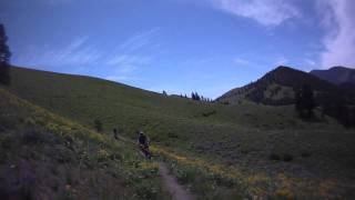
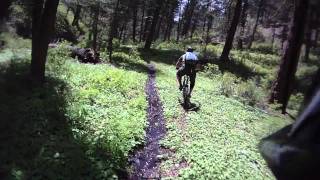
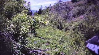
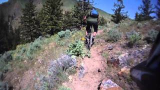
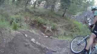
Photos of Wagonhammer Mountain Bike
Videos of Wagonhammer Mountain Bike
972 |
Oct 3, 2014 , North Fork
trail: Big Silverlead
810 |
Oct 3, 2014 , North Fork
trail: Big Silverlead
756 |
Oct 3, 2014 , North Fork
856 |
Oct 3, 2014 , North Fork
trail: Burns Gulch
853 |
Oct 3, 2014 , North Fork
Recent Trail Reports
| status | trail | date | condition | info | user |
|---|---|---|---|---|---|
| Little Silverlead | Jun 14, 2026 @ 3:33pm (America/Boise) Jun 14, 2026 | Dry | elsquatcho | ||
| Stein Ridge | Jun 14, 2026 @ 3:28pm (America/Boise) Jun 14, 2026 | Dry | elsquatcho | ||
| Trail Gulch | Jun 14, 2026 @ 3:27pm (America/Boise) Jun 14, 2026 | Dry | elsquatcho | ||
| Wagonhammer Divide | May 25, 2026 @ 6:28pm (America/Boise) May 25, 2026 | Ideal | chuktA TRAILFORKS | ||
| Stein Gulch | May 18, 2026 @ 6:02am (America/Boise) May 18, 2026 | Ideal | chuktA TRAILFORKS | ||
| Stein Mountain | May 18, 2026 @ 6:00am (America/Boise) May 18, 2026 | Ideal | chuktA TRAILFORKS | ||
| Big Silverlead | May 13, 2026 @ 10:27am (America/Boise) May 13, 2026 | Dry | wildbillmac simba | ||
| Burns Ridge | May 10, 2026 @ 7:23pm (America/Boise) May 10, 2026 | Dry | wildbillmac simba | ||
| 4th July to N Tower | May 5, 2026 @ 5:43pm (America/Boise) May 5, 2026 | Dry | sidehiller1 TRAILFORKS | ||
| Elk Loop | Mar 30, 2026 @ 10:07am (America/Boise) Mar 30, 2026 | Ideal | northforkmtb NFTA |
Activity Feed
| username | action | type | title | date |
|---|---|---|---|---|
| elsquatcho | vote | trail | activity #97404298 | Jun 20, 2026 @ 9:26am Jun 20, 2026 |
| elsquatcho | ridden | trail | activity #97404257 and 2 more | Jun 20, 2026 @ 9:25am Jun 20, 2026 |
| elsquatcho | add | photo | activity #97085014 | Jun 15, 2026 @ 8:23pm Jun 15, 2026 |
| elsquatcho | vote | trail | activity #97084975 and 1 more | Jun 15, 2026 @ 8:21pm Jun 15, 2026 |
| elsquatcho | add | report | activity #97004951 and 2 more | Jun 14, 2026 @ 2:27pm Jun 14, 2026 |
Recent Comments
| username | type | title | comment | date |
|---|---|---|---|---|
| trail | Yes it’s pretty steep, but it’s also... | Jun 14, 2026 @ 2:27pm Jun 14, 2026 | ||
| trail | Very fun sidehill trail at the top of the... | Jul 26, 2025 @ 12:18pm Jul 26, 2025 | ||
| trail | Sign at bottom at Silverleads is in the wrong... | Jul 26, 2025 @ 12:15pm Jul 26, 2025 | ||
| report | The FS is supposed to get saws in there soon... | Jul 10, 2025 @ 3:05pm Jul 10, 2025 | ||
| trail | Great way to gain elevation in the wagonhammer... | May 24, 2025 @ 4:54pm May 24, 2025 |
Nearby Areas
| name | distance | ||||
|---|---|---|---|---|---|
| CDT - North Beaverheads | 2 | 3 | 11 | 2 | 8.2 km |
| State Line - Divide | 4 | 19 | 9.1 km | ||
| Stormy Peak | 4 | 5 | 2 | 12.9 km | |
| Chief Joseph Pass | 5 | 16 | 10 | 17 km | |
| Discovery Hill | 8 | 24 | 4 | 17.5 km |
Local Badges
-

Completionist0 awarded
Local Products
Activity Type Stats
| activitytype | trails | distance | descent | descent distance | total vertical | rating | global rank | state rank | photos | reports | routes | ridelogs |
|---|---|---|---|---|---|---|---|---|---|---|---|---|
| Mountain Bike | 50 | 77 miles | 24,902 ft | 39 miles | 4,872 ft | #3,236 | #1,134 | 198 | 686 | 2 | 681 | |
| E-Bike | 2 | 1 mile | 138 ft | 2,221 ft | 174 ft | #10,307 | #3,650 | 488 | 3 | |||
| Gravel Bike | 1 | #4,033 | #1,807 | |||||||||
| Horse | 9 | 12 miles | 4,577 ft | 6 miles | 4,783 ft | #1,942 | #1,033 | 484 | ||||
| Hike | 49 | 80 miles | 25,233 ft | 40 miles | 4,872 ft | #353 | #198 | 14 | 688 | 40 | ||
| Trail Running | 49 | 80 miles | 25,233 ft | 40 miles | 4,872 ft | #2,294 | 688 | 15 |
Frequently Asked Questions About Wagonhammer
▼
What are the highest rated mountain biking trails in Wagonhammer?
The highest rated mountain biking trails in Wagonhammer are:
- Trail Gulch (4.1/5)
- Stein Mountain (Upper) (4.1/5)
- Stein Mountain (4/5)
- Middle Burns (4/5)
- Wagonhammer Divide (4/5)
▼
What is the best time of the year to ride in Wagonhammer?
Based on ride log data, the most popular months to ride in Wagonhammer are:
- May (44 activities)
- April (31 activities)
- July (13 activities)
▼
Where can I park to ride in Wagonhammer?
There are 4 parking locations listed in Wagonhammer. The most popular parking spots are: View all parking and trailhead locations on the map to plan your visit.
▼
What is the longest trail in Wagonhammer?
The longest trail in Wagonhammer is East Fork Pierce Creek at 3.4 miles. View all trails sorted by distance.
Activities
Trails
Points of Interest
- By chuktA
 TRAILFORKS NFTA & contributors
 - Admins: simba, sidehiller1, northforkmtb
- #6223 - 8,261 views
- wagonhammer activity log | embed map of Wagonhammer mountain bike trails | wagonhammer mountain biking points of interest
Downloading of trail gps tracks in kml & gpx formats is enabled for Wagonhammer.
You must login to download files.