


19.0 miles
Distance
2,063 ft
Climb
-1,985 ft
Descent
529 ft
High Point
76 ft
Altitude change
77 ft
Altitude min
294 ft
Altitude start
371 ft
Altitude end
0.1%
Grade
-30.5%
Grade max
28.6%
Grade min
8 miles
Distance climb
8 miles
Distance down
2 miles
Distance flat

A big-terrain perimeter loop linking three of Greater Portland’s most iconic riding zones—East Windham Conservation Area, Lowell Preserve, and Blackstrap—into one continuous clockwise adventure. This route is designed to stay on the outer edge of each network, creating a scenic, flowy, and occasionally punchy tour of the region’s forests, ridgelines, and signature glacial terrain.

Starting in East Windham, the ride rolls through fast, modern machine-built singletrack and mellow woods roads before dipping into Lowell Preserve, where the trail character becomes more classic Maine: roots, twisty hand-cut lines, and short technical features that keep you on your toes. The loop continues north toward Blackstrap, home to steeper climbs, ledge rolls, and rugged rock features. Expect a mix of tight tech, ridge traverses, and rewarding descents with big-woods backcountry vibes.

Ridden clockwise, the climbs feel more gradual, the transitions between networks flow better, and the Blackstrap descents line up more naturally. Overall, this is a moderate-to-advanced endurance loop with a bit of everything—modern flow, old-school tech, elevation challenges, and long stretches of deep-woods immersion. Ideal for riders looking to connect multiple systems in one go or to explore the outer boundaries of each network in a single, satisfying tour of the region.

Detailed Description
EWCA, Lowell, Blackstrap Outer Loop (Clockwise) is a 19 mile popular intermediate route located near Windham Maine. This mountain bike primary route and has a extreme overall physical rating. This route includes 23 trails. This route climbs 2,063 ft with a max elevation of 529 ft then descends -1,985 ft.
Tags

Trail Issues on Route

  • Significant Issue / Amber: 1 trail (newest: May 18, 2026)

Local Trail Association

Please consider joining or donating to the local riding association to support trail development & maintenance.
Donate to earn trail karma!

Stats

  • Distance
    19 miles
  • Avg time
    2 hr 47 min
  • Altitude min
    77 ft
  • Altitude start
    294 ft
  • Altitude end
    371 ft
  • Climb
    2,063 ft
  • Descent
    -1,985 ft
  • Grade
    0.1%
  • Grade max
    -30.5%
  • Grade min
    28.6%
  • Distance climb
    8 miles
  • Distance down
    8 miles
  • Distance flat
    2 miles

11 Reviews & Comments


We hope you've been enjoying Trailforks!

Create a FREE account to view all route reviews and much more.

Details

  • Riding area
  • Primary Activity
    Mountain Bike
  • Other Activities
    • E-Bike
  • Difficulty rating
    Blue
  • Route Type
    Loop
  • eBike Allowed
  • Bike type
    AM, XC
  • Physical rating
    Extreme
  • Activity Logs
    1

Directions

  1. Walk northeast on Access Road.
  2. Continue for 50 meters.
  3. Walk northeast on Access Road.
  4. Continue for 100 meters.
  5. Walk south on Stranger Things.
  6. Continue for 100 meters.
  7. Walk northeast on Stranger Things.
  8. Continue for 100 meters.
  9. Walk northeast on Stranger Things.
  10. Continue for 100 meters.
  11. Walk east on Purple Main Trail.
  12. Continue for 100 meters.
  13. Walk east on Purple Main Trail.
  14. Continue for 100 meters.
  15. Walk southwest on Purple Main Trail.
  16. Continue for 80 meters.
  17. Walk east on Purple Main Trail.
  18. Continue for 400 meters.
  19. Walk northeast on Purple Main Trail.
  20. Continue for 300 meters.
  21. Walk northeast on Purple Main Trail.
  22. Continue for 30 meters.
  23. Walk east on Purple Main Trail.
  24. Continue for 90 meters.
  25. Walk southeast on Purple Main Trail.
  26. Continue for 100 meters.
  27. Walk northeast on Purple Main Trail.
  28. Continue for 200 meters.
  29. Walk east on Purple Main Trail.
  30. Continue for 200 meters.
  31. Walk southeast on Purple Main Trail.
  32. Continue for 300 meters.
  33. Walk south on Purple Main Trail.
  34. Continue for 300 meters.
  35. Turn left to stay on Purple Main Trail.
  36. Continue for 100 meters.
  37. Walk south on Purple Main Trail.
  38. Continue for 300 meters.
  39. Keep straight to stay on Red Main Trail Loop.
  40. Continue for 20 meters.
  41. Walk east on Trail 7.
  42. Continue for 30 meters.
  43. Walk southeast on Trail 7.
  44. Continue for 400 meters.
  45. Walk east on Orange Main Trail.
  46. Continue for 300 meters.
  47. Walk east on Lowell/Blackstrap Connector.
  48. Continue for 300 meters.
  49. Walk southeast on Outback Trail.
  50. Continue for 300 meters.
  51. Walk southwest on Outback Trail.
  52. Continue for 300 meters.
  53. Walk south on Epiphany Trail (Red Blaze).
  54. Continue for 400 meters.
  55. Walk southeast on Epiphany Trail (Red Blaze).
  56. Continue for 400 meters.
  57. Walk south on Epiphany Trail (Red Blaze).
  58. Continue for 200 meters.
  59. Walk east on Outback Trail.
  60. Continue for 200 meters.
  61. Walk southeast on Outback Trail.
  62. Continue for 400 meters.
  63. Walk east on Outback Trail.
  64. Continue for 90 meters.
  65. Bear left onto Poplar Ridge Trail.
  66. Continue for 200 meters.
  67. Walk south on Poplar Ridge Trail.
  68. Continue for 400 meters.
  69. Walk east on Bustamove.
  70. Continue for 200 meters.
  71. Walk south on Bustamove.
  72. Continue for 200 meters.
  73. Walk southwest on Bustamove.
  74. Continue for 100 meters.
  75. Walk south on Poplar Ridge Trail.
  76. Continue for 200 meters.
  77. Walk east on Hayfield Trail (Red Blazes).
  78. Continue for 300 meters.
  79. Walk south on Flow Creek.
  80. Continue for 60 meters.
  81. Walk east on Flow Creek.
  82. Continue for 200 meters.
  83. Walk northeast on Flow Creek.
  84. Continue for 200 meters.
  85. Walk east on Flow Creek.
  86. Continue for 300 meters.
  87. Walk southeast on Flow Creek.
  88. Continue for 200 meters.
  89. Walk northeast on Hayfield Trail (Red Blazes).
  90. Continue for 100 meters.
  91. Walk east on Hayfield Trail (Red Blazes).
  92. Continue for 30 meters.
  93. Walk south on Access Singletrack.
  94. Continue for 100 meters.
  95. Walk south on Forest Road.
  96. Continue for 100 meters.
  97. Walk southeast on Blackstrap River Trail.
  98. Continue for 200 meters.
  99. Walk southwest on Blackstrap River Trail.
  100. Continue for 200 meters.
  101. Walk south on Blackstrap River Trail.
  102. Continue for 400 meters.
  103. Walk southeast on Blackstrap River Trail.
  104. Continue for 300 meters.
  105. Walk southwest on Saw Whet.
  106. Continue for 60 meters.
  107. Walk southwest on Saw Whet Black.
  108. Continue for 100 meters.
  109. Walk south on Green Line.
  110. Continue for 70 meters.
  111. Walk east on Red South.
  112. Continue for 200 meters.
  113. Walk south on Red South.
  114. Continue for 400 meters.
  115. Walk south on Red South.
  116. Continue for 500 meters.
  117. Walk south on White.
  118. Continue for 300 meters.
  119. Walk southwest on White.
  120. Continue for 100 meters.
  121. Walk southwest on White.
  122. Continue for 200 meters.
  123. Walk north on White.
  124. Continue for 30 meters.
  125. Walk south on White.
  126. Continue for 30 meters.
  127. Walk north on White.
  128. Continue for 100 meters.
  129. Walk northwest on White.
  130. Continue for 500 meters.
  131. Walk west on White.
  132. Continue for 40 meters.
  133. Walk east on White.
  134. Continue for 40 meters.
  135. Turn left onto Red.
  136. Continue for 100 meters.
  137. Walk north on Red.
  138. Continue for 500 meters.
  139. Walk west on Green Line.
  140. Continue for 200 meters.
  141. Walk northwest on Green Line.
  142. Continue for 300 meters.
  143. Walk northeast on Green Line Summit.
  144. Continue for 30 meters.
  145. Walk northwest on Green Line Summit.
  146. Continue for 50 meters.
  147. Walk north on Green Line Summit.
  148. Continue for 20 meters.
  149. Walk southwest on Powerlines.
  150. Continue for 50 meters.
  151. Walk west on Powerlines (N).
  152. Continue for 60 meters.
  153. Walk north on Powerlines (N).
  154. Continue for 100 meters.
  155. Walk north on Bobcat Trail.
  156. Continue for 100 meters.
  157. Walk north on Bobcat Trail.
  158. Continue for 200 meters.
  159. Walk west on Bobcat Trail.
  160. Continue for 300 meters.
  161. Walk north on Bobcat Trail.
  162. Continue for 100 meters.
  163. Walk north on Rocky Ridge (NEMBA Trail).
  164. Continue for 30 meters.
  165. Walk north on Rocky Ridge (NEMBA Trail).
  166. Continue for 200 meters.
  167. Walk northeast on Rocky Ridge (NEMBA Trail).
  168. Continue for 700 meters.
  169. Walk west on Rocky Ridge (NEMBA Trail).
  170. Continue for 90 meters.
  171. Bear right onto Forest Road.
  172. Continue for 200 meters.
  173. Walk west on Happy Cats.
  174. Continue for 200 meters.
  175. Walk southwest on Happy Cats.
  176. Continue for 700 meters.
  177. Walk northwest on Hayfield Trail (Red Blazes).
  178. Continue for 200 meters.
  179. Walk north on Poplar Ridge Trail.
  180. Continue for 200 meters.
  181. Walk north on Poplar Ridge Trail.
  182. Continue for 100 meters.
  183. Walk northwest on Poplar Ridge Trail.
  184. Continue for 50 meters.
  185. Walk west on Cakewalk.
  186. Continue for 200 meters.
  187. Walk north on Cakewalk.
  188. Continue for 200 meters.
  189. Walk north on Outback Trail.
  190. Continue for 500 meters.
  191. Walk northwest on Outback Trail.
  192. Continue for 20 meters.
  193. Make a sharp left onto Lower Hemlock Trail (White Blaze).
  194. Continue for 70 meters.
  195. Walk south on Lower Hemlock Trail (White Blaze).
  196. Continue for 500 meters.
  197. Walk south on Lower Hemlock Trail (White Blaze).
  198. Continue for 400 meters.
  199. Bear right onto Upper Hemlock Trail (White Blaze).
  200. Continue for 60 meters.
  201. Walk west on Upper Hemlock Trail (White Blaze).
  202. Continue for 700 meters.
  203. Walk northwest on Upper Hemlock Trail (White Blaze).
  204. Continue for 10 meters.
  205. Turn left onto Outback Trail.
  206. Continue for 400 meters.
  207. Walk north on Outback Trail.
  208. Continue for 600 meters.
  209. Walk northeast on Epiphany Trail (Red Blaze).
  210. Continue for 300 meters.
  211. Walk northwest on Epiphany Trail (Red Blaze).
  212. Continue for 10 meters.
  213. Turn left onto Lowell/Blackstrap Connector.
  214. Continue for 200 meters.
  215. Walk southeast on Trail 8.
  216. Continue for 30 meters.
  217. Keep left to stay on Trail 8.
  218. Continue for 200 meters.
  219. Walk southwest on Trail 8.
  220. Continue for 400 meters.
  221. Walk west on Trail 8.
  222. Continue for 100 meters.
  223. Walk north on Trail 8.
  224. Continue for 30 meters.
  225. Walk northwest on Trail 8.
  226. Continue for 50 meters.
  227. Walk southwest on Red Main Trail Loop.
  228. Continue for 20 meters.
  229. Walk south on Trail 11.
  230. Continue for 300 meters.
  231. Walk south on Trail 11.
  232. Continue for 400 meters.
  233. Walk southwest on Blue Main Trail Loop.
  234. Continue for 600 meters.
  235. Walk south on Blue Main Trail Loop.
  236. Continue for 200 meters.
  237. Walk southwest on Blue Main Trail Loop.
  238. Continue for 100 meters.
  239. Walk northwest on Blue Main Trail Loop.
  240. Continue for 100 meters.
  241. Walk north on Blue Main Trail Loop.
  242. Continue for 100 meters.
  243. Walk west on Yellow Main Trail.
  244. Continue for 200 meters.
  245. Walk northwest on Yellow Main Trail.
  246. Continue for 100 meters.
  247. Walk north on Yellow Main Trail.
  248. Continue for 100 meters.
  249. Bear left onto Chain That Door.
  250. Continue for 100 meters.
  251. Walk northwest on Chain That Door.
  252. Continue for 400 meters.
  253. Walk northeast on Little Duck Pond Road.
  254. Continue for 100 meters.
  255. Bear right onto Spur To Red.
  256. Continue for 80 meters.
  257. Walk northeast on Red Main Trail Loop.
  258. Continue for 10 meters.
  259. Walk east on Red Main Trail Loop.
  260. Continue for 10 meters.
  261. Keep left to stay on Red Main Trail Loop.
  262. Continue for 200 meters.
  263. Walk northeast on Red Main Trail Loop.
  264. Continue for 200 meters.
  265. Walk north on Red Main Trail Loop.
  266. Continue for 100 meters.
  267. Walk north on Red Main Trail Loop.
  268. Continue for 50 meters.
  269. Walk southwest on Purple Main Trail.
  270. Continue for 70 meters.
  271. Walk southwest on Purple Main Trail.
  272. Continue for 200 meters.
  273. Walk southwest on Purple Main Trail.
  274. Continue for 200 meters.
  275. Walk northwest on Purple Main Trail.
  276. Continue for 400 meters.
  277. Walk northwest on Purple Main Trail.
  278. Continue for 200 meters.
  279. Walk northwest on Purple Main Trail.
  280. Continue for 100 meters.
  281. Walk southwest on Purple Main Trail.
  282. Continue for 10 meters.
  283. Walk south on Purple Main Trail.
  284. Continue for 100 meters.
  285. Walk south on Purple Main Trail.
  286. Continue for 60 meters.
  287. Walk southwest on Purple Main Trail.
  288. Continue for 80 meters.
  289. Walk southwest on Purple Main Trail.
  290. Continue for 20 meters.
  291. Walk northwest on Bandsaw.
  292. Continue for 40 meters.
  293. Walk southwest on 1-2 Approach.
  294. Continue for 20 meters.
  295. Walk west on 1-2 Approach.
  296. Continue for 200 meters.
  297. Walk northwest on E Line.
  298. Continue for 200 meters.
  299. Walk south on E Line.
  300. Continue for 200 meters.
  301. Walk north on Purple Main Trail.
  302. Continue for 20 meters.
  303. Walk northwest on Access Road.
  304. Continue for 100 meters.
  305. Walk northeast on Access Road.
  306. Continue for 100 meters.
  307. Walk southwest on E Line.
  308. Continue for 90 meters.
no votes yet
close
Trail transparency
  • Singletrack
  • Unpaved
mtb
trail: Odyssey
56
mtb
trail: Odyssey
45
mtb
trail: Odyssey
59
mtb
trail: Odyssey
51
Blackstrap Short
mtb
Blackstrap Short
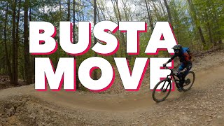
trail: Bustamove
0:01 | 718 | comments: 0 | favs:
Sep 14, 2022
Southern Maine's new favorite MTB trail //...
mtb
Southern Maine's new favorite MTB trail // Bustamove at Blackstrap
trail: Bustamove
5:53 | 496 | comments: 0 | favs:
Sep 14, 2022

Recent Trail Reports Along Route

statustraildateconditiondescription
Trail 7
Sep 12, 2026 @ 10:01am (America/New_York)
Sep 12, 2026
Odyssey
Sep 12, 2026 @ 10:01am (America/New_York)
Sep 12, 2026
Epiphany Trail (Red Blaze)
Sep 7, 2026 @ 11:51am (America/New_York)
Sep 7, 2026
Cakewalk
Aug 29, 2026 @ 2:16pm (America/New_York)
Aug 29, 2026
Access Singletrack
Aug 29, 2026 @ 2:16pm (America/New_York)
Aug 29, 2026
more reports »

Hit the Trail

Open in App

Get this route on your phone instantly.

Download Route

Save to wishlist, Garmin & download.
