



Open in App
Get this route on your phone instantly.
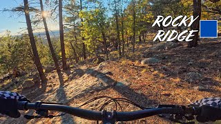
Please note that at the time of this writing (May, 2019) that the Schultz Creek and Rocky Ridge trails are closed for logging. Please start at Buffalo Park and ride north on the AZT until you turn right on Pipeline road.
The goal of the Flagstaff Loop Trail is to provide an exceptional multi-use, non-motorized recreational experience close to the urban fringe. The trail will offer improved connectivity within our community while providing a safe and inviting transportation alternative.
When completed the 42 mile trail will circumnavigate Flagstaff, providing access from all areas of the city. The concept is that of an outer wheel surrounding Flagstaff, with the linking trails acting as spokes entering the city (the Flagstaff Urban Trail System). The wheel will then link to the communities outside the city limits and to the network of Forest Service trails, including the Arizona National Scenic Trail. The Loop Trail will utilize a variety of Forest Service trails, abandoned roads, the Flagstaff Urban Trail System, State Land department trail easements and the Arizona Trail.

We hope you've been enjoying Trailforks!
Create a FREE account to view route comments and much more.
| 2,651 ft | |||||
| 2 miles | |||||
| 1,729 ft | |||||
| 2,907 ft | |||||
| 1 mile | |||||
| 3,409 ft | |||||
| 69 ft | |||||
| 302 ft | |||||
| 2 miles | |||||
| 2 miles | |||||
| 1 mile | |||||
| 4 miles | |||||
| 5,052 ft | |||||
| 2 miles | |||||
| 5 miles | |||||
| 4 miles | |||||
| 4,459 ft | |||||
| 1 mile | |||||
| 128 ft | |||||
| 2 miles | |||||
| 3,681 ft | |||||
| 2,070 ft | |||||
| 338 ft | |||||
| 781 ft | |||||
| 1,762 ft | |||||
| 2 miles | |||||
| 551 ft | |||||
| 338 ft | |||||
| 2 miles | |||||
| 2 miles |


Service Road Atlas is a free to use, community-driven service for viewing and creating reports on the numerous back-country service roads around B.C. and Alberta.
Save the current map location and zoom level as your default home location whenever this page is loaded.
Save