

15.5 miles
Distance
665 ft
Climb
-690 ft
Descent
1,826 ft
High Point
-25 ft
Altitude change
1,486 ft
Altitude min
1,696 ft
Altitude start
1,673 ft
Altitude end
-0%
Grade
-60.2%
Grade max
27.5%
Grade min
7 miles
Distance climb
7 miles
Distance down
2 miles
Distance flat

Seasonal trail closure from March 15 - May 15. The trail loop gets very muddy when wet and can be overgrown in the late summer.

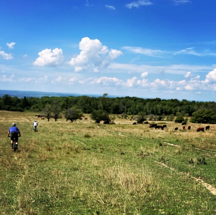
This loop takes riders to the north end of FLNF via the Backbone, Interloken, and No Tan Takto trails. These are mostly doubletrack trails shared with hikers and horses, and these trails get very muddy when wet.

The loops begins at the Picnic Area Road parking lot. Travel east down Picnic Area Rd until the start of the Backbone trail on your right. Travel north on the Backbone trail to the gated intersection with Ball Diamond Road, but turn right at the gate to continue east on the Backbone trail until it intersects with Potomac Road. Turn left on Potomac Road and follow it until the next intersection with County Rt 1. Turn left (east) up the road and look for the gated entrance to the Interloken trail on your right. Follow the Interloken trail across the pasture and out to Teeter Pond, and across the road to continue on Interloken through the pasture, down into the forest and across a small creek. Follow Interloken north to end at Parmenter Rd.

Turn right and head back south on the No Tan Takto trail. Follow No Tan Takto south through fields, across Townsend Road, and continue south for several miles across pasture land until the trails end at County Rt 1. Continue south on Wardners Corners Road until the gated intersection with Backbone trail, and follow Backbone trail south all the way to Picnic Area Road. Turn left and climb back up Picnic Area Road to the parking lots.

Detailed Description
FLNF North Loop is a 15 mile moderately popular intermediate route located near Hector New York. This mountain bike primary route can be used both directions and has a moderate overall physical rating. This route includes 1 trails. This route climbs 665 ft with a max elevation of 1,826 ft then descends -690 ft.
Tags
LakePicnic spotRiver or creek

Local Trail Association

Local trail association
Cycle-CNY (www.cycle-cny.com)
Please consider joining or donating to the local riding association to support trail development & maintenance.
Donate to earn trail karma!

Stats

  • Distance
    15 miles
  • Altitude min
    1,486 ft
  • Altitude start
    1,696 ft
  • Altitude end
    1,673 ft
  • Climb
    665 ft
  • Descent
    -690 ft
  • Grade
    -0%
  • Grade max
    -60.2%
  • Grade min
    27.5%
  • Distance climb
    7 miles
  • Distance down
    7 miles
  • Distance flat
    2 miles

Comments


We hope you've been enjoying Trailforks!

Create a FREE account to view all route reviews and much more.
Trails in Route

No Tan Takto4 miles

Details

  • Riding area
  • Primary Activity
    Mountain Bike
  • Other Activities
    • Hike
    • Trail Running
  • Difficulty rating
    Blue
  • Route Type
    Loop
  • eBike Allowed
  • Bike type
    XC, Fat
  • Direction
    Both Directions
  • Physical rating
    Moderate

Directions

  1. Walk north on Backbone Trail.
  2. Continue for 5 kilometers.
  3. Walk north on Interloken Trail.
  4. Continue for 2 kilometers.
  5. Keep right to take Interloken/No-Tan-Takto Trail.
  6. Continue for 40 meters.
  7. Keep left to take Interloken Trail.
  8. Continue for 3 kilometers.
  9. Walk south on No Tan Takto.
  10. Continue for 4 kilometers.
  11. Keep left to take Interloken Trail.
  12. Continue for 10 meters.
  13. Keep right to take Interloken/No-Tan-Takto Trail.
  14. Continue for 10 meters.
  15. Keep straight to take No Tan Takto.
  16. Continue for 2 kilometers.
  17. Walk south on Wardner Corners Road.
  18. Continue for 1 kilometer.
no votes yet
close
Trail transparency
  • Unpaved
mtb
50
mtb
70

Recent Trail Reports Along Route

no previous reports.

  • By 607trailsTF Pro Cycle-CNY & contributors
  • #66906 - 205 views

Hit the Trail

Open in App

Get this route on your phone instantly.

Download Route

Save to wishlist, Garmin & download.
