
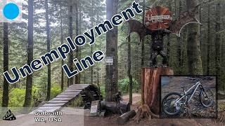
Unemployment line, AKA U-Line, is one of the signature trails at Galbraith Mountain. Starting at the end of Scorpion, U-Line drops in with some awesome machine-built flow. There are huge berms, and over forty jumps throughout the trail. Pretty much all of the features are rollable, with only a couple gaps. More advanced riders will love lining up the bigger jumps, doubles, and feeling the flow.
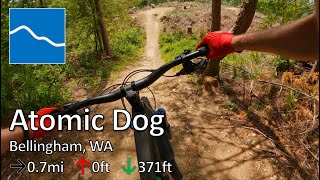
Atomic Dog is another Galby classic, with more fun flow and some jumps. This trail is a little bit more technical than Unemployment line, but still super fun. It drops from the end of Pump Track and Unemployment Line to the bottom of Galbraith Mountain.
Local Trail Association
Whatcom Mountain Bike Coalition (wmbcmtb.org)Trail Products
Stats
-
Distance6 miles
-
Avg time59 min 22 sec
-
Altitude min728 ft
-
Altitude start730 ft
-
Altitude end728 ft
-
Climb867 ft
-
Descent-866 ft
-
Grade max-23%
-
Grade min29.1%
-
Distance climb3 miles
-
Distance down2 miles
-
Distance flat2,379 ft
44 Reviews & Comments
We hope you've been enjoying Trailforks!
Create a FREE account to view all route reviews and much more.
Trails in Route
| 1,650 ft | |||||
| 3,635 ft | |||||
| 3,494 ft | |||||
| 2,989 ft |
Details
-
Riding area
-
Primary ActivityMountain Bike
-
Difficulty ratingBlue
-
Route TypeLoop
-
eBike Allowed
-
DirectionOne Direction
-
Physical ratingModerate
-
Activity Logs
- Unknown
- Snow Groomed
- Snow Packed
- Snow Covered
- Snow Cover Partial
- Freeze/thaw Cycle
- Icy
- Prevalent Mud
- Wet
- Variable
- Ideal
- Dry
- Very Dry
The colour categories are based on what percentage of users are riding a trail in its intended direction.
- > 96%
- > 90%
- > 80%
- > 70%
- > 50%
- < 50%
- bi-directional trail
- no data
- < 2 days
- < 1 week
- < 2 weeks
- < 1 month
- < 6 months
- > 6 months
- Downhill Only
- Downhill Primary
- Both Directions
- Uphill Primary
- Uphill Only
- One Direction
- Description
- Photos
- Description & Photos
- Videos
- most popular
- popular
- less popular
- not popular
Service Road Atlas is a free to use, community-driven service for viewing and creating reports on the numerous back-country service roads around B.C. and Alberta.
Save the current map location and zoom level as your default home location whenever this page is loaded.
Save- Singletrack
Photos
Videos
Recent Trail Reports Along Route
- By JasperTheBiker & contributors
- #47199 - 1,680 views
