


10.2 miles
Distance
911 ft
Climb
-914 ft
Descent
481 ft
High Point
0 ft
Altitude change
244 ft
Altitude min
249 ft
Altitude start
249 ft
Altitude end
-43.4%
Grade max
30.4%
Grade min
3 miles
Distance climb
3 miles
Distance down
5 miles
Distance flat

Essentially copy of "Goat Hill 11 miler" route with a slightly different way out back to parking

Detailed Description
Goat Hill Loop is a 10 mile moderately popular intermediate route located near Northbridge Massachusetts. This mountain bike only route. This route includes 8 trails. This route climbs 911 ft with a max elevation of 481 ft then descends -914 ft.

Trail Issues on Route

  • Significant Issue / Amber: 1 trail (newest: Apr 16, 2026)

Local Trail Association

Local trail association
Blackstone Valley NEMBA Chapter (www.nemba.org)
Please consider joining or donating to the local riding association to support trail development & maintenance.
Donate to earn trail karma!

Stats

  • Distance
    10 miles
  • Avg time
    2 hr 32 min
  • Altitude change
    0 ft
  • Altitude min
    244 ft
  • Altitude start
    249 ft
  • Altitude end
    249 ft
  • Climb
    911 ft
  • Descent
    -914 ft
  • Grade max
    -43.4%
  • Grade min
    30.4%
  • Distance climb
    3 miles
  • Distance down
    3 miles
  • Distance flat
    5 miles

6 Reviews & Comments


We hope you've been enjoying Trailforks!

Create a FREE account to view all route reviews and much more.

Trails in Route

Wind UP2 miles
Down & Out1,795 ft
Reload South2,356 ft
Bonespur2,001 ft
Greenway Trail2 miles
Ribbon Candy West2,589 ft

Details

no votes yet
close
Trail transparency
  • Singletrack
  • Unpaved
mtb
19
mtb
107
mtb
trail: Wind UP
63
mtb
trail: Wind UP
70
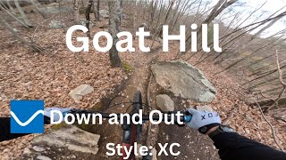
Down and Out - Goat Hill
mtb
Down and Out - Goat Hill
trail: Down & Out
4:44 | 236 | comments: 0 | favs:
Dec 31, 2024
Wind Up - Goat Hill
mtb
Wind Up - Goat Hill
trail: Wind UP
25:40 | 139 | comments: 0 | favs:
Jun 14, 2024

Recent Trail Reports Along Route

statustraildateconditiondescription
Greenway Trail
Aug 11, 2026 @ 12:10pm (America/New_York)
Aug 11, 2026
Trees cleared off trail
Down & Out
Aug 7, 2026 @ 5:11pm (America/New_York)
Aug 7, 2026
Tree cleared (exit ramp also clear)
Reload South
Jul 5, 2026 @ 9:49am (America/New_York)
Jul 5, 2026
Wind UP
Jul 4, 2026 @ 12:22pm (America/New_York)
Jul 4, 2026
Down trees cleared
Ribbon Candy West
Apr 16, 2026 @ 6:45pm (America/New_York)
Apr 16, 2026
3 large trees down blocking trail, but can walk around or over, not rideable over. reporter
more reports »
  • By SeanF82TF Pro & contributors
  • #24981 - 920 views

Hit the Trail

Open in App

Get this route on your phone instantly.

Download Route

Save to wishlist, Garmin & download.

