8.2 miles
Distance
1,156 ft
Climb
-1,160 ft
Descent
1,296 ft
High Point
-2 ft
Altitude change
872 ft
Altitude min
1,280 ft
Altitude start
1,276 ft
Altitude end
-43.4%
Grade max
30.9%
Grade min
4 miles
Distance climb
3 miles
Distance down
1 mile
Distance flat

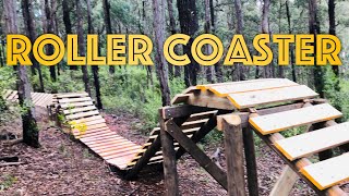
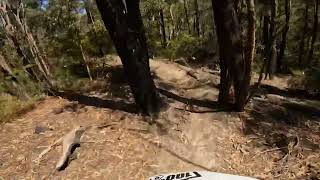
Happy Loop covers most of the main trails out at SWG in the best direction. Variations can easily be made to the loop to incorporate additional trails such as ADD, The Rockies, Jump Run, Rip & Berm or Lenny's Rocks into the loop.

This route is Unsanctioned, Ride at your own Risk!

Detailed Description
Happy Loop is a 8 mile moderately popular intermediate unsanctioned route located near Glengarry. This mountain bike primary route can be used one direction and has a moderate overall physical rating. This route includes 32 trails. This route climbs 1,156 ft with a max elevation of 1,296 ft then descends -1,160 ft.

Stats

  • Distance
    8 miles
  • Avg time
    1 hr 10 min
  • Altitude min
    872 ft
  • Altitude start
    1,280 ft
  • Altitude end
    1,276 ft
  • Climb
    1,156 ft
  • Descent
    -1,160 ft
  • Grade max
    -43.4%
  • Grade min
    30.9%
  • Distance climb
    4 miles
  • Distance down
    3 miles
  • Distance flat
    1 mile

Comments


We hope you've been enjoying Trailforks!

Create a FREE account to view route comments and much more.

Trails in Route

Lyrebird2,549 ft
ADD56 ft
Flow Track4,724 ft
Chainsaw2,605 ft
Strap On3,222 ft
Crayfish4,675 ft
Goanna650 ft
Stump Run1 mile
Fireroad4,295 ft
Goanna2,913 ft
Fireroad1,234 ft
Killer2,723 ft
Rip And Berm164 ft
Link - R&B Exit108 ft
Fireroad472 ft
Return Trail3,248 ft
Lyrebird36 ft

Details

  • Riding area
  • Primary Activity
    Mountain Bike
  • Other Activities
    • E-Bike
  • Difficulty rating
    Blue
  • Route Type
    Loop
  • eBike Allowed
  • Bike type
    AM
  • Direction
    One Direction
  • Physical rating
    Moderate
  • Ridelogs
    74
no votes yet
close
3D
Trail Conditions
  • Unknown
  • Snow Groomed
  • Snow Packed
  • Snow Covered
  • Snow Cover Partial
  • Freeze/thaw Cycle
  • Icy
  • Prevalent Mud
  • Wet
  • Variable
  • Ideal
  • Dry
  • Very Dry
Trail Flow (Ridden Direction)
Trailforks scans users ridelogs to determine the most popular direction each trail is ridden. A good flowing trail network will have most trails flowing in a single direction according to their intension.
The colour categories are based on what percentage of riders are riding a trail in its intended direction.
  • > 96%
  • > 90%
  • > 80%
  • > 70%
  • > 50%
  • < 50%
  • bi-directional trail
  • no data
Trail Last Ridden
Trailforks scans ridelogs to determine the last time a trail was ridden.
  • < 2 days
  • < 1 week
  • < 2 weeks
  • < 1 month
  • < 6 months
  • > 6 months
Trail Ridden Direction
The intended direction a trail should be ridden.
  • Downhill Only
  • Downhill Primary
  • Both Directions
  • Uphill Primary
  • Uphill Only
  • One Direction
Contribute Details
Colors indicate trail is missing specified detail.
  • Description
  • Photos
  • Description & Photos
  • Videos
Trail Popularity ?
Trailforks scans ridelogs to determine which trails are ridden the most in the last 9 months. Trails are compared with nearby trails in the same city region with a possible 25 colour shades. Think of this as a heatmap, more rides = more kinetic energy = warmer colors.
  • most popular
  • popular
  • less popular
  • not popular
ATV/ORV/OHV Filter
Max Vehicle Width
inches
US Cell Coverage
Legend
cell carrier legend

Radar Time
Activity Recordings
Trailforks uses anonymized public activity data. ?
Activity Recordings
Trailforks uses anonymized public activity data. ?
Personal Heatmap
Activity Types
all / none
Options
2
Date range month
Winter Trails
Warning A routing network for winter maps does not exist. Selecting trails using the winter trails layer has been disabled.
Missing Trails
Most Popular
Least Popular
Trails are colored based on popularity. The more popular a trail is, the more red. Less popular trails trend towards green.
Jump Magnitude Heatmap
Heatmap of where riders jump on trails. Zoom in to see individual jumps, click circles to view jump details.
BC Backroad Status

Service Road Atlas is a free to use, community-driven service for viewing and creating reports on the numerous back-country service roads around B.C. and Alberta.

map legend
Slope Aspect
Direction the slope faces
Flat N NE E SE S SW W NW
Trails Deemphasized
Trails are shown in grey.
disable
Only show trails with no bike usage.
Enable
Suggested Layers
Based on selected activity type

    Save the current map location and zoom level as your default home location whenever this page is loaded.

    Save
    Trail transparency
    • Singletrack
    • Unpaved
    142
    84
    108
    138
    youtuber Getting DEEP into the Glengarry MTB Park.
    Getting DEEP into the Glengarry MTB Park.
    trail: Stump Run
    5:22 | 1178 | comments: 0 | favs:
    Sep 24, 2020
    youtuber Strap On Somewhere Good
    Strap On Somewhere Good
    trail: Strap On
    0:41 | 22 | comments: 0 | favs:
    Feb 10, 2023

    Recent Trail Reports Along Route

    statustraildateconditiondescription
    Lyrebird
    May 31, 2025 @ 1:49pm
    May 31, 2025
    Buffed to perfection, the trail team have outdone themselves.
    ADD
    May 31, 2025 @ 1:49pm
    May 31, 2025
    Buffed to perfection, the trail team have outdone themselves.
    Chainsaw
    May 31, 2025 @ 1:49pm
    May 31, 2025
    Buffed to perfection, the trail team have outdone themselves.
    Stump Run
    May 31, 2025 @ 1:49pm
    May 31, 2025
    Buffed to perfection, the trail team have outdone themselves.
    Goanna
    May 31, 2025 @ 1:49pm
    May 31, 2025
    more reports »
    • By gtrewernTF Pro Gmtb & contributors
    • #21432 - 813 views

    Hit the Trail

    Open in App

    Get this route on your phone instantly.

    Download Route

    Save to wishlist, Garmin & download.