12.0 miles
Distance
919 ft
Climb
-925 ft
Descent
1,623 ft
High Point
-7 ft
Altitude change
1,048 ft
Altitude min
1,054 ft
Altitude start
1,047 ft
Altitude end
-74%
Grade max
48.6%
Grade min
5 miles
Distance climb
5 miles
Distance down
2 miles
Distance flat

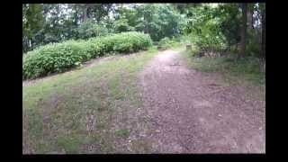
Intermediate Trail Loop on Montesano. Includes some flow and fun downhill sections.

Have care on the Sinks Trail downhill section as some parts are loose and rocky.

Detailed Description
Intermediate Loop is a 12 mile moderately popular intermediate route located near Huntsville Alabama. This mountain bike only route can be used both directions and has a moderate overall physical rating. This route includes 14 trails. This route climbs 919 ft with a max elevation of 1,623 ft then descends -925 ft.

Trail Issues on Route

  • Closed: 7 trails (newest: Jun 1, 2026)
  • Minor Issue / Yellow: 1 trail (newest: Jun 19, 2026)
Local Trail Association
Local trail association
Huntsville Area Mountainbike Riders (www.hamrhsv.com)
Please consider joining or donating to the local riding association to support trail development & maintenance.
Donate to earn trail karma!

Stats

  • Distance
    12 miles
  • Avg time
    1 hr 46 min
  • Altitude min
    1,048 ft
  • Altitude start
    1,054 ft
  • Altitude end
    1,047 ft
  • Climb
    919 ft
  • Descent
    -925 ft
  • Grade max
    -74%
  • Grade min
    48.6%
  • Distance climb
    5 miles
  • Distance down
    5 miles
  • Distance flat
    2 miles

21 Reviews & Comments


We hope you've been enjoying Trailforks!

Create a FREE account to view route comments and much more.

Details

  • Riding area
  • Primary Activity
    Mountain Bike
  • Difficulty rating
    Blue
  • Route Type
    Loop
  • Bike type
    AM, XC
  • Direction
    Both Directions
  • Physical rating
    Moderate
  • Ridelogs
    1
no votes yet
close
3D
Trail Conditions
  • Unknown
  • Snow Groomed
  • Snow Packed
  • Snow Covered
  • Snow Cover Partial
  • Freeze/thaw Cycle
  • Icy
  • Prevalent Mud
  • Wet
  • Variable
  • Ideal
  • Dry
  • Very Dry
Trail Flow (Ridden Direction)
Trailforks scans users ridelogs to determine the most popular direction each trail is ridden. A good flowing trail network will have most trails flowing in a single direction according to their intension.
The colour categories are based on what percentage of riders are riding a trail in its intended direction.
  • > 96%
  • > 90%
  • > 80%
  • > 70%
  • > 50%
  • < 50%
  • bi-directional trail
  • no data
Trail Last Ridden
Trailforks scans ridelogs to determine the last time a trail was ridden.
  • < 2 days
  • < 1 week
  • < 2 weeks
  • < 1 month
  • < 6 months
  • > 6 months
Trail Ridden Direction
The intended direction a trail should be ridden.
  • Downhill Only
  • Downhill Primary
  • Both Directions
  • Uphill Primary
  • Uphill Only
  • One Direction
Contribute Details
Colors indicate trail is missing specified detail.
  • Description
  • Photos
  • Description & Photos
  • Videos
Trail Popularity ?
Trailforks scans ridelogs to determine which trails are ridden the most in the last 9 months. Trails are compared with nearby trails in the same city region with a possible 25 colour shades. Think of this as a heatmap, more rides = more kinetic energy = warmer colors.
  • most popular
  • popular
  • less popular
  • not popular
ATV/ORV/OHV Filter
Max Vehicle Width
inches
US Cell Coverage
Legend
cell carrier legend

Radar Time
Activity Recordings
Trailforks uses anonymized public activity data. ?
Activity Recordings
Trailforks uses anonymized public activity data. ?
Personal Heatmap
Activity Types
all / none
Options
2
Date range month
Winter Trails
Warning A routing network for winter maps does not exist. Selecting trails using the winter trails layer has been disabled.
Missing Trails
Most Popular
Least Popular
Trails are colored based on popularity. The more popular a trail is, the more red. Less popular trails trend towards green.
Jump Magnitude Heatmap
Heatmap of where riders jump on trails. Zoom in to see individual jumps, click circles to view jump details.
BC Backroad Status

Service Road Atlas is a free to use, community-driven service for viewing and creating reports on the numerous back-country service roads around B.C. and Alberta.

map legend
Slope Aspect
Direction the slope faces
Flat N NE E SE S SW W NW
Trails Deemphasized
Trails are shown in grey.
disable
Only show trails with no bike usage.
Enable
Suggested Layers
Based on selected activity type

    Save the current map location and zoom level as your default home location whenever this page is loaded.

    Save
    Trail transparency
    • Singletrack
    • Paved
    21
    22
    307
    311
    Alabama: Monte Sano State Park and The U.S....
    Alabama: Monte Sano State Park and The U.S. Space and Rocket Center
    19:11 | 714 | comments: 0 | favs:
    Dec 14, 2020
    To Sinks Low Point
    To Sinks Low Point
    trail: Sinks
    1103 | comments: 0 | favs:
    Nov 11, 2015

    Recent Trail Reports Along Route

    statustraildateconditiondescription
    South Plateau Loop
    Jun 19, 2026 @ 1:55pm (America/Chicago)
    Jun 19, 2026
    tree down
    Mountain Mist
    Jun 4, 2026 @ 8:50am (America/Chicago)
    Jun 4, 2026
    Trail Crew weedeatted and brushcut Mountain Mist 6/4/26
    South Plat to Bankhead Connector
    Jun 1, 2026 @ 11:19am (America/Chicago)
    Jun 1, 2026
    Region Closed, lots of rain over past two weeks, please don't use wet trails until re-opened. reporter
    Sinks
    Jun 1, 2026 @ 11:19am (America/Chicago)
    Jun 1, 2026
    Region Closed, lots of rain over past two weeks, please don't use wet trails until re-opened. reporter
    North Plateau Loop
    Jun 1, 2026 @ 11:19am (America/Chicago)
    Jun 1, 2026
    Region Closed, lots of rain over past two weeks, please don't use wet trails until re-opened. reporter
    more reports »
    • By softbatchTF Pro & contributors
    • #2982 - 2,556 views

    Hit the Trail

    Open in App

    Get this route on your phone instantly.

    Download Route

    Save to wishlist, Garmin & download.