
Open in App
Get this route on your phone instantly.
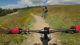
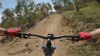
Loop 2 is one of the shorter loops climbing, traversing and taking you to access points to most of Stromlo Forest Park. The trail uses the main trunk trail network to climb gently to the top of Mt Stromlo, before a long, flowing descent back to the car park area. Riders are rewarded with expansive 360 degree views of the ACT from the summit and a descent that will leave you smiling for days. This trail requires a degree of fitness and skill level as there are a number of challenging climbs and obstacles.
We hope you've been enjoying Trailforks!
Create a FREE account to view route comments and much more.
| 1,870 ft | |||||
| 2,083 ft | |||||
| 1,247 ft | |||||
| 1,549 ft | |||||
| 1,296 ft | |||||
| 1,496 ft | |||||
| 3,133 ft | |||||
| 1,086 ft | |||||
| 1,266 ft | |||||
| 942 ft | |||||
| 1,877 ft | |||||
| 1,457 ft | |||||
| 5,249 ft | |||||
| 2 miles | |||||
| 1 mile |

Service Road Atlas is a free to use, community-driven service for viewing and creating reports on the numerous back-country service roads around B.C. and Alberta.
Save the current map location and zoom level as your default home location whenever this page is loaded.
Save