
13.0 miles
Distance
1,154 ft
Climb
-1,171 ft
Descent
4,836 ft
High Point
-18 ft
Altitude change
4,056 ft
Altitude min
4,074 ft
Altitude start
4,055 ft
Altitude end
-15.7%
Grade max
22.9%
Grade min
6 miles
Distance climb
6 miles
Distance down
1 mile
Distance flat

8/17/22 Tylers is closed from the bottom of Lone Wolf to Steve Larsen. This is a great loop to ride Lower Tylers.

Detailed Description
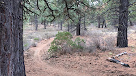
Lower Tylers loop is a 13 mile moderately popular intermediate route located near Bend Oregon. This mountain bike only route. This route includes 4 trails. This route climbs 1,154 ft with a max elevation of 4,836 ft then descends -1,171 ft.
Tags

Local Trail Association

Local trail association
Central Oregon Trail Alliance (cotamtb.com)
Please consider joining or donating to the local riding association to support trail development & maintenance.
Donate to earn trail karma!

Trail Products

Stats

  • Distance
    13 miles
  • Avg time
    1 hr 54 min
  • Altitude min
    4,056 ft
  • Altitude start
    4,074 ft
  • Altitude end
    4,055 ft
  • Climb
    1,154 ft
  • Descent
    -1,171 ft
  • Grade max
    -15.7%
  • Grade min
    22.9%
  • Distance climb
    6 miles
  • Distance down
    6 miles
  • Distance flat
    1 mile

7 Reviews & Comments


We hope you've been enjoying Trailforks!

Create a FREE account to view all route reviews and much more.

Trails in Route

Details

  • Riding area
  • Primary Activity
    Mountain Bike
  • Difficulty rating
    Blue
  • Route Type
    Loop
  • eBike Allowed
  • Bike type
    AM
  • Activity Logs
    1

Directions

  1. Walk west on Catch and Release.
  2. Continue for 20 meters.
  3. Bear left onto Storm King Trail.
  4. Continue for 5 kilometers.
  5. Walk northeast on Storm King Trail.
  6. Continue for 300 meters.
  7. Turn left onto Lower Tiddlywinks.
  8. Continue for 400 meters.
  9. Walk west on Lower Tiddlywinks.
  10. Continue for 1 kilometer.
  11. Turn left onto Steve Larsen's.
  12. Continue for 300 meters.
  13. Walk east on Steve Larsen's.
  14. Continue for 4 kilometers.
  15. Walk southwest on Steve Larsen's.
  16. Continue for 400 meters.
  17. Bear left onto Tyler's Traverse.
  18. Continue for 500 meters.
  19. Walk northeast on Tyler's Traverse.
  20. Continue for 4 kilometers.
  21. Walk southeast on Tyler's Traverse.
  22. Continue for 800 meters.
  23. Turn left onto Catch and Release.
  24. Continue for 90 meters.
  25. Walk northwest on Catch and Release.
  26. Continue for 4 kilometers.
  27. Walk north on Catch and Release.
  28. Continue for 100 meters.
  29. Turn right to stay on Catch and Release.
  30. Continue for 60 meters.
  31. Keep right to take Storm King Access.
  32. Continue for 100 meters.
Avg: 1 (1 votes)
close
Trail transparency
  • Singletrack
  • Unpaved
mtb
116
mtb
98
mtb
94
mtb
113
Rock climb
mtb
Rock climb
0:14 | 729 | comments: 0 | favs:
Nov 25, 2016
Catch and Release fun

Recent Trail Reports Along Route

statustraildateconditiondescription
Steve Larsen's
Jul 12, 2026 @ 10:11am (America/Boise)
Jul 12, 2026
Catch and Release
Jul 12, 2026 @ 10:11am (America/Boise)
Jul 12, 2026
Storm King Access
Nov 16, 2025 @ 2:07pm (America/Boise)
Nov 16, 2025
more reports »
  • By alextrails9TF Pro COTA & contributors
  • #42194 - 900 views

Hit the Trail

Open in App

Get this route on your phone instantly.

Download Route

Save to wishlist, Garmin & download.