8.3 miles
Distance
740 ft
Climb
-801 ft
Descent
465 ft
High Point
-60 ft
Altitude change
246 ft
Altitude min
307 ft
Altitude start
246 ft
Altitude end
-0.1%
Grade
-19.2%
Grade max
24.2%
Grade min
4 miles
Distance climb
4 miles
Distance down
1 mile
Distance flat

Lystie loop avoiding initial climb

Detailed Description
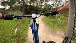
Lystie loop is a 8 mile popular intermediate route located near Lysterfield. This mountain bike only route. This route includes 9 trails. This route climbs 740 ft with a max elevation of 465 ft then descends -801 ft.
Tags
Berms

Local Trail Association

Local trail association
Lysterfield District Trail Riders (www.LysterfieldMTB.com)
Please consider joining or donating to the local riding association to support trail development & maintenance.
Donate to earn trail karma!

Stats

  • Distance
    8 miles
  • Avg time
    1 hr 16 min
  • Altitude change
    -60 ft
  • Altitude min
    246 ft
  • Altitude start
    307 ft
  • Altitude end
    246 ft
  • Climb
    740 ft
  • Descent
    -801 ft
  • Grade
    -0.1%
  • Grade max
    -19.2%
  • Grade min
    24.2%
  • Distance climb
    4 miles
  • Distance down
    4 miles
  • Distance flat
    1 mile

15 Reviews & Comments


We hope you've been enjoying Trailforks!

Create a FREE account to view all route reviews and much more.

Trails in Route

Short Cut Track167 ft
Powells Track5,141 ft
Dog Pound978 ft
Middle1 mile
Redgum2,943 ft
Hug1 mile
Upper Blair Witch1 mile
Snipe1,266 ft

Details

  • Riding area
  • Primary Activity
    Mountain Bike
  • Difficulty rating
    Blue
  • Bike type
    DH, AM, XC, Trials
  • Activity Logs
    93
no votes yet
close
Trail transparency
  • Singletrack
  • Unpaved
Snipe Track @ Lysterfield MTB
mtb
Snipe Track @ Lysterfield MTB
trail: Snipe
0:25 | 1400 | comments: 0 | favs:
Dec 7, 2020
youtuber Lysterfield MTB Park – Snipe Trail Build [Day 1]
mtb
Lysterfield MTB Park – Snipe Trail Build [Day 1]
trail: Snipe
4:59 | 509 | comments: 0 | favs:
Jul 4, 2020

Recent Trail Reports Along Route

statustraildateconditiondescription
Upper Blair Witch
Nov 12, 2026 @ 12:14pm (Australia/Melbourne)
Nov 11, 2026
Snipe
Nov 12, 2026 @ 12:14pm (Australia/Melbourne)
Nov 11, 2026
Hug
Nov 12, 2026 @ 12:14pm (Australia/Melbourne)
Nov 11, 2026
Redgum
Oct 21, 2026 @ 10:24am (Australia/Melbourne)
Oct 20, 2026
Middle
Oct 21, 2026 @ 10:24am (Australia/Melbourne)
Oct 20, 2026
The new trail work on the downhill section are great 👍🏻
more reports »
  • By SolarflexTF Pro & contributors
  • #58899 - 571 views

Hit the Trail

Open in App

Get this route on your phone instantly.

Download Route

Save to wishlist, Garmin & download.