3.3 miles
Distance
439 ft
Climb
-427 ft
Descent
344 ft
High Point
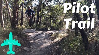
Loop ride using green and blue trails on lower part of Melville, including What Track, Stonemasons and Off Camber. Start at grass carpark (Lions Park) on Serpentine Road and head up granite. Slippery when wet.
Detailed Description
Melville Loop is a 3 mile moderately popular intermediate route located near Albany. This mountain bike primary route can be used one direction and has a moderate overall physical rating. This route includes 17 trails. This route climbs 439 ft with a max elevation of 344 ft then descends -427 ft.
Local Trail Association
Please consider joining or donating to the local riding association to support trail development & maintenance.
donate to earn trail karma!
5 Reviews & Comments
-
+ 0
Brake
(Dec 25, 2020 at 22:16)

Trail Pilot Trail
Riding well. Dry but coping with it well. A bit cut up through the tight berms.
[Reply]

Trail Pilot Trail
Really awesome trail. Lots of rocks and loose stuff.
[Reply]
Trails in Route
253 ft | |||||
538 ft | |||||
1,086 ft | |||||
4,977 ft | |||||
276 ft | |||||
984 ft | |||||
1,699 ft | |||||
2,362 ft | |||||
246 ft | |||||
1,227 ft | |||||
840 ft | |||||
702 ft | |||||
761 ft | |||||
341 ft | |||||
1,896 ft | |||||
1,076 ft | |||||
4,659 ft |
Details
-
Riding area
-
Primary ActivityMountain Bike
-
Other Activities
- E-Bike
-
Difficulty ratingBlue
-
Route TypeLoop
-
eBike Allowed
-
Bike typeAM, XC
-
DirectionOne Direction
-
Physical ratingModerate
More Stats for Melville Loop mountain bike route
-
Altitude min157 ft
-
Altitude start207 ft
-
Altitude end220 ft
-
Grade0.1%
-
Grade max-28.7%
-
Grade min27.2%
-
Distance climb1 mile
-
Distance down2 miles
-
Distance flat1,906 ft
close
Trail Conditions
- Unknown
- Snow Groomed
- Snow Packed
- Snow Covered
- Snow Cover Inadequate
- Freeze/thaw Cycle
- Icy
- Prevalent Mud
- Wet
- Variable
- Ideal
- Dry
- Very Dry
Trail Flow (Ridden Direction)
Trailforks scans users ridelogs to determine the most popular direction each trail is ridden. A good flowing trail network will have most trails flowing in a single direction according to their intension.
The colour categories are based on what percentage of riders are riding a trail in its intended direction.
- > 96%
- > 90%
- > 80%
- > 70%
- > 50%
- < 50%
- bi-directional trail
- no data
Trail Last Ridden
Trailforks scans ridelogs to determine the last time a trail was ridden.
- < 2 days
- < 1 week
- < 2 weeks
- < 1 month
- < 6 months
- > 6 months
Trail Ridden Direction
The intended direction a trail should be ridden.
- Downhill Only
- Downhill Primary
- Both Directions
- Uphill Primary
- Uphill Only
- One Direction
Contribute Details
Colors indicate trail is missing specified detail.
- Description
- Photos
- Description & Photos
- Videos
Trail Popularity ?
Trailforks scans ridelogs to determine which trails are ridden the most in the last 9 months.
Trails are compared with nearby trails in the same city region with a possible 25 colour shades.
Think of this as a heatmap, more rides = more kinetic energy = warmer colors.
- most popular
- popular
- less popular
- not popular
ATV/ORV/OHV Filter
Max Vehicle Width
inches
Radar Time
x
Activity Recordings
Trailforks users anonymized public ridelogs from the past 6 months.
- mountain biking recent
- mountain biking (>6 month)
- hiking (1 year)
- moto (1 year)
Activity Recordings
Trailforks users anonymized public skilogs from the past 12 months.
- Downhill Ski
- Backcountry Ski
- Nordic Ski
Jump Magnitude Heatmap
Heatmap of where riders jump on trails. Zoom in to see individual jumps, click circles to view jump details.
Trails Deemphasized
Trails are shown in grey.
Only show trails with NO bikes.
Save the current map location and zoom level as your default home location whenever this page is loaded.
Save
Trail transparency
Photos
Videos

THIS TRAIL IS SO MUCH BETTER! | Pilot Trail | Albany, Western Australia
trail: Pilot Trail
2:43 | 381 | comments: 0 | favs:
Jul 19, 2020
Recent Trail Reports Along Route
more reports »
- By Mossy77 & contributors
- #16600 - 476 views
- login to download gpx or kml files.