MooseDuro 2021 Race Course
Long Course will race Stages 1, 2, 3, and 4
Short Course will race Stages 2, 3, and 4 ONLY.
Stage 1: Upper Family Guy to Toothless, Includes a small climb. The Toothless "Steeps" will not be in the race.
Stage 2: Ushoulda, ends at Elbow Valley
Stage 3: SECRET Stage, to be announced the morning of Mooseduro, it will be a blue level trail.
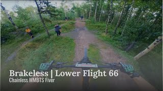
Stage 4: Brakeless
Trail Issues on Route
- Minor Issue / Yellow: 1 trail (newest: Aug 6, 2025)
Route Supporters
Local Trail Association
Moose Mountain Bike Trail Society (www.mmbts.com)Stats
-
Distance13 miles
-
Avg time2 hr 9 min
-
Altitude change15 ft
-
Altitude min4,818 ft
-
Altitude start4,828 ft
-
Altitude end4,843 ft
-
Climb2,953 ft
-
Descent-2,937 ft
-
Grade max-68.2%
-
Grade min75.2%
-
Distance climb7 miles
-
Distance down6 miles
-
Distance flat2,861 ft
24 Reviews & Comments
We hope you've been enjoying Trailforks!
Create a FREE account to view route comments and much more.
Route Sections
| 1 | Stage 1: Upper Family Guy to Toothless |
| 2 | Stage 2: Ushoulda (ends at Elbow Valley) |
| 3 | Stage 4: Brakeless |
Trails in Route
| 4 miles | |||||
| 4,295 ft | |||||
| 1 mile | |||||
| 1,421 ft | |||||
Route POI
| Aid Station | Aid Station | |
| Bike Mechanics | Mechanical Station | |
| Water | Water Fountain/Source |
Details
-
Race Course
-
Riding area
-
Primary ActivityMountain Bike
-
Other Activities
- E-Bike
-
Difficulty ratingBlue
-
eBike Allowed
-
Ridelogs
Directions
- Bike northwest on Moose Mountain Road.
- Continue for 700 meters.
- Bike west on Moose Mountain Road.
- Continue for 600 meters.
- Bike northwest on Moose Mountain Road.
- Continue for 1 kilometer.
- Bike north on Moose Mountain Road.
- Continue for 1 kilometer.
- Bike north on Moose Mountain Road.
- Continue for 1 kilometer.
- Bike northwest on Moose Mountain Road.
- Continue for 1.5 kilometers.
- Bike southeast on Moose Mountain Road.
- Continue for 40 meters.
- Keep right to take Family Guy.
- Continue for 500 meters.
- Bike southeast on Family Guy.
- Continue for 200 meters.
- Bike south on Family Guy.
- Continue for 400 meters.
- Bike southeast on Toothless.
- Continue for 400 meters.
- Bike southwest on Toothless.
- Continue for 300 meters.
- Bike south on Toothless.
- Continue for 200 meters.
- Bike northwest on Toothless.
- Continue for 400 meters.
- Turn left onto Ing's Mine Road.
- Continue for 50 meters.
- Bike southeast on Ing's Mine Road.
- Continue for 1 kilometer.
- Bike south on Ing's Mine Road.
- Continue for 700 meters.
- Bike south on Ing's Mine Road.
- Continue for 600 meters.
- Bike south on Ing's Mine Road.
- Continue for 500 meters.
- Bike southeast on Ing's Mine Road.
- Continue for 400 meters.
- Bike north on Ing's Mine Road.
- Continue for 100 meters.
- Make a sharp left onto Elbow Valley.
- Continue for less than 10 meters.
- Turn right to stay on Elbow Valley.
- Continue for 300 meters.
- Bear right onto Prairie Mountain Shoulder Road.
- Continue for 300 meters.
- Bike northwest on Prairie Mountain Shoulder Road.
- Continue for 900 meters.
- Bike northwest on Prairie Mountain Shoulder Road.
- Continue for 500 meters.
- Bike north on Prairie Mountain Shoulder Road.
- Continue for 600 meters.
- Bike east on Prairie Mountain Shoulder Road.
- Continue for 30 meters.
- Turn right onto Ushoulda.
- Continue for 600 meters.
- Bike southeast on Ushoulda.
- Continue for 500 meters.
- Bike southeast on Ushoulda.
- Continue for 300 meters.
- Bike south on Ushoulda.
- Continue for 300 meters.
- Bike southeast on Ushoulda.
- Continue for 200 meters.
- Bike southeast on Elbow Valley.
- Continue for 100 meters.
- Bike east on Elbow Valley.
- Continue for 400 meters.
- Bike southeast on Elbow Valley.
- Continue for 100 meters.
- Bear left to stay on Elbow Valley.
- Continue for 400 meters.
- Bike east on Elbow Valley.
- Continue for 400 meters.
- Bike southeast on Elbow Valley.
- Continue for 300 meters.
- Bike east on Elbow Valley.
- Continue for 100 meters.
- Turn left onto Sulphur Springs.
- Continue for 300 meters.
- Bike northwest on Sulphur Springs.
- Continue for 400 meters.
- Bike north on Ninja Cow.
- Continue for 200 meters.
- Bike northeast on Ninja Cow.
- Continue for 200 meters.
- Turn right onto Moose Mountain Road.
- Continue for 50 meters.
- Turn right onto Brakeless.
- Continue for 200 meters.
- Bike east on Brakeless.
- Continue for 500 meters.
- Bike east on Brakeless.
- Continue for 1 kilometer.
- Bike south on Brakeless.
- Continue for 100 meters.
- Unknown
- Snow Groomed
- Snow Packed
- Snow Covered
- Snow Cover Partial
- Freeze/thaw Cycle
- Icy
- Prevalent Mud
- Wet
- Variable
- Ideal
- Dry
- Very Dry
The colour categories are based on what percentage of riders are riding a trail in its intended direction.
- > 96%
- > 90%
- > 80%
- > 70%
- > 50%
- < 50%
- bi-directional trail
- no data
- < 2 days
- < 1 week
- < 2 weeks
- < 1 month
- < 6 months
- > 6 months
- Downhill Only
- Downhill Primary
- Both Directions
- Uphill Primary
- Uphill Only
- One Direction
- Description
- Photos
- Description & Photos
- Videos
- most popular
- popular
- less popular
- not popular
Service Road Atlas is a free to use, community-driven service for viewing and creating reports on the numerous back-country service roads around B.C. and Alberta.
Save the current map location and zoom level as your default home location whenever this page is loaded.
Save- Singletrack
- Unpaved
Photos
Videos
Recent Trail Reports Along Route
- By MooseMountain
MMBTS & contributors - #31887 - 2,371 views

