

Open in App
Get this route on your phone instantly.
The Mount York loop is a series of heritage roads down from Mount Victoria to Hartley Vale. There are three trails down from Mount Victoria, and all are both directions but the direction shown in this route is the most fun down and the least punish up.
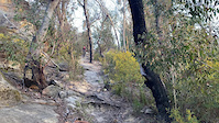
Parking on Mount York Road, first join Powerlines which is a cruisy singletrack climb to the top of Lockyer's Track. White knuckle it down, but make sure you stop at the lookouts for stunning views to the west of the Great Dividing Range. After this pass through the Hartley Valley Campground and the Hartley Vale Singletrack which bypasses riding on the road. Sadly, the pub in town is closed. After riding through town, Lawsons Long Alley starts with a flat gravel road before peeling off into a singletrack climb. There's some technical wooden sections through a swamp and at least one section of big chunky rocks but you'll only have to push up about 100m or so before you finish the loop back at the carpark.
Despite not being designed for mountain bikes, this loop is great fun and well worth the stopover. Its proper singletrack, not firetrail. Make sure you watch out for hikers
Not suitable for adaptive bikes-there's a few too many off camber sections downhill and the climb up isn't doable without getting off the bike.

We hope you've been enjoying Trailforks!
Create a FREE account to view all route reviews and much more.
| 3 miles | |||||
| 1,732 ft | |||||

Service Road Atlas is a free to use, community-driven service for viewing and creating reports on the numerous back-country service roads around B.C. and Alberta.
Save the current map location and zoom level as your default home location whenever this page is loaded.
Save & contributors