

25.3 miles
Distance
5,728 ft
Climb
-5,674 ft
Descent
1 mile
High Point
52 ft
Altitude change
1,133 ft
Altitude min
1,164 ft
Altitude start
1,217 ft
Altitude end
-80.8%
Grade max
67.1%
Grade min
14 miles
Distance climb
11 miles
Distance down
5,043 ft
Distance flat

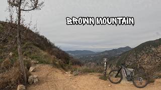
Mt wilson mega ride. load up the camelback, this is an all day event.

Detailed Description
Mt. Wilson Mega is a 25 mile popular extreme route located near Altadena California. This mountain bike only route. This route includes 31 trails. This route climbs 5,728 ft with a max elevation of 5,394 ft then descends -5,674 ft.
Tags

Trail Issues on Route

  • Closed: 2 trails (newest: Jul 2, 2026)
  • Minor Issue / Yellow: 6 trails (newest: Oct 30, 2026)

Local Trail Association

Local trail association
Mount Wilson Bicycling Association (mwba.org)
Please consider joining or donating to the local riding association to support trail development & maintenance.
Donate to earn trail karma!

Stats

  • Distance
    25 miles
  • Avg time
    6 hr 27 min
  • Altitude min
    1,133 ft
  • Altitude start
    1,164 ft
  • Altitude end
    1,217 ft
  • Climb
    1 mile
  • Descent
    -5,674 ft
  • Grade max
    -80.8%
  • Grade min
    67.1%
  • Distance climb
    14 miles
  • Distance down
    11 miles
  • Distance flat
    5,043 ft

69 Reviews & Comments

dantepetri1
Highly recommend. Trail bike with solid trail tires should be great. This descent should be in the top 10 list for the west coast imo
BigMeech
Great ride. I did it all except for Chutes on an XC bike. Chutes is a legit double-black trail. The middle two trails: Middle Sam Merrill and Sunset Ridge are riding best now, and were empty. El Prieto is a bit blown out and there were a bunch of hikers. (11/26/2021)

We hope you've been enjoying Trailforks!

Create a FREE account to view all route reviews and much more.

Details

  • Riding area
  • Primary Activity
    Mountain Bike
  • Difficulty rating
    Double Black Diamond
  • Route Type
    Loop
  • Bike type
    AM
  • Activity Logs
    5
Avg: 5 (1 votes)
close
Trail transparency
  • Singletrack
  • Unpaved
  • Paved
Sunset ridge trail | black diamond | Altadena
mtb
Sunset ridge trail | black diamond | Altadena
9:29 | 5 | comments: 0 | favs:
Nov 11, 2026
I Came for El Prieto, But Sunset Ridge Stole...
mtb
I Came for El Prieto, But Sunset Ridge Stole the Show
15:27 | 9 | comments: 0 | favs:
Nov 7, 2026

Recent Trail Reports Along Route

statustraildateconditiondescription
Sunset Ridge
Nov 11, 2026 @ 9:06pm (America/Los_Angeles)
2 days
It’s so beautiful, hero dirt all round it’s most probably in the best condition it’s ever been . I also posted a video about it on YouTube
Sam Merrill (Upper)
Nov 11, 2026 @ 9:04pm (America/Los_Angeles)
2 days
Everything’s rideable , nothing crazy but just not anything fun tbh
Lower Sunset Ridge
Nov 10, 2026 @ 10:07am (America/Los_Angeles)
Nov 10, 2026
Recently brushed back! Running fast and flowy. A+ conditions
Brown Mountain Road
Oct 30, 2026 @ 4:10pm (America/Los_Angeles)
Oct 30, 2026
Poodle dog bush is mostly all dead now. Clear ride to Ken Burton.
Mt Lowe Railroad (Inspiration Point)
Oct 17, 2026 @ 2:05pm (America/Los_Angeles)
Oct 17, 2026
Tree Down 0.6 miles below Mt Lowe Trail Camp. Only blocking half the road. Wasn't down a few weeks ago. Plenty room to get around without slowing down.
more reports »
  • By collinellis198 & contributors
  • #25121 - 1,858 views

Hit the Trail

Open in App

Get this route on your phone instantly.

Download Route

Save to wishlist, Garmin & download.