

3.8 miles
Distance
742 ft
Climb
-1,074 ft
Descent
1,666 ft
High Point
-332 ft
Altitude change
991 ft
Altitude min
1,418 ft
Altitude start
1,086 ft
Altitude end
-1.7%
Grade
-49.9%
Grade max
33.3%
Grade min
2 miles
Distance climb
1 mile
Distance down
1,079 ft
Distance flat

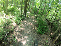
This is my favorite ride / loop in the park. The two main descents (Whole Shebang and Fall Line) are two of the rowdier descents in the parl. It is highly recommended that you're on a trail bike with a more aggressive geo than cross country geo.

The ride starts from the Deer trail parking area and goes up to the ranger station then to the top of wild turkey. Follow the ridge until you come across the entrance to the Whole Shebang. Follow this trail (marked with orange ribbon) till you hit rhododendron at the bottom. Follow rhododendron about 3 hundred yards too the parking lot and ascend the main access road in the park to the top. At the top, hang a left onto red fox and about 100 yards in, hang a left onto fall line trail. Fall line is steeeeeep, rocky, and has the largest drop in the park (8 ft, go around riders right). Fall line ends on deer trail (access road). Follow the river downstream until you reach the asphalt access road and ascend the hill too the deer trail parking area.

Detailed Description
Nate's Loop is a 4 mile moderately popular extreme route located near Grafton West Virginia. This mountain bike only route and has a hard overall physical rating. This route includes 9 trails. This route climbs 742 ft with a max elevation of 1,666 ft then descends -1,074 ft.
Tags

Trail Issues on Route

  • Minor Issue / Yellow: 2 trails (newest: Jun 25, 2026)

Local Trail Association

Please consider joining or donating to the local riding association to support trail development & maintenance.
Donate to earn trail karma!

Stats

  • Distance
    4 miles
  • Avg time
    1 hr 28 min
  • Altitude min
    991 ft
  • Altitude start
    1,418 ft
  • Altitude end
    1,086 ft
  • Climb
    742 ft
  • Descent
    -1,074 ft
  • Grade
    -1.7%
  • Grade max
    -49.9%
  • Grade min
    33.3%
  • Distance climb
    2 miles
  • Distance down
    1 mile
  • Distance flat
    1,079 ft

8 Reviews & Comments


We hope you've been enjoying Trailforks!

Create a FREE account to view all route reviews and much more.

Trails in Route

Details

  • Riding area
  • Primary Activity
    Mountain Bike
  • Difficulty rating
    Double Black Diamond
  • Route Type
    Loop
  • Bike type
    AM, XC
  • Physical rating
    Hard
no votes yet
close
Trail transparency
  • Singletrack
mtb
117
mtb
111
mtb
93
mtb
89
Copperhead Trail
mtb
Copperhead Trail
2:39 | 100 | comments: 0 | favs:
Jun 25, 2022
Valley Falls: Find The Line
mtb
Valley Falls: Find The Line
4:13 | 278 | comments: 0 | favs:
Jan 14, 2022

Recent Trail Reports Along Route

statustraildateconditiondescription
Dogwood
Jun 25, 2026 @ 10:14am (America/Detroit)
Jun 25, 2026
Several large trees down
Fall Line Trail
Jun 25, 2026 @ 10:14am (America/Detroit)
Jun 25, 2026
Few down trees towards the end
Access Rd
Jun 25, 2026 @ 10:14am (America/Detroit)
Jun 25, 2026
Good
Deer Trail
Apr 12, 2026 @ 11:22am (America/Detroit)
Apr 12, 2026
A few mud spots here and there but wasn’t terrible.
Copperhead Trail
Mar 14, 2026 @ 7:13pm (America/New_York)
Mar 14, 2026
Freshly leaf blown and all down trees cleared.
more reports »
  • By sharpiemtbTF Pro & contributors
  • #4957 - 1,284 views

Hit the Trail

Open in App

Get this route on your phone instantly.

Download Route

Save to wishlist, Garmin & download.
