

45.8 miles
Distance
5,526 ft
Climb
-5,508 ft
Descent
1,170 ft
High Point
17 ft
Altitude change
496 ft
Altitude min
549 ft
Altitude start
564 ft
Altitude end
-80.3%
Grade max
49.8%
Grade min
18 miles
Distance climb
17 miles
Distance down
10 miles
Distance flat

Brain Storming for most challenging course possible at Oak Mountain

Detailed Description
Oak Ass Plus is a 46 mile popular intermediate route located near Pelham Alabama. This mountain bike only route can be used one direction and has a extreme overall physical rating. This route includes 20 trails. This route climbs 5,526 ft with a max elevation of 1,170 ft then descends -5,508 ft.
Tags

Trail Issues on Route

  • Significant Issue / Amber: 3 trails (newest: Oct 4, 2026)
  • Minor Issue / Yellow: 2 trails (newest: Jul 24, 2026)

Local Trail Association

Local trail association
Birmingham Urban Mountain Pedalers (bump.org)
Please consider joining or donating to the local riding association to support trail development & maintenance.
Donate to earn trail karma!

Stats

  • Distance
    46 miles
  • Avg time
    5 hr 43 min
  • Altitude min
    496 ft
  • Altitude start
    549 ft
  • Altitude end
    564 ft
  • Climb
    1 mile
  • Descent
    -5,508 ft
  • Grade max
    -80.3%
  • Grade min
    49.8%
  • Distance climb
    18 miles
  • Distance down
    17 miles
  • Distance flat
    10 miles

23 Reviews & Comments


We hope you've been enjoying Trailforks!

Create a FREE account to view all route reviews and much more.

Details

  • Riding area
  • Primary Activity
    Mountain Bike
  • Difficulty rating
    Blue
  • Route Type
    Loop
  • Bike type
    XC
  • Direction
    One Direction
  • Physical rating
    Extreme

Directions

  1. Walk southwest on Double Oak Lake Access Road.
  2. Continue for 400 meters.
  3. Turn left to stay on Double Oak Lake Access Road.
  4. Continue for 400 meters.
  5. Turn right onto Terrace Drive.
  6. Continue for 1 kilometer.
  7. Turn left onto Peavine Falls Road.
  8. Continue for 600 meters.
  9. Turn right onto Johnsons Mountain.
  10. Continue for 4 kilometers.
  11. Walk north on Mr Toads Snake to Fore Play.
  12. Continue for 600 meters.
  13. Turn left onto Rattlesnake Connector.
  14. Continue for 200 meters.
  15. Bear left onto Family Trail.
  16. Continue for 1 kilometer.
  17. Turn left onto Rattlesnake Ridge.
  18. Continue for 4 kilometers.
  19. Turn left onto Lake Trail.
  20. Continue for 500 meters.
  21. Bear right to stay on Lake Trail.
  22. Continue for 5 kilometers.
  23. Bear right onto Group Camp Road.
  24. Continue for 1 kilometer.
  25. Turn left onto Garrett's Gulch.
  26. Continue for 2 kilometers.
  27. Walk northeast on The Chimneys.
  28. Continue for 1.5 kilometers.
  29. Turn right onto Cat Dog Snake.
  30. Continue for 2 kilometers.
  31. Turn left onto Red Road.
  32. Continue for 80 meters.
  33. Walk southeast on Catfish Lake Overlook Rd.
  34. Continue for 50 meters.
  35. Walk southwest on Belcher Drive.
  36. Continue for 500 meters.
  37. Walk west on Belcher Drive.
  38. Continue for 500 meters.
  39. Walk southwest on Belcher Drive.
  40. Continue for 500 meters.
  41. Walk southwest on Belcher Drive.
  42. Continue for 400 meters.
  43. Walk south on Belcher Drive.
  44. Continue for 60 meters.
  45. Keep left to stay on Belcher Drive.
  46. Continue for 50 meters.
  47. Keep left to stay on Belcher Drive.
  48. Continue for 50 meters.
  49. Keep left to stay on Belcher Drive.
  50. Continue for 50 meters.
  51. Keep straight to stay on Belcher Drive.
  52. Continue for 60 meters.
  53. Keep straight to stay on Belcher Drive.
  54. Continue for 70 meters.
  55. Keep right to stay on Belcher Drive.
  56. Continue for 50 meters.
  57. Keep left to stay on Belcher Drive.
  58. Continue for 40 meters.
  59. Keep left to stay on Belcher Drive.
  60. Continue for 60 meters.
  61. Keep straight to stay on Belcher Drive.
  62. Continue for 80 meters.
  63. Keep straight to stay on Belcher Drive.
  64. Continue for 100 meters.
  65. Keep straight to stay on Belcher Drive.
  66. Continue for 70 meters.
  67. Keep right to stay on Belcher Drive.
  68. Continue for 60 meters.
  69. Walk east on Belcher Drive.
  70. Continue for 50 meters.
  71. Keep left to stay on Belcher Drive.
  72. Continue for 50 meters.
  73. Keep left to stay on Belcher Drive.
  74. Continue for 40 meters.
  75. Keep straight to stay on Belcher Drive.
  76. Continue for 50 meters.
  77. Keep straight to stay on Belcher Drive.
  78. Continue for 10 meters.
  79. Walk southwest on Belcher Forest Rd 1.
  80. Continue for 100 meters.
  81. Walk southwest on Belcher Forest Rd 1.
  82. Continue for 100 meters.
  83. Walk west on Overlook Access.
  84. Continue for 10 meters.
  85. Walk north on Belcher Drive.
  86. Continue for 70 meters.
  87. Keep straight to stay on Belcher Drive.
  88. Continue for 40 meters.
  89. Keep straight to stay on Belcher Drive.
  90. Continue for 40 meters.
  91. Keep left to stay on Belcher Drive.
  92. Continue for 30 meters.
  93. Walk north on Steep Road.
  94. Continue for 200 meters.
no votes yet
close
Trail transparency
  • Singletrack
  • Unpaved
Submission for Friday Fails
mtb
Submission for Friday Fails
0:07 | 1138 | comments: 1 | favs: 2
Jul 3, 2020
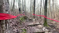
Xc race at oak Mtn. Alabama

Recent Trail Reports Along Route

statustraildateconditiondescription
Mr Toads Snake to Fore Play
Oct 4, 2026 @ 8:55am (America/Kentucky/Monticello)
Oct 4, 2026
Tree down on trail
Breezy
Aug 30, 2026 @ 1:09pm (America/Chicago)
Aug 30, 2026
Lunker Lake Trail
Aug 21, 2026 @ 4:11pm (America/Chicago)
Aug 21, 2026
Downed Evergreen tree reporter
Seven Bridges
Aug 12, 2026 @ 10:02am (America/Kentucky/Monticello)
Aug 12, 2026
Group Camp Road
Aug 7, 2026 @ 12:41pm (America/Los_Angeles)
Aug 7, 2026
All Clear
more reports »
  • By cdraper122TF Pro BUMP & contributors
  • #62646 - 389 views

Hit the Trail

Open in App

Get this route on your phone instantly.

Download Route

Save to wishlist, Garmin & download.
