

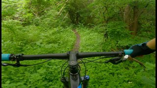
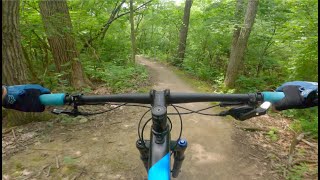
A clockwise route around the majority of Palos singletrack starting at Maple Lake East parking lot at Resurrection Trail and heading east towards the triangle via Burrito Hill and Stonehouse. After a challenging climb up Three Ravines, you'll ride down the "Zip Tie" portion of Campground to Turf. Take Turf north to the road and climb up the road back to the Campground crossing. This time you'll take Campground north to a downhill section people refer to as The Fun Way or Flowy McFlowface. Continue on Campground until it reaches Maple Lake. A quick climb up Grass Hill and a side trail to Half Acre will bring you back to the multi-track. Take the multi east toward the top of Bullwhip. Bullwhip to Hickory Smoked to Maple Lake East will bring you back to the Maple Lake East parking lot. Toss in a loop of Cemetery Hill if you feel like you need a few more miles.

Local Trail Association
Chicago Area Mountain Bikers (cambr.org)Stats
-
Distance15 miles
-
Altitude min605 ft
-
Altitude start707 ft
-
Altitude end712 ft
-
Climb1,240 ft
-
Descent-1,239 ft
-
Grade max-27.6%
-
Grade min23%
-
Distance climb6 miles
-
Distance down6 miles
-
Distance flat3 miles
27 Reviews & Comments
We hope you've been enjoying Trailforks!
Create a FREE account to view all route reviews and much more.
Trails in Route
| 2 miles | |||||
| 2,008 ft | |||||
| 4 miles | |||||
| 2,874 ft | |||||
| 4,613 ft | |||||
| 646 ft | |||||
| 2 miles | |||||
| 856 ft | |||||
| 4,826 ft | |||||
| 1,949 ft | |||||
| 1,919 ft |

Details
-
Riding area
-
Primary ActivityMountain Bike
-
Difficulty ratingBlue
-
Route TypeLoop
-
eBike Allowed
-
Bike typeXC
-
Physical ratingModerate
Directions
- Bike south on Resurrection (TAN).
- Continue for 2.5 kilometers.
- Bike southeast on Yellow Multitrack.
- Continue for 100 meters.
- Bike northeast on Yellow Multitrack.
- Continue for 200 meters.
- Turn right onto Burrito Hill (GREEN).
- Continue for 500 meters.
- Bike south on Burrito Hill (GREEN).
- Continue for 200 meters.
- Bear right onto Stonehouse (BLACK).
- Continue for 1 kilometer.
- Bike south on Stonehouse (BLACK).
- Continue for 90 meters.
- Turn right to stay on Stonehouse (BLACK).
- Continue for 700 meters.
- Turn left to stay on Stonehouse (BLACK).
- Continue for 1.5 kilometers.
- Bike north on Stonehouse (BLACK).
- Continue for 500 meters.
- Turn left to stay on Stonehouse (BLACK).
- Continue for 1.5 kilometers.
- Bike east on Stonehouse (BLACK).
- Continue for 700 meters.
- Turn left onto One Day (ORANGE).
- Continue for 900 meters.
- Bear left onto 3 Ravines (ORANGE).
- Continue for 100 meters.
- Bike west on 3 Ravines (ORANGE).
- Continue for 1.5 kilometers.
- Bike northeast on 3 Ravines (ORANGE).
- Continue for 50 meters.
- Bear right onto Dynamite Road (BLUE / ORANGE).
- Continue for 500 meters.
- Bear left onto Old Argonne Access Road.
- Continue for 100 meters.
- Bike northeast on Old Argonne Access Road.
- Continue for 50 meters.
- Turn left onto Campground Trail (YELLOW / BLUE).
- Continue for 200 meters.
- Bike northwest on Campground Trail (YELLOW / BLUE).
- Continue for 1.5 kilometers.
- Bike southwest on Campground Trail (YELLOW / BLUE).
- Continue for 300 meters.
- Bike northeast on TURF (ORANGE).
- Continue for 40 meters.
- Bike north on TURF (ORANGE).
- Continue for 1 kilometer.
- Turn right onto Old Argonne Access Road.
- Continue for 100 meters.
- Bike south on Old Argonne Access Road.
- Continue for 300 meters.
- Bike southeast on Campground Trail (YELLOW / BLUE).
- Continue for 80 meters.
- Bike east on Campground Trail (YELLOW / BLUE).
- Continue for 1 kilometer.
- Bike north on Campground Trail (YELLOW / BLUE).
- Continue for 1.5 kilometers.
- Bike southeast on Campground Trail (YELLOW / BLUE).
- Continue for 300 meters.
- Bike east on Campground Trail (YELLOW / BLUE).
- Continue for 600 meters.
- Bike southwest on Campground Trail (YELLOW / BLUE).
- Continue for 40 meters.
- Bike southeast on Campground Trail (YELLOW / BLUE).
- Continue for 80 meters.
- Bike east on Grass Hill (GREEN).
- Continue for 300 meters.
- Bike southwest on Grass Hill (GREEN).
- Continue for 200 meters.
- Turn right onto Half Acre.
- Continue for 300 meters.
- Bike east on Orange Multitrack.
- Continue for 300 meters.
- Bike north on Bullwhip (YELLOW).
- Continue for 800 meters.
- Bike northeast on Bullwhip (YELLOW).
- Continue for 800 meters.
- Bike east on Maple Lake Boating Center Parking.
- Continue for 100 meters.
- Bike northeast on Hickory Smoked (YELLOW).
- Continue for 200 meters.
- Bike northeast on Hickory Smoked (YELLOW).
- Continue for 1 kilometer.
- Unknown
- Snow Groomed
- Snow Packed
- Snow Covered
- Snow Cover Partial
- Freeze/thaw Cycle
- Icy
- Prevalent Mud
- Wet
- Variable
- Ideal
- Dry
- Very Dry
The colour categories are based on what percentage of users are riding a trail in its intended direction.
- > 96%
- > 90%
- > 80%
- > 70%
- > 50%
- < 50%
- bi-directional trail
- no data
- < 2 days
- < 1 week
- < 2 weeks
- < 1 month
- < 6 months
- > 6 months
- Downhill Only
- Downhill Primary
- Both Directions
- Uphill Primary
- Uphill Only
- One Direction
- Description
- Photos
- Description & Photos
- Videos
- most popular
- popular
- less popular
- not popular
Service Road Atlas is a free to use, community-driven service for viewing and creating reports on the numerous back-country service roads around B.C. and Alberta.
Save the current map location and zoom level as your default home location whenever this page is loaded.
Save- Singletrack
Photos
Videos
Recent Trail Reports Along Route
- By Jcoyoung
CAMBR CAMBR-JUMPS CAMBR-PFP & contributors - #57118 - 1,657 views
