1.4 miles
Distance
128 ft
Climb
-133 ft
Descent
892 ft
High Point
-5 ft
Altitude change
771 ft
Altitude min
892 ft
Altitude start
889 ft
Altitude end
-0.1%
Grade
-15%
Grade max
17.4%
Grade min
3,110 ft
Distance climb
2,897 ft
Distance down
1,348 ft
Distance flat

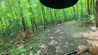
The Purple Loop begins at the top of Giro, descends into Foxtrot, and Rabbit Run and back out. Alternatively after completing Rabbit Run you can ride the entire Dump Road climb back to Giro.

Detailed Description
Purple Loop (Rabbit Run Loop) is a 1 mile popular intermediate route located near Sault Ste Marie Ontario. This mountain bike primary route can be used both directions. This route includes 37 trails. This route climbs 128 ft with a max elevation of 892 ft then descends -133 ft.

Trail Issues on Route

  • Minor Issue / Yellow: 1 trail (newest: Sep 17, 2021)
Local Trail Association
Local trail association
Sault Cycling Club (saultcyclingclub.ca)
Please consider joining or donating to the local riding association to support trail development & maintenance.
Donate to earn trail karma!

Stats

  • Distance
    1 mile
  • Avg time
    1 hr 22 min
  • Altitude min
    771 ft
  • Altitude start
    892 ft
  • Altitude end
    889 ft
  • Climb
    128 ft
  • Descent
    -133 ft
  • Grade
    -0.1%
  • Grade max
    -15%
  • Grade min
    17.4%
  • Distance climb
    3,110 ft
  • Distance down
    2,897 ft
  • Distance flat
    1,348 ft

Comments


We hope you've been enjoying Trailforks!

Create a FREE account to view route comments and much more.

Trails in Route

Wolf Tree1,024 ft
Penny Lane394 ft
Tricky Bit787 ft
Magic Forest1,102 ft
Big Bird1,572 ft
Sesame Street2,251 ft
Cattle Run1,352 ft
Korker748 ft
Foxtrot1,883 ft
Giro1 mile
Rabbit Run1,778 ft
Fish Bowl1,083 ft
Dump Road2,260 ft
Giro233 ft
Meadow469 ft
Easier1,424 ft
Jakalmon1,401 ft
Crystal4,183 ft
Sideline2,444 ft
Anymel3,881 ft
Connor Connector1,470 ft
Gunsmoke2,218 ft
Bermese2846 ft
Jedi587 ft
Guillotine1,096 ft
Rootn361 ft
Squishy384 ft
Rock'n456 ft
Roll'n564 ft
Inner Loop1,526 ft
Yoda702 ft
Wave266 ft
Flow1,663 ft
Ridge Run1,391 ft

Details

  • Riding area
  • Primary Activity
    Mountain Bike
  • Other Activities
    • Gravel Bike
  • AKA
    red pine, rabbit run, giro
  • Difficulty rating
    Blue
  • Route Type
    Out & Back
  • Bike type
    DH, AM, XC, DJ, Fat, CX, Gravel
  • Direction
    Both Directions
no votes yet
close
3D
Trail Conditions
  • Unknown
  • Snow Groomed
  • Snow Packed
  • Snow Covered
  • Snow Cover Partial
  • Freeze/thaw Cycle
  • Icy
  • Prevalent Mud
  • Wet
  • Variable
  • Ideal
  • Dry
  • Very Dry
Trail Flow (Ridden Direction)
Trailforks scans users ridelogs to determine the most popular direction each trail is ridden. A good flowing trail network will have most trails flowing in a single direction according to their intension.
The colour categories are based on what percentage of riders are riding a trail in its intended direction.
  • > 96%
  • > 90%
  • > 80%
  • > 70%
  • > 50%
  • < 50%
  • bi-directional trail
  • no data
Trail Last Ridden
Trailforks scans ridelogs to determine the last time a trail was ridden.
  • < 2 days
  • < 1 week
  • < 2 weeks
  • < 1 month
  • < 6 months
  • > 6 months
Trail Ridden Direction
The intended direction a trail should be ridden.
  • Downhill Only
  • Downhill Primary
  • Both Directions
  • Uphill Primary
  • Uphill Only
  • One Direction
Contribute Details
Colors indicate trail is missing specified detail.
  • Description
  • Photos
  • Description & Photos
  • Videos
Trail Popularity ?
Trailforks scans ridelogs to determine which trails are ridden the most in the last 9 months. Trails are compared with nearby trails in the same city region with a possible 25 colour shades. Think of this as a heatmap, more rides = more kinetic energy = warmer colors.
  • most popular
  • popular
  • less popular
  • not popular
ATV/ORV/OHV Filter
Max Vehicle Width
inches
US Cell Coverage
Legend
cell carrier legend

Radar Time
Activity Recordings
Trailforks uses anonymized public activity data. ?
Activity Recordings
Trailforks uses anonymized public activity data. ?
Personal Heatmap
Activity Types
all / none
Options
2
Date range month
Winter Trails
Warning A routing network for winter maps does not exist. Selecting trails using the winter trails layer has been disabled.
Missing Trails
Most Popular
Least Popular
Trails are colored based on popularity. The more popular a trail is, the more red. Less popular trails trend towards green.
Jump Magnitude Heatmap
Heatmap of where riders jump on trails. Zoom in to see individual jumps, click circles to view jump details.
BC Backroad Status

Service Road Atlas is a free to use, community-driven service for viewing and creating reports on the numerous back-country service roads around B.C. and Alberta.

map legend
Slope Aspect
Direction the slope faces
Flat N NE E SE S SW W NW
Trails Deemphasized
Trails are shown in grey.
disable
Only show trails with no bike usage.
Enable
Suggested Layers
Based on selected activity type

    Save the current map location and zoom level as your default home location whenever this page is loaded.

    Save
    Trail transparency
    • Singletrack
    • Unpaved
    27
    34
    25
    122
    Yoda
    Yoda
    trail: Yoda
    0:16 | 11 | comments: 0 | favs:
    Aug 16, 2025
    Short single track connector trail
    Flow - A season of mountain biking
    Flow - A season of mountain biking
    trail: Flow
    33:21 | 849 | comments: 2 | favs: 2
    Sep 16, 2008
    A season of riding at various locations in Canada and the USA.

    Recent Trail Reports Along Route

    statustraildateconditiondescription
    Tricky Bit
    May 21, 2026 @ 10:08am (America/Toronto)
    May 21, 2026
    reporter
    Wolf Tree
    May 21, 2026 @ 10:08am (America/Toronto)
    May 21, 2026
    reporter
    Sesame Street
    May 21, 2026 @ 10:08am (America/Toronto)
    May 21, 2026
    reporter
    Rabbit Run
    May 21, 2026 @ 10:08am (America/Toronto)
    May 21, 2026
    reporter
    Penny Lane
    May 21, 2026 @ 10:08am (America/Toronto)
    May 21, 2026
    reporter
    more reports »
    • By PaulmcdoTF Pro SSM & contributors
    • #24241 - 717 views

    Hit the Trail

    Open in App

    Get this route on your phone instantly.

    Download Route

    Save to wishlist, Garmin & download.