9.1 miles
Distance
1,552 ft
Climb
-1,531 ft
Descent
715 ft
High Point
21 ft
Altitude change
161 ft
Altitude min
161 ft
Altitude start
184 ft
Altitude end
-41.7%
Grade max
41%
Grade min
5 miles
Distance climb
4 miles
Distance down
4,544 ft
Distance flat

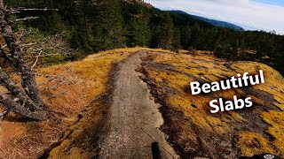
Here's a good Quadra loop for you TK.

Depending on the rider, "Deadfish" is a perfectly acceptable alternative to "Morning Beer" for the last leg of this great loop... BOTH trails are "fun", just different types of fun

Detailed Description
Quadra loop for TK is a 9 mile popular intermediate route located near Quadra Island British Columbia. This mountain bike only route. This route includes 23 trails. This route climbs 1,552 ft with a max elevation of 715 ft then descends -1,531 ft.

Trail Issues on Route

  • Significant Issue / Amber: 1 trail (newest: Aug 13, 2025)
  • Minor Issue / Yellow: 4 trails (newest: Aug 12, 2025)
Local Trail Association
Local trail association
Quadra Island Recreation Society
Please consider joining or donating to the local riding association to support trail development & maintenance.
Donate to earn trail karma!

Stats

  • Distance
    9 miles
  • Avg time
    1 hr 45 min
  • Altitude change
    21 ft
  • Altitude min
    161 ft
  • Altitude start
    161 ft
  • Altitude end
    184 ft
  • Climb
    1,552 ft
  • Descent
    -1,531 ft
  • Grade max
    -41.7%
  • Grade min
    41%
  • Distance climb
    5 miles
  • Distance down
    4 miles
  • Distance flat
    4,544 ft

27 Reviews & Comments


We hope you've been enjoying Trailforks!

Create a FREE account to view route comments and much more.

Details

Avg: 4.5 (2 votes)
close
3D
Trail Conditions
  • Unknown
  • Snow Groomed
  • Snow Packed
  • Snow Covered
  • Snow Cover Partial
  • Freeze/thaw Cycle
  • Icy
  • Prevalent Mud
  • Wet
  • Variable
  • Ideal
  • Dry
  • Very Dry
Trail Flow (Ridden Direction)
Trailforks scans users ridelogs to determine the most popular direction each trail is ridden. A good flowing trail network will have most trails flowing in a single direction according to their intension.
The colour categories are based on what percentage of riders are riding a trail in its intended direction.
  • > 96%
  • > 90%
  • > 80%
  • > 70%
  • > 50%
  • < 50%
  • bi-directional trail
  • no data
Trail Last Ridden
Trailforks scans ridelogs to determine the last time a trail was ridden.
  • < 2 days
  • < 1 week
  • < 2 weeks
  • < 1 month
  • < 6 months
  • > 6 months
Trail Ridden Direction
The intended direction a trail should be ridden.
  • Downhill Only
  • Downhill Primary
  • Both Directions
  • Uphill Primary
  • Uphill Only
  • One Direction
Contribute Details
Colors indicate trail is missing specified detail.
  • Description
  • Photos
  • Description & Photos
  • Videos
Trail Popularity ?
Trailforks scans ridelogs to determine which trails are ridden the most in the last 9 months. Trails are compared with nearby trails in the same city region with a possible 25 colour shades. Think of this as a heatmap, more rides = more kinetic energy = warmer colors.
  • most popular
  • popular
  • less popular
  • not popular
ATV/ORV/OHV Filter
Max Vehicle Width
inches
US Cell Coverage
Legend
cell carrier legend

Radar Time
Activity Recordings
Trailforks uses anonymized public activity data. ?
Activity Recordings
Trailforks uses anonymized public activity data. ?
Personal Heatmap
Activity Types
all / none
Options
2
Date range month
Winter Trails
Warning A routing network for winter maps does not exist. Selecting trails using the winter trails layer has been disabled.
Missing Trails
Most Popular
Least Popular
Trails are colored based on popularity. The more popular a trail is, the more red. Less popular trails trend towards green.
Jump Magnitude Heatmap
Heatmap of where riders jump on trails. Zoom in to see individual jumps, click circles to view jump details.
BC Backroad Status

Service Road Atlas is a free to use, community-driven service for viewing and creating reports on the numerous back-country service roads around B.C. and Alberta.

map legend
Slope Aspect
Direction the slope faces
Flat N NE E SE S SW W NW
Trails Deemphasized
Trails are shown in grey.
disable
Only show trails with no bike usage.
Enable
Suggested Layers
Based on selected activity type

    Save the current map location and zoom level as your default home location whenever this page is loaded.

    Save
    Trail transparency
    • Singletrack
    • Unpaved
    5
    34
    183
    439
    Silk Stockings // Quadra Island
    Silk Stockings // Quadra Island
    5:48 | 486 | comments: 0 | favs:
    Dec 22, 2021
    Morning Beer // Quadra island
    Morning Beer // Quadra island
    4:49 | 653 | comments: 0 | favs:
    Nov 17, 2021

    Recent Trail Reports Along Route

    statustraildateconditiondescription
    Rich Ride
    Jun 30, 2026 @ 1:57pm (America/Vancouver)
    Jun 30, 2026
    reporter
    Morning Beer
    Jun 3, 2026 @ 3:28pm (America/Vancouver)
    Jun 3, 2026
    Wasps about halfway down. Don’t stop.
    Ridge Trail
    May 22, 2026 @ 11:52am (America/Vancouver)
    May 22, 2026
    Multiple trees down halfway along need chainsaw
    Deadfish
    Feb 26, 2026 @ 12:36pm (America/Vancouver)
    Feb 26, 2026
    Windfalls removed. reporter
    Seven Sins
    Aug 17, 2025 @ 1:49pm
    Aug 17, 2025
    more reports »
    • By dpechterTF Pro & contributors
    • #7998 - 2,340 views

    Hit the Trail

    Open in App

    Get this route on your phone instantly.

    Download Route

    Save to wishlist, Garmin & download.