
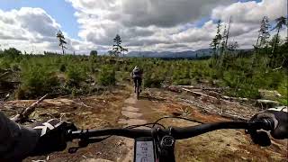
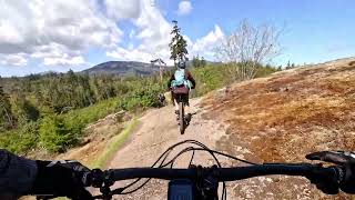
Route can be done both directions but better to do it clockwise. About 14 kms. Takes about 2 hours. A reasonable way to get from the lower trails to the upper trails at Ridge Runner. "The Great White" trail is a steady grunt up. Lots of open areas, Spanky and Bottle Drive are fun XC downs.
This route is Unsanctioned, Ride at your own Risk!
Trail Issues on Route
- Significant Issue / Amber: 1 trail (newest: May 1, 2024)
- Minor Issue / Yellow: 2 trails (newest: Sep 15, 2026)
Stats
-
Distance8 miles
-
Avg time1 hr 48 min
-
Altitude min635 ft
-
Altitude start635 ft
-
Altitude end636 ft
-
Climb855 ft
-
Descent-852 ft
-
Grade max-27.6%
-
Grade min46.8%
-
Distance climb3 miles
-
Distance down3 miles
-
Distance flat1 mile
11 Reviews & Comments
We hope you've been enjoying Trailforks!
Create a FREE account to view all route reviews and much more.
Trails in Route
| 505 ft | |||||
| 223 ft | |||||
| 1,198 ft | |||||
| 2,031 ft | |||||
| 197 ft | |||||
| 1,936 ft | |||||
| 3,202 ft | |||||
| 607 ft | |||||
| 2,116 ft | |||||
| 541 ft | |||||
| 344 ft | |||||
| 187 ft | |||||
| 2,890 ft | |||||
| 292 ft | |||||
| 577 ft | |||||
| 633 ft | |||||
| 4,393 ft | |||||
| 1,683 ft | |||||
| 958 ft | |||||
| 144 ft | |||||
| 4,432 ft | |||||
| 1,690 ft | |||||
| 2,306 ft | |||||
| 2,195 ft | |||||
| 118 ft | |||||
| 2,894 ft | |||||
| 377 ft | |||||
| 1,066 ft | |||||
| 1,913 ft | |||||
| 154 ft |
Details
-
Riding area
-
Primary ActivityMountain Bike
-
Other Activities
- E-Bike
- Hike
- Trail Running
-
Difficulty ratingBlue
-
Route TypeLoop
-
eBike Allowed
-
Bike typeXC
-
DirectionBoth Directions
-
Physical ratingModerate
-
Activity Logs
- Unknown
- Snow Groomed
- Snow Packed
- Snow Covered
- Snow Cover Partial
- Freeze/thaw Cycle
- Icy
- Prevalent Mud
- Wet
- Variable
- Ideal
- Dry
- Very Dry
The colour categories are based on what percentage of users are riding a trail in its intended direction.
- > 96%
- > 90%
- > 80%
- > 70%
- > 50%
- < 50%
- bi-directional trail
- no data
- < 2 days
- < 1 week
- < 2 weeks
- < 1 month
- < 6 months
- > 6 months
- Downhill Only
- Downhill Primary
- Both Directions
- Uphill Primary
- Uphill Only
- One Direction
- Description
- Photos
- Description & Photos
- Videos
- most popular
- popular
- less popular
- not popular
Service Road Atlas is a free to use, community-driven service for viewing and creating reports on the numerous back-country service roads around B.C. and Alberta.
Save the current map location and zoom level as your default home location whenever this page is loaded.
Save- Singletrack
- Unpaved
Photos
Videos
Recent Trail Reports Along Route
- By l-venables
NTB & contributors - #24093 - 1,168 views