

Open in App
Get this route on your phone instantly.
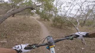
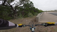
This is the official SATN Outer Loop route. It incorporates the outermost segments in the SATN for a complete riding experience. A little bit of everything here, folks It also includes the excellent new east side trails.

We hope you've been enjoying Trailforks!
Create a FREE account to view all route reviews and much more.
| 610 ft | |||||
| 4,026 ft | |||||
| 3,156 ft | |||||
| 2,877 ft | |||||
| 390 ft | |||||
| 3,921 ft | |||||
| 2,297 ft | |||||
| 2,221 ft | |||||
| 994 ft | |||||
| 1,745 ft | |||||
| 942 ft | |||||
| 430 ft | |||||
| 427 ft | |||||
| 1,276 ft | |||||
| 469 ft | |||||
| 446 ft | |||||
| 226 ft | |||||
| 5,223 ft | |||||
| 2 miles | |||||
| 2 miles | |||||
| 755 ft | |||||
| 3,219 ft | |||||
| 4,324 ft | |||||
| 574 ft | |||||
| 446 ft | |||||
| 1,995 ft | |||||
| 262 ft | |||||
| 1,880 ft | |||||
| 528 ft | |||||
| 2,835 ft | |||||
| 3,199 ft | |||||
| 3,671 ft | |||||
| 1,365 ft | |||||
| 2,503 ft | |||||
| 951 ft | |||||
| 518 ft | |||||
| 4,587 ft | |||||
| 3,077 ft | |||||
| 3,212 ft | |||||
| 1,601 ft | |||||
| 1,565 ft | |||||
| 1 mile | |||||
| 1 mile | |||||
| 2,146 ft | |||||
| 2 miles | |||||
| 2 miles | |||||
| 1,929 ft | |||||
| 1,512 ft | |||||
| 404 ft | |||||
| 1 mile | |||||
| 2,136 ft | |||||
| 794 ft | |||||
| 873 ft | |||||
| 2,848 ft | |||||
| 495 ft | |||||
| 4,774 ft | |||||
| 2,123 ft |

Service Road Atlas is a free to use, community-driven service for viewing and creating reports on the numerous back-country service roads around B.C. and Alberta.
Save the current map location and zoom level as your default home location whenever this page is loaded.
Save