


8.8 miles
Distance
1,069 ft
Climb
-1,761 ft
Descent
1,973 ft
High Point
-692 ft
Altitude change
758 ft
Altitude min
1,463 ft
Altitude start
771 ft
Altitude end
-1.5%
Grade
-40.2%
Grade max
28.3%
Grade min
3 miles
Distance climb
4 miles
Distance down
4,226 ft
Distance flat

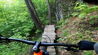
A shuttle route that starts on the edge of the valley and descends all the way back to the river. An easy climb up Swell Hill will drop you at the top of Ridgie, a mildly techy trail that descends along a ridge and features sections with multiple options. As you reach the bottom be on the lookout for Maple Twist, it will be on your right, which descends to Tucker Hill Rd. Make a right up and then down Enchanted Forest, which is a rocket of a descent through a magical (enchanted) Eastern Boreal forest that proves doubletrack can still be fun! Enchanted rolls into Dana Hill Rd (doubletrack), which quickly leads to Busternut and Goodnight Irene right back to Madbush Falls. This flowy downhill includes tons of berms, a few optional drops and a couple of optional logs and rock features hiding on the edges. You’ll flow all the way down across the “Butcher Block” bridge to Butternut Hill Rd. A flat, relaxing 2 minute dirt road pedal past a farm and across the Mad River takes you to Rt 100. Cross Rt 100 and look to your right (Bundy Rd) where you catch the quick singletrack descent to Madbush Falls.


Detailed Description
Shuttle Bump is a 9 mile popular intermediate route located near Warren Vermont. This mountain bike only route can be used one direction and has a moderate overall physical rating. This route includes 8 trails. This route climbs 1,069 ft with a max elevation of 1,973 ft then descends -1,761 ft.

Trail Issues on Route

  • Minor Issue / Yellow: 2 trails (newest: Sep 30, 2026)
Route Supporters

Local Trail Association

Local trail association
Mad River Trail Alliance (www.madriverriders.com)
Please consider joining or donating to the local riding association to support trail development & maintenance.
Donate to earn trail karma!

Stats

  • Distance
    9 miles
  • Avg time
    1 hr 53 min
  • Altitude change
    -692 ft
  • Altitude min
    758 ft
  • Altitude start
    1,463 ft
  • Altitude end
    771 ft
  • Climb
    1,069 ft
  • Descent
    -1,761 ft
  • Grade
    -1.5%
  • Grade max
    -40.2%
  • Grade min
    28.3%
  • Distance climb
    3 miles
  • Distance down
    4 miles
  • Distance flat
    4,226 ft

34 Reviews & Comments


We hope you've been enjoying Trailforks!

Create a FREE account to view all route reviews and much more.

Trails in Route

Details

  • Riding area
  • Primary Activity
    Mountain Bike
  • Difficulty rating
    Blue
  • Route Type
    Point to Point
  • Bike type
    AM, XC
  • Direction
    One Direction
  • Physical rating
    Moderate
no votes yet
close
Trail transparency
  • Singletrack
  • Unpaved
mtb
64
mtb
trail: Ridgie
120
mtb
trail: Swell Hill
71
mtb
trail: Swell Hill
49
Evolution – Mad River Valley
mtb
Evolution – Mad River Valley
trail: Evolution
9:08 | 333 | comments: 0 | favs:
Sep 25, 2025
The 2 State Shred | Sketchy Bridges And Fast...
mtb

Recent Trail Reports Along Route

statustraildateconditiondescription
Swell Hill
Oct 10, 2026 @ 1:51pm (America/New_York)
Oct 10, 2026
Goodnight Irene
Oct 10, 2026 @ 1:51pm (America/New_York)
Oct 10, 2026
Busternut
Sep 30, 2026 @ 2:02pm (America/New_York)
Sep 30, 2026
Large tree down across trail, blocking trail. Best access from Dana Hill.
Evolution
Sep 26, 2026 @ 9:08am (America/New_York)
Sep 26, 2026
Enchanted Forest
Sep 10, 2026 @ 5:29pm (America/New_York)
Sep 10, 2026
Please use reroute through the field during boardwalk construction.
more reports »
  • By MadBushFallsTF Pro & contributors
  • #56140 - 1,137 views

Hit the Trail

Open in App

Get this route on your phone instantly.

Download Route

Save to wishlist, Garmin & download.
