7.4 miles
Distance
656 ft
Climb
-651 ft
Descent
699 ft
High Point
3 ft
Altitude change
549 ft
Altitude min
586 ft
Altitude start
591 ft
Altitude end
-39.6%
Grade max
35.7%
Grade min
2 miles
Distance climb
2 miles
Distance down
3 miles
Distance flat

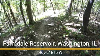
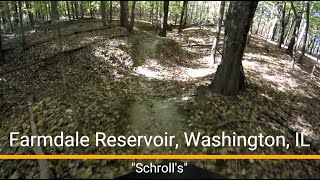
South Side Farmdale loop features all the best downhill trails, technical climbs, and no major creek crossings. Ideal for trail bike use.

NOTE: This loop includes the DH oriented trail Knock-Knock. If you are not comfortable with drops, jumps, steep descents, consider using Blue Chevy as an alternate route to the playground trails.

Detailed Description
South Side Loop is a 7 mile popular intermediate route located near East Peoria Illinois. This mountain bike only route can be used one direction and has a moderate overall physical rating. This route includes 13 trails. This route climbs 656 ft with a max elevation of 699 ft then descends -651 ft.

Trail Issues on Route

  • Minor Issue / Yellow: 1 trail (newest: Oct 20, 2025)
Local Trail Association
Local trail association
Peoria Area Mountain Bike Association (www.pambamtb.org)
Please consider joining or donating to the local riding association to support trail development & maintenance.
Donate to earn trail karma!

Stats

  • Distance
    7 miles
  • Avg time
    1 hr 13 min
  • Altitude min
    549 ft
  • Altitude start
    586 ft
  • Altitude end
    591 ft
  • Climb
    656 ft
  • Descent
    -651 ft
  • Grade max
    -39.6%
  • Grade min
    35.7%
  • Distance climb
    2 miles
  • Distance down
    2 miles
  • Distance flat
    3 miles

5 Reviews & Comments


We hope you've been enjoying Trailforks!

Create a FREE account to view route comments and much more.

Details

  • Riding area
  • Primary Activity
    Mountain Bike
  • Difficulty rating
    Blue
  • Route Type
    Loop
  • Bike type
    AM, XC
  • Direction
    One Direction
  • Physical rating
    Moderate
  • Ridelogs
    22
Avg: 4 (1 votes)
close
3D
Trail Conditions
  • Unknown
  • Snow Groomed
  • Snow Packed
  • Snow Covered
  • Snow Cover Partial
  • Freeze/thaw Cycle
  • Icy
  • Prevalent Mud
  • Wet
  • Variable
  • Ideal
  • Dry
  • Very Dry
Trail Flow (Ridden Direction)
Trailforks scans users ridelogs to determine the most popular direction each trail is ridden. A good flowing trail network will have most trails flowing in a single direction according to their intension.
The colour categories are based on what percentage of riders are riding a trail in its intended direction.
  • > 96%
  • > 90%
  • > 80%
  • > 70%
  • > 50%
  • < 50%
  • bi-directional trail
  • no data
Trail Last Ridden
Trailforks scans ridelogs to determine the last time a trail was ridden.
  • < 2 days
  • < 1 week
  • < 2 weeks
  • < 1 month
  • < 6 months
  • > 6 months
Trail Ridden Direction
The intended direction a trail should be ridden.
  • Downhill Only
  • Downhill Primary
  • Both Directions
  • Uphill Primary
  • Uphill Only
  • One Direction
Contribute Details
Colors indicate trail is missing specified detail.
  • Description
  • Photos
  • Description & Photos
  • Videos
Trail Popularity ?
Trailforks scans ridelogs to determine which trails are ridden the most in the last 9 months. Trails are compared with nearby trails in the same city region with a possible 25 colour shades. Think of this as a heatmap, more rides = more kinetic energy = warmer colors.
  • most popular
  • popular
  • less popular
  • not popular
ATV/ORV/OHV Filter
Max Vehicle Width
inches
US Cell Coverage
Legend
cell carrier legend

Radar Time
Activity Recordings
Trailforks uses anonymized public activity data. ?
Activity Recordings
Trailforks uses anonymized public activity data. ?
Personal Heatmap
Activity Types
all / none
Options
2
Date range month
Winter Trails
Warning A routing network for winter maps does not exist. Selecting trails using the winter trails layer has been disabled.
Missing Trails
Most Popular
Least Popular
Trails are colored based on popularity. The more popular a trail is, the more red. Less popular trails trend towards green.
Jump Magnitude Heatmap
Heatmap of where riders jump on trails. Zoom in to see individual jumps, click circles to view jump details.
BC Backroad Status

Service Road Atlas is a free to use, community-driven service for viewing and creating reports on the numerous back-country service roads around B.C. and Alberta.

map legend
Slope Aspect
Direction the slope faces
Flat N NE E SE S SW W NW
Trails Deemphasized
Trails are shown in grey.
disable
Only show trails with no bike usage.
Enable
Suggested Layers
Based on selected activity type

    Save the current map location and zoom level as your default home location whenever this page is loaded.

    Save
    Trail transparency
    • Singletrack
    • Unpaved
    73
    60
    47
    35
    Farmdale Reservoir MTB trail - 'Roy-L'
    Farmdale Reservoir MTB trail - "Roy-L"
    trail: Roy-L
    2:33 | 48 | comments: 0 | favs:
    Oct 22, 2025
    Farmdale Reservoir MTB trail - 'Schroll's'
    Farmdale Reservoir MTB trail - "Schroll's"
    trail: Schrolls
    15:34 | 72 | comments: 0 | favs:
    Oct 21, 2025

    Recent Trail Reports Along Route

    statustraildateconditiondescription
    Rosewood
    Jun 27, 2026 @ 3:37pm (America/Chicago)
    Jun 27, 2026
    Tree has been removed.
    Roy-L
    Jun 20, 2026 @ 12:48pm (America/Chicago)
    Jun 20, 2026
    Giant you ball blocking most of the trail
    Schrolls
    Jun 15, 2026 @ 6:27pm (America/Chicago)
    Jun 15, 2026
    Tree across the trail
    Lower Dam Trail
    Oct 20, 2025 @ 10:05am (America/Chicago)
    Oct 20, 2025
    Lower Fire Road
    Oct 20, 2025 @ 10:05am (America/Chicago)
    Oct 20, 2025
    more reports »
    • By whatajohnyTF Pro & contributors
    • #22144 - 1,075 views

    Hit the Trail

    Open in App

    Get this route on your phone instantly.

    Download Route

    Save to wishlist, Garmin & download.