4.1 miles
Distance
491 ft
Climb
-531 ft
Descent
3,399 ft
High Point
-42 ft
Altitude change
2,920 ft
Altitude min
2,962 ft
Altitude start
2,920 ft
Altitude end
-0.2%
Grade
-28.3%
Grade max
26.5%
Grade min
2 miles
Distance climb
2 miles
Distance down
2,116 ft
Distance flat

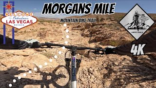
Nice warmup with TK heading up to the "spaghetti bowl", then up nice curves for a good climb to the flagpole. Enjoy the views bit and loop up top a few times, then the killer ride down Morgons mile!

Detailed Description
Steves Flagpole Loop is a 4 mile popular intermediate route located near Las Vegas Nevada. This mountain bike only route. This route includes 8 trails. This route climbs 491 ft with a max elevation of 3,399 ft then descends -531 ft.

Trail Issues on Route

  • Closed: 1 trail (newest: Nov 1, 2025)
  • Minor Issue / Yellow: 1 trail (newest: Jan 19, 2025)
Local Trail Association
Local trail association
Southern Nevada Mountain Biking Association (snmba.org)
Please consider joining or donating to the local riding association to support trail development & maintenance.
Donate to earn trail karma!

Stats

  • Distance
    4 miles
  • Avg time
    43 min 22 sec
  • Altitude change
    -42 ft
  • Altitude min
    2,920 ft
  • Altitude start
    2,962 ft
  • Altitude end
    2,920 ft
  • Climb
    491 ft
  • Descent
    -531 ft
  • Grade
    -0.2%
  • Grade max
    -28.3%
  • Grade min
    26.5%
  • Distance climb
    2 miles
  • Distance down
    2 miles
  • Distance flat
    2,116 ft

18 Reviews & Comments


We hope you've been enjoying Trailforks!

Create a FREE account to view route comments and much more.

Trails in Route

TK4,715 ft
Nice Curves1 mile
Flagpole3,159 ft
Flagpole Cutoff630 ft
Flagpole1,713 ft
Morgans Mile1 mile

Details

Avg: 4 (1 votes)
close
3D
Trail Conditions
  • Unknown
  • Snow Groomed
  • Snow Packed
  • Snow Covered
  • Snow Cover Partial
  • Freeze/thaw Cycle
  • Icy
  • Prevalent Mud
  • Wet
  • Variable
  • Ideal
  • Dry
  • Very Dry
Trail Flow (Ridden Direction)
Trailforks scans users ridelogs to determine the most popular direction each trail is ridden. A good flowing trail network will have most trails flowing in a single direction according to their intension.
The colour categories are based on what percentage of riders are riding a trail in its intended direction.
  • > 96%
  • > 90%
  • > 80%
  • > 70%
  • > 50%
  • < 50%
  • bi-directional trail
  • no data
Trail Last Ridden
Trailforks scans ridelogs to determine the last time a trail was ridden.
  • < 2 days
  • < 1 week
  • < 2 weeks
  • < 1 month
  • < 6 months
  • > 6 months
Trail Ridden Direction
The intended direction a trail should be ridden.
  • Downhill Only
  • Downhill Primary
  • Both Directions
  • Uphill Primary
  • Uphill Only
  • One Direction
Contribute Details
Colors indicate trail is missing specified detail.
  • Description
  • Photos
  • Description & Photos
  • Videos
Trail Popularity ?
Trailforks scans ridelogs to determine which trails are ridden the most in the last 9 months. Trails are compared with nearby trails in the same city region with a possible 25 colour shades. Think of this as a heatmap, more rides = more kinetic energy = warmer colors.
  • most popular
  • popular
  • less popular
  • not popular
ATV/ORV/OHV Filter
Max Vehicle Width
inches
US Cell Coverage
Legend
cell carrier legend

Radar Time
Activity Recordings
Trailforks uses anonymized public activity data. ?
Activity Recordings
Trailforks uses anonymized public activity data. ?
Personal Heatmap
Activity Types
all / none
Options
2
Date range month
Winter Trails
Warning A routing network for winter maps does not exist. Selecting trails using the winter trails layer has been disabled.
Missing Trails
Most Popular
Least Popular
Trails are colored based on popularity. The more popular a trail is, the more red. Less popular trails trend towards green.
Jump Magnitude Heatmap
Heatmap of where riders jump on trails. Zoom in to see individual jumps, click circles to view jump details.
BC Backroad Status

Service Road Atlas is a free to use, community-driven service for viewing and creating reports on the numerous back-country service roads around B.C. and Alberta.

map legend
Slope Aspect
Direction the slope faces
Flat N NE E SE S SW W NW
Trails Deemphasized
Trails are shown in grey.
disable
Only show trails with no bike usage.
Enable
Suggested Layers
Based on selected activity type

    Save the current map location and zoom level as your default home location whenever this page is loaded.

    Save
    Trail transparency
    • Singletrack
    26
    45
    28
    34
    Morgan’s Mile, Las Vegas Mountain Biking
    Morgan’s Mile, Las Vegas Mountain Biking
    4:22 | 83 | comments: 0 | favs:
    Apr 24, 2025
    Morgans Mile
    Morgans Mile
    6:01 | 186 | comments: 0 | favs:
    May 22, 2024

    Recent Trail Reports Along Route

    statustraildateconditiondescription
    Morgans Mile
    Jun 7, 2026 @ 5:31pm (America/Los_Angeles)
    Jun 7, 2026
    Flagpole
    May 27, 2026 @ 7:28pm (America/Los_Angeles)
    May 27, 2026
    Absolutely worth climbing up nice curves. Once you get to the top of nice curves, take a right to get the scenic downhill
    Nice Curves
    May 27, 2026 @ 7:27pm (America/Los_Angeles)
    May 27, 2026
    This should be black
    TK
    Nov 1, 2025 @ 7:03pm (America/Los_Angeles)
    Nov 1, 2025
    Flagpole Cutoff
    Jan 19, 2025 @ 3:37pm
    Jan 19, 2025
    more reports »
    • By Mano1192TF Pro & contributors
    • #18645 - 1,205 views

    Hit the Trail

    Open in App

    Get this route on your phone instantly.

    Download Route

    Save to wishlist, Garmin & download.