more stats
4,908 ft
Distance
148 ft
Climb
00:08:10
Avg time
148 ft
Altitude change
2,963 ft
Altitude min
3,111 ft
Altitude max
2,963 ft
Altitude start
3,110 ft
Altitude end
3%
Grade
-0.9%
Grade max
15%
Grade min
3,970 ft
Distance climb
72 ft
Distance down
866 ft
Distance flat
00:08:10
Avg time

TK Details

  • Activities
    • Mountain Bike
    • E-Bike
    • Winter Fat Bike
    • Hike
    • Trail Running
  • Riding Area
    Red Rock - Bear’s Best
    Las Vegas, Nevada
  • Difficulty Rating
  • Local Popularity
    90 in Mountain Biking [+]
    • 100 in E-Biking
    • 80 in Trail Running
    • 70 in Hiking
  • Global Ranking
    #37388 in Mountain Biking [+]
    • #4209 in E-Biking
    • #74081 in Trail Running
    • #74665 in Hiking
  • Blaze Color
  • Trail Type
    Singletrack
  • Bike Type
    AM, XC, Fat
  • Direction
    Both Directions
  • Climb Difficulty
    Green
  • Physical Rating
    Moderate
  • Dogs Allowed
    Yes
  • eBike Allowed
    Yes up to Class 1
  • Year Opened
    2018
  • Land Owner
    Illegal trail

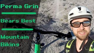
New trail that popped up, great easy alternative climb to riding benchmark to when you don't have the time, energy, or skill.. when riding to connecting trails... This also has great flow for riding fast downhill. Very few dangers to worry about.

Access Info

Nice curves (climb), Flagpole (climb), Benchmark (descent), Permagrin (descent), or Betty Boop

This trail is unsanctioned.

Trail Supporters
  • BLM
    BLM
    Land Manager

Recent Activity on Trail

Past Week
  • 0 rides
  •  
6 Months
  • 2 rides
  • 15 miles avg distance
All
  • 1,461 rides
  • Last: Feb 16, 2026
c1c2c3c4
January
February
March
April
May
June
July
August
September
October
November
December
update trails status or condition

TK Trail Reports

statusdatedescription
Nov 1, 2025 @ 7:03pm (America/Los_Angeles)
Nov 1, 2025
Oct 26, 2025 @ 9:04pm (America/Los_Angeles)
Oct 26, 2025
At this point the trail is completely gone due to construction. Looks like Benchmark is next..
Oct 22, 2025 @ 4:09pm (America/Los_Angeles)
Oct 22, 2025
Half of the trail is gone due to construction.
Jan 19, 2025 @ 3:37pm
Jan 19, 2025
Jul 13, 2024 @ 11:13pm
Jul 13, 2024
more »
Status:
on Nov 1, 2025
Dry
Avg: 4.29 (13 votes)
Your vote: 0

view (9,132)
close
3D
Trail Conditions
  • Unknown
  • Snow Groomed
  • Snow Packed
  • Snow Covered
  • Snow Cover Partial
  • Freeze/thaw Cycle
  • Icy
  • Prevalent Mud
  • Wet
  • Variable
  • Ideal
  • Dry
  • Very Dry
Trail Flow (Ridden Direction)
Trailforks scans users ridelogs to determine the most popular direction each trail is ridden. A good flowing trail network will have most trails flowing in a single direction according to their intension.
The colour categories are based on what percentage of riders are riding a trail in its intended direction.
  • > 96%
  • > 90%
  • > 80%
  • > 70%
  • > 50%
  • < 50%
  • bi-directional trail
  • no data
Trail Last Ridden
Trailforks scans ridelogs to determine the last time a trail was ridden.
  • < 2 days
  • < 1 week
  • < 2 weeks
  • < 1 month
  • < 6 months
  • > 6 months
Trail Ridden Direction
The intended direction a trail should be ridden.
  • Downhill Only
  • Downhill Primary
  • Both Directions
  • Uphill Primary
  • Uphill Only
  • One Direction
Contribute Details
Colors indicate trail is missing specified detail.
  • Description
  • Photos
  • Description & Photos
  • Videos
Trail Popularity ?
Trailforks scans ridelogs to determine which trails are ridden the most in the last 9 months. Trails are compared with nearby trails in the same city region with a possible 25 colour shades. Think of this as a heatmap, more rides = more kinetic energy = warmer colors.
  • most popular
  • popular
  • less popular
  • not popular
ATV/ORV/OHV Filter
Max Vehicle Width
inches
US Cell Coverage
Legend
cell carrier legend

Radar Time
Activity Recordings
Trailforks uses anonymized public activity data. ?
Activity Recordings
Trailforks uses anonymized public activity data. ?
Personal Heatmap
Activity Types
all / none
Options
2
Date range month
Winter Trails
Warning A routing network for winter maps does not exist. Selecting trails using the winter trails layer has been disabled.
Missing Trails
Most Popular
Least Popular
Trails are colored based on popularity. The more popular a trail is, the more red. Less popular trails trend towards green.
Jump Magnitude Heatmap
Heatmap of where riders jump on trails. Zoom in to see individual jumps, click circles to view jump details.
BC Backroad Status

Service Road Atlas is a free to use, community-driven service for viewing and creating reports on the numerous back-country service roads around B.C. and Alberta.

map legend
Slope Aspect
Direction the slope faces
Flat N NE E SE S SW W NW
Trails Deemphasized
Trails are shown in grey.
disable
Only show trails with no bike usage.
Enable
Suggested Layers
Based on selected activity type

    Save the current map location and zoom level as your default home location whenever this page is loaded.

    Save
        Directions to tk trailhead (36.093500, -115.342500)

        Photos

        3 more »
        26 |
        Dec 27, 2025 @ 2:39pm
        Dec 27, 2025
        45 |
        Nov 27, 2025 @ 11:54am
        Nov 27, 2025
        36 |
        Oct 25, 2025 @ 12:02pm
        Oct 25, 2025

        Videos

        2 more »
        Las Vegas Mountain Biking: Perma Grin - Bears...
        4:32 | 356 | Jan 14, 2022 , Las Vegas
        TK Trail - Bears Best, Las Vegas
        357 | Dec 22, 2019 , Las Vegas

        Routes with this trail

        5.0 24 miles 2,436 ft 47 Loop
        want a good combination of ascend and descend? this route will give you both, some good punch climb and a...
        4.0 4 miles 491 ft 8
        Nice warmup with TK heading up to the "spaghetti bowl", then up nice curves for a good climb to the...
        4.0 1 mile 101 ft 8
        Alternative track to Round the Outside, bordering Summit Club.

        3 Reviews & Comments


        We hope you've been enjoying Trailforks!

        Create a FREE account to view trail comments and much more.

        • #142993 - 11,819 views

        Frequently Asked Questions About TK

        Where is TK located?
        TK is located in Red Rock - Bear’s Best, Las Vegas, Nevada, United States. It is part of the Red Rock - Bear’s Best trail network. The trailhead is located at coordinates 36.0935, -115.3425.
        How hard is TK?
        TK is rated as Green difficulty. The physical rating is Moderate. The average grade is 3%. The climb difficulty is rated Green.
        What is the elevation gain for TK?
        TK has 148 ft of elevation gain. The elevation ranges from 2,963 ft to 3,111 ft.
        Is TK a point to point trail?
        TK is not a point to point trail. The direction is Both Directions. The trail type is singletrack.

        Hit the Trail

        Open in App

        Get this trail on your phone instantly.
        open trail in app

        Download Trail

        Save to wishlist, Garmin & download.
        save the trail

        Find Related Routes

        Find routes and users activities that include this trail.
        find routes for this trail

        You must enter a description before submitting.