

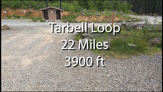
The Tarbell loop is that actual continuous Tarbell trail. It's a varied route with lots of different types of terrain and fantastic descents. The best way to ride it is CLOCKWISE, so you're ascending hiking trails with moderate grades and descending mountain bike trails- doing it counter-clockwise is an exercise in frustration. The trail travels through a lot of clear cuts, so start early in the morning or ride it on a cool day. The section that climbs over Larch Mountain can be under snow from about mid December through Early May. This is the closest epic loop to the Portland area, and it's one every mountain biker should ride if they haven't yet.

Trail Issues on Route
- Significant Issue / Amber: 1 trail (newest: Aug 1, 2026)
- Minor Issue / Yellow: 1 trail (newest: Jul 28, 2026)
Local Trail Association
Evergreen - Southwest Chapter (www.evergreenmtb.org)Trail Products
Stats
-
Distance23 miles
-
Avg time3 hr 41 min
-
Altitude change-1 ft
-
Altitude min1,010 ft
-
Altitude start1,321 ft
-
Altitude end1,319 ft
-
Climb4,332 ft
-
Descent-4,333 ft
-
Grade max-50.5%
-
Grade min55.4%
-
Distance climb10 miles
-
Distance down10 miles
-
Distance flat3 miles
38 Reviews & Comments
Clockwise = LOTS of slow climbs + a few good downhill sections
Counter-clockwise = MAJOR initial climb (starting from Yacolt) + lots of mellow downhill on hiking trails
1. Is counterclockwise, which is recommended and the map shows.
2. Avoids climbing Cold Creek in the first stage.
https://www.trailforks.com/route/tarbell-loop-counterclockwise-no-cold-creek/
We hope you've been enjoying Trailforks!
Create a FREE account to view all route reviews and much more.
Trails in Route
| 1 mile | |||||
| 5 miles | |||||
| 7 miles | |||||
| 3 miles | |||||

Details
- Featured
-
Riding area
-
Primary ActivityMountain Bike
-
Other Activities
- Horse
- Hike
- Trail Running
-
Difficulty ratingBlue
-
eBike Allowed
-
Bike typeAM, XC
-
DirectionBoth Directions
-
Activity Logs
- Unknown
- Snow Groomed
- Snow Packed
- Snow Covered
- Snow Cover Partial
- Freeze/thaw Cycle
- Icy
- Prevalent Mud
- Wet
- Variable
- Ideal
- Dry
- Very Dry
The colour categories are based on what percentage of users are riding a trail in its intended direction.
- > 96%
- > 90%
- > 80%
- > 70%
- > 50%
- < 50%
- bi-directional trail
- no data
- < 2 days
- < 1 week
- < 2 weeks
- < 1 month
- < 6 months
- > 6 months
- Downhill Only
- Downhill Primary
- Both Directions
- Uphill Primary
- Uphill Only
- One Direction
- Description
- Photos
- Description & Photos
- Videos
- most popular
- popular
- less popular
- not popular
Service Road Atlas is a free to use, community-driven service for viewing and creating reports on the numerous back-country service roads around B.C. and Alberta.
Save the current map location and zoom level as your default home location whenever this page is loaded.
Save- Singletrack
Photos
Videos
Recent Trail Reports Along Route
- By josefski
EMBA-SW & contributors - #20443 - 10,832 views


