
13.0 miles
Distance
1,638 ft
Climb
-1,676 ft
Descent
1,168 ft
High Point
-40 ft
Altitude change
575 ft
Altitude min
651 ft
Altitude start
610 ft
Altitude end
-0.1%
Grade
-32.5%
Grade max
51.2%
Grade min
5 miles
Distance climb
5 miles
Distance down
3 miles
Distance flat

Full on pedal and race for the S'ender

Detailed Description
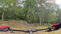
The "Enduro" is a 13 mile moderately popular expert race route located near Poultney Vermont. This mountain bike primary route can be used both directions and has a hard overall physical rating. This route includes 9 trails. This route climbs 1,638 ft with a max elevation of 1,168 ft then descends -1,676 ft.
Tags

Local Trail Association

Local trail association
Vermont Mountain Bike Association (vmba.org)
Please consider joining or donating to the local riding association to support trail development & maintenance.
Donate to earn trail karma!

Stats

  • Distance
    13 miles
  • Avg time
    2 hr 2 min
  • Altitude min
    575 ft
  • Altitude start
    651 ft
  • Altitude end
    610 ft
  • Climb
    1,638 ft
  • Descent
    -1,676 ft
  • Grade
    -0.1%
  • Grade max
    -32.5%
  • Grade min
    51.2%
  • Distance climb
    5 miles
  • Distance down
    5 miles
  • Distance flat
    3 miles

14 Reviews & Comments


We hope you've been enjoying Trailforks!

Create a FREE account to view all route reviews and much more.

Trails in Route

Details

  • Race Course
  • Race Date
    Saturday September 19, 2026
  • Riding area
  • Primary Activity
    Mountain Bike
  • Other Activities
    • E-Bike
  • Difficulty rating
    Black Diamond
  • Route Type
    Out & Back
  • eBike Allowed
  • Bike type
    AM, XC
  • Direction
    Both Directions
  • Physical rating
    Hard

Directions

  1. Bike west on Ringmaster.
  2. Continue for 500 meters.
  3. Bike north on Cotton Candy.
  4. Continue for 1 kilometer.
  5. Bike west on Ringmaster.
  6. Continue for 40 meters.
  7. Bike west on Ringmaster.
  8. Continue for 200 meters.
  9. Bear right onto Big Top.
  10. Continue for 3 kilometers.
  11. Bike southwest on Big Top.
  12. Continue for 800 meters.
  13. Bike northeast on Scrambler.
  14. Continue for 800 meters.
  15. Bike northeast on Scrambler.
  16. Continue for 40 meters.
  17. Make a sharp right onto Ringmaster.
  18. Continue for 600 meters.
  19. Turn left onto Fairgrounds Connector.
  20. Continue for 700 meters.
  21. Bike south on Fairgrounds Connector.
  22. Continue for 1 kilometer.
  23. Bike east on Pond Road.
  24. Continue for 80 meters.
  25. Bike south on Porcupine.
  26. Continue for 50 meters.
  27. Turn left to stay on Porcupine.
  28. Continue for 100 meters.
  29. Bike northwest on Porcupine.
  30. Continue for 10 meters.
  31. Turn left to stay on Porcupine.
  32. Continue for 100 meters.
  33. Bike east on Porcupine.
  34. Continue for 40 meters.
  35. Turn right to stay on Porcupine.
  36. Continue for 100 meters.
  37. Turn right to stay on Porcupine.
  38. Continue for 100 meters.
  39. Bear left to stay on Porcupine.
  40. Continue for 300 meters.
  41. Bike northeast on Porcupine.
  42. Continue for 20 meters.
  43. Turn right to stay on Porcupine.
  44. Continue for 400 meters.
  45. Bike northeast on Porcupine.
  46. Continue for 400 meters.
  47. Bike east on Porcupine.
  48. Continue for 300 meters.
  49. Bike north on Maple Run.
  50. Continue for 100 meters.
  51. Bike north on Upper Birdie.
  52. Continue for 200 meters.
  53. Bike southwest on Upper Birdie.
  54. Continue for 1.5 kilometers.
  55. Bike south on Lower Birdie.
  56. Continue for 90 meters.
  57. Turn right to stay on Lower Birdie.
  58. Continue for 1.5 kilometers.
  59. Bike northwest on Pond Road.
  60. Continue for 100 meters.
  61. Turn right onto Fairgrounds Connector.
  62. Continue for 2 kilometers.
  63. Turn right onto Ringmaster.
  64. Continue for 500 meters.
  65. Bike north on Ringmaster.
  66. Continue for 900 meters.
  67. Bike northeast on Ringmaster.
  68. Continue for 40 meters.
  69. Bear right onto Clown Shoes.
  70. Continue for 800 meters.
  71. Bike northwest on Clown Shoes.
  72. Continue for 100 meters.
  73. Turn right onto Ringmaster.
  74. Continue for 400 meters.
  75. Turn left onto Tightrope.
  76. Continue for 30 meters.
  77. Turn left onto Cotton Candy.
  78. Continue for 700 meters.
  79. Bike northeast on Cotton Candy.
  80. Continue for 700 meters.
  81. Bike south on Cotton Candy.
  82. Continue for 300 meters.
no votes yet
close
Trail transparency
  • Singletrack
  • Unpaved
mtb
45
mtb
trail: Big Top
82
mtb
trail: Big Top
78
mtb
trail: Big Top
103
Birdie
mtb
Birdie
2:53 | 219 | comments: 0 | favs:
Sep 18, 2023
Farrah & Stash

Recent Trail Reports Along Route

statustraildateconditiondescription
Big Top
Sep 7, 2026 @ 10:01am (America/New_York)
Sep 7, 2026
Fairgrounds Connector
Sep 7, 2026 @ 10:01am (America/New_York)
Sep 7, 2026
Clown Shoes
Aug 16, 2026 @ 8:38am (America/New_York)
Aug 16, 2026
Cotton Candy
Aug 16, 2026 @ 8:38am (America/New_York)
Aug 16, 2026
Lower Birdie
Aug 7, 2026 @ 1:10pm (America/New_York)
Aug 7, 2026
more reports »
  • By JoeGaynor22TF Pro VMBA & contributors
  • #68755 - 109 views

Hit the Trail

Open in App

Get this route on your phone instantly.

Download Route

Save to wishlist, Garmin & download.