

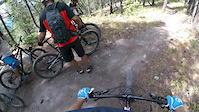
If you want to experience the best of Beaver Lakes, then this riding area, which includes views, flow, and moderate climbs, is the loop for you. Some aspects of this ride will have you riding on gravel roads. One segment of the ride (Little Beaver Connector Trail) will have you wondering if you are still on course. You are, it's just that The Whitefish Trails folks only maintains it to a certain point and then the trail only exists due to it being worn in by riders. You will encounter some fun boulders to weave through. The trail will terminate at a gravel road and that gravel road will get you back to the main trail complex. Enjoy
Trail Issues on Route
- Minor Issue / Yellow: 2 trails (newest: Apr 21, 2026)
Route Supporters

Whitefish Legacy PartnersMaintainer
Local Trail Association
Whitefish Legacy Partners (www.whitefishlegacy.org)Stats
-
Distance16 miles
-
Altitude min3,275 ft
-
Altitude start3,343 ft
-
Altitude end3,343 ft
-
Climb1,930 ft
-
Descent-1,931 ft
-
Grade max-42%
-
Grade min30.6%
-
Distance climb7 miles
-
Distance down7 miles
-
Distance flat2 miles
12 Reviews & Comments
We hope you've been enjoying Trailforks!
Create a FREE account to view all route reviews and much more.
Trails in Route
| 2,500 ft | |||||
| 2 miles | |||||
| 1 mile | |||||
| 5,266 ft | |||||
| 1 mile | |||||
| 2,710 ft | |||||
| 2 miles | |||||
| 3,717 ft |

Details
- Featured
-
Riding area
-
Primary ActivityMountain Bike
-
Other Activities
- Hike
- Trail Running
-
Difficulty ratingGreen
-
Route TypeLoop
-
eBike Allowed
-
Bike typeAM, XC
-
DirectionBoth Directions
-
Physical ratingModerate
Directions
- Walk northeast on Beaver Lake Trailhead Connector.
- Continue for 800 meters.
- Turn left onto Beaver Lake Trail.
- Continue for 600 meters.
- Bear right onto Beaver to Woods Lake Trail.
- Continue for 4 kilometers.
- Keep left to take Woods Lake Loop.
- Continue for 3 kilometers.
- Make a sharp left onto Whitefish Lake Overlook Loop Connector.
- Continue for 1.5 kilometers.
- Bear left onto Whitefish Lake Overlook Loop Trail.
- Continue for 1.5 kilometers.
- Turn left onto Dollar Lake Trail.
- Continue for 2 kilometers.
- Bear right onto Little Beaver Lake Trail.
- Continue for 1 kilometer.
- Walk south on Little Beaver Lake Connector Trail.
- Continue for 800 meters.
- Bear left onto Beaver Lease Road.
- Continue for 900 meters.
- Turn left onto North Beaver Road.
- Continue for 1 kilometer.
- Walk east on Beaver to Woods Lake Trail.
- Continue for 900 meters.
- Turn left onto Beaver Lake Overlook.
- Continue for 2.5 kilometers.
- Turn left onto Beaver Lake Trail.
- Continue for 2 kilometers.
- Turn right onto Beaver Lake Rd..
- Continue for 1.5 kilometers.
- Make a right U-turn to stay on Beaver Lake Rd..
- Continue for 20 meters.
- Make a right U-turn to stay on Beaver Lake Rd..
- Continue for 20 meters.
- Walk west on Beaver Lake Trail.
- Continue for 400 meters.
- Turn right to stay on Beaver Lake Trail.
- Continue for 600 meters.
- Turn left onto Beaver Lake Trailhead Connector.
- Continue for 800 meters.
- Unknown
- Snow Groomed
- Snow Packed
- Snow Covered
- Snow Cover Partial
- Freeze/thaw Cycle
- Icy
- Prevalent Mud
- Wet
- Variable
- Ideal
- Dry
- Very Dry
The colour categories are based on what percentage of users are riding a trail in its intended direction.
- > 96%
- > 90%
- > 80%
- > 70%
- > 50%
- < 50%
- bi-directional trail
- no data
- < 2 days
- < 1 week
- < 2 weeks
- < 1 month
- < 6 months
- > 6 months
- Downhill Only
- Downhill Primary
- Both Directions
- Uphill Primary
- Uphill Only
- One Direction
- Description
- Photos
- Description & Photos
- Videos
- most popular
- popular
- less popular
- not popular
Service Road Atlas is a free to use, community-driven service for viewing and creating reports on the numerous back-country service roads around B.C. and Alberta.
Save the current map location and zoom level as your default home location whenever this page is loaded.
Save- Singletrack
- Unpaved
Photos
Videos
Recent Trail Reports Along Route
- By JeffVonKiper
& contributors - #56063 - 1,185 views